Country:
 Switzerland
Region:
City:
Latitude and Longitude:
Time Zone:
Postal Code:
IP information under different IP Channel
ip-api
Country
Region
City
ASN
Time Zone
ISP
Blacklist
Proxy
Latitude
Longitude
Postal
Route
IPinfo
Country
Region
City
ASN
Time Zone
ISP
Blacklist
Proxy
Latitude
Longitude
Postal
Route
MaxMind
Country
Region
City
ASN
Time Zone
ISP
Blacklist
Proxy
Latitude
Longitude
Postal
Route
Luminati
Country
CHRegion
be
City
belp
ASN
Time Zone
Europe/Zurich
ISP
Quickline AG
Latitude
Longitude
Postal
db-ip
Country
Region
City
ASN
Time Zone
ISP
Blacklist
Proxy
Latitude
Longitude
Postal
Route
ipdata
Country
Region
City
ASN
Time Zone
ISP
Blacklist
Proxy
Latitude
Longitude
Postal
Route
Popular places and events near this IP address

Bern Airport
Airport in Bern
Distance: Approx. 2365 meters
Latitude and longitude: 46.91222222,7.49916667
Bern-Belp Regional Aerodrome (IATA: BRN, ICAO: LSZB / LSMB), marketed as Bern Airport, officially referred to as Regionalflugplatz Bern-Belp in German, is a regional aerodrome serving Bern, the capital of Switzerland. The aerodrome is located within the town limits of Belp, and used to feature scheduled flights to some European metropolitan and several leisure destinations. It handled 183,319 passengers in 2016, a decrease of 3.5 percent over 2015.
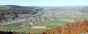
Belp
Municipality in Bern, Switzerland
Distance: Approx. 870 meters
Latitude and longitude: 46.88333333,7.5
Belp is a municipality in the Bern-Mittelland administrative district in the canton of Bern in Switzerland. It is close to Bern's Belp Airport. The municipality of Belpberg merged on 1 January 2012 into the municipality of Belp.

Wald, Bern
Municipality in Bern, Switzerland
Distance: Approx. 2518 meters
Latitude and longitude: 46.88333333,7.46666667
Wald (German pronunciation: [valt] ) is a municipality in the Bern-Mittelland administrative district in the canton of Bern in Switzerland.

Zimmerwald
Former municipality in Bern, Switzerland
Distance: Approx. 2518 meters
Latitude and longitude: 46.88333333,7.46666667
Zimmerwald (German pronunciation: [ˈtsɪmɐˌvalt]) was an independent municipality in the Canton of Bern, Switzerland until 31 December 2003. It is located on a hill in the proximity of the city of Bern in the Bernese Mittelland. On 1 January 2004 Zimmerwald united with the municipality of Englisberg to form the new municipality of Wald.

Englisberg
Village in the district of Seftigen in Canton Bern, Switzerland
Distance: Approx. 2256 meters
Latitude and longitude: 46.89805556,7.47
Englisberg is a village in the district of Seftigen in Canton Bern, Switzerland. On January 1, 2004, the independent municipality merged with Zimmerwald to form the new municipality of Wald BE. Situated on the Längenberg, above the valley of the Aare river, it combines the villages of Englisberg and Kühlewil. Englisberg is first documented in 1166 [Endlisperc].

Lohn Estate
Manor in Kehrsatz, Switzerland
Distance: Approx. 2631 meters
Latitude and longitude: 46.90861111,7.47472222
The Lohn Estate (German: Landsitz Lohn, French: Domaine du Lohn) is a manor and estate located in Kehrsatz, canton of Bern, Switzerland. It serves as the official estate of the Swiss Federal Council. From 1942 to 1994, the Lohn Estate accommodated the official guests of the Swiss Confederation, which have included a number of heads of States and royalty.

Seftigen District
District in Switzerland
Distance: Approx. 1395 meters
Latitude and longitude: 46.8833,7.48333
Seftigen District is one of the 26 administrative districts in the Canton of Bern, Switzerland. Its capital, while having administrative power, was the municipality of Seftigen. From 1 January 2010, the district lost its administrative power while seeing its constituent municipalities being divided and partly resettled in the Bern-Mittelland (administrative district), whose administrative centre is Ostermundigen but also in the Thun (administrative district), whose administrative centre being Thun.

Toffen
Municipality in Bern, Switzerland
Distance: Approx. 2714 meters
Latitude and longitude: 46.86666667,7.5
Toffen is a municipality in the Bern-Mittelland administrative district in the canton of Bern in Switzerland. It lies approximately 10 km south of the city of Bern. The palace situated there, Toffen Castle, is a heritage site of national significance.

Belp Castle
Distance: Approx. 371 meters
Latitude and longitude: 46.892701,7.501996
Belp Castle (German: Schloss Belp) is a castle in the municipality of Belp in the canton of Bern in Switzerland.

Oberried Estate
Historic site in Belp
Distance: Approx. 354 meters
Latitude and longitude: 46.888686,7.494615
Oberried Estate (German: Schloss Oberried or German: Campagne Oberried) is an estate in the municipality of Belp in the canton of Bern in Switzerland. It is a Swiss heritage site of national significance.

Belp Steinbach railway station
Railway station in Belp, Switzerland
Distance: Approx. 573 meters
Latitude and longitude: 46.895,7.49305556
Belp Steinbach railway station (German: Bahnhof Belp Steinbach) is a railway station in the municipality of Belp, in the Swiss canton of Bern.

Belp railway station
Railway station in Belp, Switzerland
Distance: Approx. 629 meters
Latitude and longitude: 46.88666667,7.4925
Belp railway station (German: Bahnhof Belp) is a railway station in the municipality of Belp, in the Swiss canton of Bern. It is an intermediate stop on the standard gauge Gürbetal line of BLS AG. A bus line links it to Bern Belp Airport.
Weather in this IP's area
overcast clouds
10 Celsius
10 Celsius
10 Celsius
12 Celsius
1019 hPa
94 %
1019 hPa
955 hPa
1500 meters
0.51 m/s
100 %
07:53:43
18:35:47