185.73.155.19 - IP Lookup: Free IP Address Lookup, Postal Code Lookup, IP Location Lookup, IP ASN, Public IP
Country:
Region:
City:
Location:
Time Zone:
Postal Code:
IP information under different IP Channel
ip-api
Country
Region
City
ASN
Time Zone
ISP
Blacklist
Proxy
Latitude
Longitude
Postal
Route
Luminati
Country
Region
sct
City
edinburgh
ASN
Time Zone
Europe/London
ISP
Fluency Communications Ltd
Latitude
Longitude
Postal
IPinfo
Country
Region
City
ASN
Time Zone
ISP
Blacklist
Proxy
Latitude
Longitude
Postal
Route
IP2Location
185.73.155.19Country
Region
scotland
City
cults
Time Zone
Europe/London
ISP
Language
User-Agent
Latitude
Longitude
Postal
db-ip
Country
Region
City
ASN
Time Zone
ISP
Blacklist
Proxy
Latitude
Longitude
Postal
Route
ipdata
Country
Region
City
ASN
Time Zone
ISP
Blacklist
Proxy
Latitude
Longitude
Postal
Route
Popular places and events near this IP address

Cults, Aberdeen
Human settlement in Scotland
Distance: Approx. 488 meters
Latitude and longitude: 57.11872,-2.173871
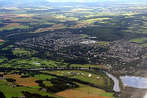
Cults ( KULTS) is a suburb on the western edge of Aberdeen, Scotland. It lies on the banks of the River Dee and marks the eastern boundary of Royal Deeside. Cults, known for its historic granite housing, sits approximately six miles from the coast of the North Sea.
Gray's School of Art
Art college of Robert Gordon University
Distance: Approx. 1087 meters
Latitude and longitude: 57.11805556,-2.14888889
Gray's School of Art is an art school located in Aberdeen, Scotland. Part of Robert Gordon University, it is one of the oldest established fine art institutions in Scotland and one of Scotland's five art schools today, and ranked among the Top 20 Schools of Art and Design in the United Kingdom. The School is housed in a building at the university's Garthdee campus in Aberdeen.
Macaulay Institute
Research institute based in Aberdeen, Scotland
Distance: Approx. 1919 meters
Latitude and longitude: 57.13333333,-2.15833333
The Macaulay Institute, formally the Macaulay Land Use Research Institute and sometimes referred to simply as The Macaulay, was a research institute based at Aberdeen in Scotland, which is now part of the James Hutton Institute. Its work covered aspects such as landscape, soil and water conservation and climate change.

Scott Sutherland School of Architecture and Built Environment
Distance: Approx. 1343 meters
Latitude and longitude: 57.1184,-2.1447
The Scott Sutherland School of Architecture and Built Environment is an architecture school administered by Robert Gordon University. It is located on the university's campus in Aberdeen, Scotland.

Shakkin' Briggie
Suspension bridge near Aberdeen, Scotland, UK
Distance: Approx. 332 meters
Latitude and longitude: 57.1146,-2.1706
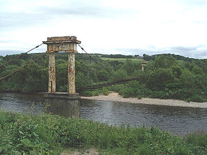
St Devenick's Bridge (locally known as the Shakkin' Briggie, or as Morison's Bridge) is a disused suspension footbridge which crosses the River Dee from Ardoe to Cults near Aberdeen in Scotland.

Banchory-Devenick
Distance: Approx. 761 meters
Latitude and longitude: 57.11277778,-2.15638889
Banchory-Devenick (Scottish Gaelic: Beannchar Dòmhnaig) is a hamlet approximately two kilometres south of the city of Aberdeen, Scotland in the Lower Deeside area of Aberdeenshire. The hamlet should not be confused with the historic civil parish of the same name which spanned the River Dee until 1891, its northern part lying in Aberdeenshire and its southern part in Kincardineshire. In that year the northern part became part of the neighbouring parish of Peterculter, the southern part (including the hamlet itself) remaining as the parish of Banchory-Devenick.

Cults Academy
School in Aberdeen, Scotland
Distance: Approx. 1353 meters
Latitude and longitude: 57.118333,-2.188889
Cults Academy is an Aberdeen City Council secondary school in Cults, Aberdeen, Scotland. It was the recipient of The Sunday Times Scottish State Secondary School of the Year Award 2008 because of its outstanding exam results that year, having been rated 3rd in 2005. As of 2023, Cults Academy is the 6th best school in Scotland.
Braeside, Aberdeen
Human settlement in Scotland
Distance: Approx. 1900 meters
Latitude and longitude: 57.13,-2.147
Braeside is an area of Aberdeen.

Bieldside railway station
Disused railway station in Aberdeenshire, Scotland
Distance: Approx. 1884 meters
Latitude and longitude: 57.1114,-2.1963
Bieldside railway station served the Bieldside area within the parish of Peterculter from 1897 to 1937 on the Deeside Railway that ran from Aberdeen (Joint) to Ballater. This area was the location of a number of mansion houses and estates such as Woodthorpe, Dalmunzie, The Firs, etc., some built as a result of the railway.

West Cults railway station
Railway station
Distance: Approx. 1064 meters
Latitude and longitude: 57.114183,-2.183681
West Cults railway station served the small suburban village of West Cults area within the parish of Peterculter from 1894 to 1937 on the Deeside Railway that ran from Aberdeen (Joint) to Ballater. It lay very close to Cults and Bieldside.

Cults railway station
Disused railway station in Scotland
Distance: Approx. 271 meters
Latitude and longitude: 57.1178,-2.1707
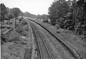
Cults railway station was opened on 8 September 1853 by the Deeside Railway and served part of Cults with mansion houses such as Southfield, Wellwood, Woodbank, Inchgarth, Drumgarth and Norwood nearby. The Deeside Railway station was replaced in 1855 by a new GNoSR that remained open, despite the 1937 closure of many other stations on the Aberdeen suburban service, until 1966 as an intermediate station on the Deeside Railway that ran from Aberdeen (Joint) to Ballater. Cults is located in the parish of Peterculter, Aberdeenshire, Scotland.

Pitfodels railway station
Former railway station in Scotland
Distance: Approx. 768 meters
Latitude and longitude: 57.1205,-2.1561
Pitfodels railway station or Pitfodels Halt was opened on 2 July 1894 by the GNoSR and served a suburb of Aberdeen with housing and estates such as Wellwood, Inchgarth and Norwood. The halt was one of several victims of the 1937 closure of stations on the Aberdeen suburban service. The Deeside Railway itself ran from Aberdeen (Joint) to Ballater.
Weather in this IP's area
light intensity drizzle
7 Celsius
6 Celsius
7 Celsius
8 Celsius
1031 hPa
95 %
1031 hPa
1028 hPa
4200 meters
2.06 m/s
340 degree
75 %
