Country:
 Czech Republic
Region:
City:
Latitude and Longitude:
Time Zone:
Postal Code:
IP information under different IP Channel
ip-api
Country
Region
City
ASN
Time Zone
ISP
Blacklist
Proxy
Latitude
Longitude
Postal
Route
IPinfo
Country
Region
City
ASN
Time Zone
ISP
Blacklist
Proxy
Latitude
Longitude
Postal
Route
MaxMind
Country
Region
City
ASN
Time Zone
ISP
Blacklist
Proxy
Latitude
Longitude
Postal
Route
Luminati
Country
CZRegion
20
City
kralupynadvltavou
ASN
Time Zone
Europe/Prague
ISP
Milan Zelenka
Latitude
Longitude
Postal
db-ip
Country
Region
City
ASN
Time Zone
ISP
Blacklist
Proxy
Latitude
Longitude
Postal
Route
ipdata
Country
Region
City
ASN
Time Zone
ISP
Blacklist
Proxy
Latitude
Longitude
Postal
Route
Popular places and events near this IP address

Nelahozeves
Municipality in the Czech Republic
Distance: Approx. 2802 meters
Latitude and longitude: 50.26166667,14.29888889
Nelahozeves is a municipality and village in Mělník District in the Central Bohemian Region of the Czech Republic. It has about 2,200 inhabitants. It is known for the Nelahozeves Castle and as the birthplace of Antonín Dvořák, who is one of the most important Czech composers.

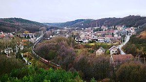
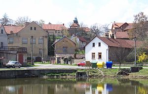
Kralupy nad Vltavou
Town in Central Bohemian, Czech Republic
Distance: Approx. 734 meters
Latitude and longitude: 50.24083333,14.30666667
Kralupy nad Vltavou (Czech pronunciation: [ˈkralupɪ ˈnad vl̩tavou]; German: Kralup an der Moldau) is a town in Mělník District in the Central Bohemian Region of the Czech Republic. It has about 19,000 inhabitants. It is known as a traffic hub and industrial agglomeration.

Veltrusy
Town in Central Bohemian, Czech Republic
Distance: Approx. 4341 meters
Latitude and longitude: 50.27055556,14.32861111
Veltrusy (Czech pronunciation: [ˈvɛltrusɪ]; German: Weltrus) is a town in Mělník District in the Central Bohemian Region of the Czech Republic. It has about 2,300 inhabitants. It is known for the Veltrusy Mansion.
Otvovice
Municipality in Central Bohemian, Czech Republic
Distance: Approx. 3321 meters
Latitude and longitude: 50.21166667,14.27305556
Otvovice is a municipality and village in Kladno District in the Central Bohemian Region of the Czech Republic. It has about 800 inhabitants.

Dolany nad Vltavou
Municipality in Central Bohemian, Czech Republic
Distance: Approx. 3953 meters
Latitude and longitude: 50.22222222,14.34972222
Dolany nad Vltavou (until 2016 Dolany) is a municipality and village in Mělník District in the Central Bohemian Region of the Czech Republic. It has about 1,000 inhabitants.

Chvatěruby
Municipality in Central Bohemian, Czech Republic
Distance: Approx. 3152 meters
Latitude and longitude: 50.23277778,14.34277778
Chvatěruby is a municipality and village in Mělník District in the Central Bohemian Region of the Czech Republic. It has about 600 inhabitants.

Kozomín
Municipality in Central Bohemian, Czech Republic
Distance: Approx. 5142 meters
Latitude and longitude: 50.23694444,14.37111111
Kozomín is a municipality and village in Mělník District in the Central Bohemian Region of the Czech Republic. It has about 500 inhabitants.

Olovnice
Municipality in Central Bohemian, Czech Republic
Distance: Approx. 4159 meters
Latitude and longitude: 50.23472222,14.24055556
Olovnice is a municipality and village in Mělník District in the Central Bohemian Region of the Czech Republic. It has about 600 inhabitants.

Zlončice
Municipality in Central Bohemian, Czech Republic
Distance: Approx. 4277 meters
Latitude and longitude: 50.22888889,14.35777778
Zlončice is a municipality and village in Mělník District in the Central Bohemian Region of the Czech Republic. It has about 600 inhabitants.
Holubice (Prague-West District)
Municipality in Central Bohemian, Czech Republic
Distance: Approx. 3746 meters
Latitude and longitude: 50.20305556,14.29305556
Holubice is a municipality and village in Prague-West District in the Central Bohemian Region of the Czech Republic. It has about 2,200 inhabitants.

Tursko (Prague-West District)
Municipality in Central Bohemian, Czech Republic
Distance: Approx. 5283 meters
Latitude and longitude: 50.19138889,14.32194444
Tursko is a municipality and village in Prague-West District in the Central Bohemian Region of the Czech Republic. It has about 900 inhabitants.
Roudnice Lobkowicz Library
Distance: Approx. 2731 meters
Latitude and longitude: 50.261,14.301
The Roudnice Lobkowicz Library (Czech: Roudnická lobkowiczká knihovna) is a large private collection of books kept at Nelahozeves Castle, 35 km north of Prague, Czech Republic. The library belongs to the Lobkowicz family, a noble dynasty of Bohemia. Together with the family's collection of artworks, music, and other valuable assets, the library forms the Lobkowicz Collection, most of which is held in the Lobkowicz Palace, part of the Prague Castle complex.
Weather in this IP's area
light rain
15 Celsius
15 Celsius
14 Celsius
16 Celsius
1018 hPa
96 %
1018 hPa
996 hPa
10000 meters
7.72 m/s
10 degree
40 %
06:40:29
19:14:52