Country:
 Great Britain
Region:
City:
Latitude and Longitude:
Time Zone:
Postal Code:
IP information under different IP Channel
ip-api
Country
Region
City
ASN
Time Zone
ISP
Blacklist
Proxy
Latitude
Longitude
Postal
Route
IPinfo
Country
Region
City
ASN
Time Zone
ISP
Blacklist
Proxy
Latitude
Longitude
Postal
Route
MaxMind
Country
Region
City
ASN
Time Zone
ISP
Blacklist
Proxy
Latitude
Longitude
Postal
Route
Luminati
Country
GBASN
Time Zone
Europe/London
ISP
Pulsant (Scotland) Ltd
Latitude
Longitude
Postal
db-ip
Country
Region
City
ASN
Time Zone
ISP
Blacklist
Proxy
Latitude
Longitude
Postal
Route
ipdata
Country
Region
City
ASN
Time Zone
ISP
Blacklist
Proxy
Latitude
Longitude
Postal
Route
Popular places and events near this IP address

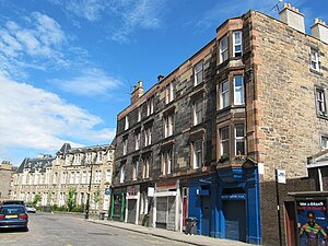
Bonnington, Edinburgh
Distance: Approx. 80 meters
Latitude and longitude: 55.97083333,-3.17916667
Bonnington is a district of Edinburgh, the capital of Scotland. The area centres upon an original village which grew up around a ford on the Water of Leith, on the old boundary between Edinburgh and the port of Leith. Before the creation of Leith Walk, the road via the villages of Broughton and Bonnington, or Wester Road as it appears on some old maps, was one of two roads formerly connecting Edinburgh to Leith; the other being Easter Road.

Great Junction Street
Distance: Approx. 416 meters
Latitude and longitude: 55.97388889,-3.17694444
Great Junction Street is a street in Leith, on the northern outskirts of Edinburgh, Scotland. It runs southeast to northwest following approximately the southwestmost line of the old town walls around Leith.

South Leith Parish Church
Church in Edinburgh's harbour district, Scotland
Distance: Approx. 496 meters
Latitude and longitude: 55.97194444,-3.17277778
South Leith Parish Church, originally the Kirk of Our Lady, St Mary, is a congregation of the Church of Scotland. It is the principal church and congregation in Leith, in Edinburgh. Its kirkyard is the burial place for John Home (author of Douglas) and John Pew, the man from whom the author Robert Louis Stevenson reputedly derived the character of Blind Pew in the novel Treasure Island.
Henderson Street
Distance: Approx. 527 meters
Latitude and longitude: 55.973126,-3.173161
Henderson Street is a street in Leith, a district of the city of Edinburgh, Scotland. It forms a curving artery between Great Junction Street and an area known as the Shore, where the Water of Leith runs into the Port of Leith/Leith Docks. Henderson Street lies within the boundaries of the Leith Conservation Area and includes several listed buildings.
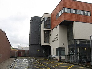
Leith Community Treatment Centre
Hospital in Edinburgh, Scotland
Distance: Approx. 280 meters
Latitude and longitude: 55.97138889,-3.17611111
The Leith Community Treatment Centre is a community hospital in Junction Place, Leith, Edinburgh, Scotland. It is managed by NHS Lothian.

Rosebank Cemetery
Cemetery in Edinburgh, Scotland
Distance: Approx. 439 meters
Latitude and longitude: 55.9677,-3.185
Rosebank Cemetery is a 19th-century cemetery in Edinburgh, Scotland, at the junction of Pilrig Street and Broughton Road in the Pilrig area, close to the historical boundary of Leith. The cemetery is protected as a category C listed building.

Bun-sgoil Taobh na Pàirce
Primary school in Edinburgh, Scotland
Distance: Approx. 51 meters
Latitude and longitude: 55.9705,-3.1797
Bun-sgoil Taobh na Pàirce (English: Parkside Primary School, referring to the adjoining Pilrig Park) is a Gaelic medium primary school in Edinburgh, Scotland. Administered by the City of Edinburgh Council, the school is open to any parents in the city or surrounding areas who wish to have their children learn and be educated through Scottish Gaelic. The opening of Edinburgh's first dedicated Gaelic school on 16 August 2013, after many years of campaigning by parents and supporters, was hailed as a "landmark day" for the Scottish capital.

Dr Bell's School
Building
Distance: Approx. 381 meters
Latitude and longitude: 55.9719,-3.1747
Dr Bell's School is a building located at 101 Great Junction Street, Leith, Scotland. The building was named after Scottish educationalist Andrew Bell (1753–1832), and is a Category B listed building of historical importance.

Leith Hospital
Hospital in Edinburgh, Scotland
Distance: Approx. 441 meters
Latitude and longitude: 55.9745269,-3.1786133
Leith Hospital was situated on Mill Lane in Leith, Edinburgh, and was a general hospital with adult medical and surgical wards, paediatric medical and surgical wards, a casualty department and a wide range of out-patient services. It closed in 1987.

Bonnington railway station
Disused railway station in Bonnington, Edinburgh
Distance: Approx. 512 meters
Latitude and longitude: 55.9725,-3.188
Bonnington railway station served the district of Bonnington, Edinburgh, Scotland from 1846 to 1968 on the Edinburgh, Leith and Granton Railway.

Junction Road railway station, Edinburgh
Disused railway station in Leith, Edinburgh
Distance: Approx. 460 meters
Latitude and longitude: 55.9748,-3.1795
Junction Road railway station served the district of Leith, Edinburgh, Scotland from 1869 to 1947 on the Edinburgh, Leith and Granton Line of the North British Railway.
Bonnington Chemical Works
Chemical plant in Edinburgh, Scotland, UK
Distance: Approx. 362 meters
Latitude and longitude: 55.970903,-3.186236
The Bonnington Chemical Works was a pioneer coal tar processing plant established in Edinburgh. It was probably the first successful independent facility established for the integrated treatment of gasworks waste, and manufactured the residues of the Edinburgh gasworks into useful products for over half a century.
Weather in this IP's area
scattered clouds
10 Celsius
10 Celsius
9 Celsius
12 Celsius
1032 hPa
86 %
1032 hPa
1030 hPa
10000 meters
0.96 m/s
1.43 m/s
13 degree
37 %
06:52:45
19:20:11