185.71.169.84 - IP Lookup: Free IP Address Lookup, Postal Code Lookup, IP Location Lookup, IP ASN, Public IP
Country:
Region:
City:
Location:
Time Zone:
Postal Code:
IP information under different IP Channel
ip-api
Country
Region
City
ASN
Time Zone
ISP
Blacklist
Proxy
Latitude
Longitude
Postal
Route
Luminati
Country
Region
be
City
berlin
ASN
Time Zone
Europe/Berlin
ISP
Campus, Hofnetz & Events GmbH
Latitude
Longitude
Postal
IPinfo
Country
Region
City
ASN
Time Zone
ISP
Blacklist
Proxy
Latitude
Longitude
Postal
Route
IP2Location
185.71.169.84Country
Region
nordrhein-westfalen
City
oberhausen
Time Zone
Europe/Berlin
ISP
Language
User-Agent
Latitude
Longitude
Postal
db-ip
Country
Region
City
ASN
Time Zone
ISP
Blacklist
Proxy
Latitude
Longitude
Postal
Route
ipdata
Country
Region
City
ASN
Time Zone
ISP
Blacklist
Proxy
Latitude
Longitude
Postal
Route
Popular places and events near this IP address

Schleiden
Town in North Rhine-Westphalia, Germany
Distance: Approx. 2956 meters
Latitude and longitude: 50.53305556,6.46666667
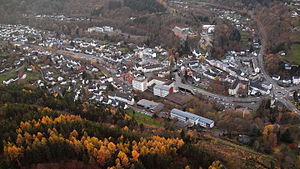
Schleiden is a town in North Rhine-Westphalia, Germany. It lies in the Eifel hills, in the district of Euskirchen, and has 12,998 inhabitants as of 30 June 2017. Schleiden is connected by a tourist railway to Kall, on the Eifel Railway between Cologne and Trier.

Hellenthal
Municipality in North Rhine-Westphalia, Germany
Distance: Approx. 3479 meters
Latitude and longitude: 50.48333333,6.43333333
Hellenthal is a municipality in the district of Euskirchen in the state of North Rhine-Westphalia, Germany. It is located in the Eifel hills, near the border with Belgium, approx. 30 km south-west of Euskirchen and 40 km south-east of Aachen.

Steinfeld Abbey
Distance: Approx. 6935 meters
Latitude and longitude: 50.502,6.564
Steinfeld Abbey (Kloster Steinfeld) is a former Premonstratensian monastery, now a Salvatorian convent, with an important basilica, in Steinfeld in Kall, North Rhine-Westphalia, Germany.

High Fens – Eifel Nature Park
Distance: Approx. 6820 meters
Latitude and longitude: 50.508,6.37
The German-Belgian High Fens – Eifel Nature Park (German: Naturpark Hohes Venn – Eifel), often called the North Eifel Nature Park (Naturpark Nord Eifel), is a cross-border nature park with elements in the German federal states of North Rhine-Westphalia and Rhineland-Palatinate as well as the Belgian province of Liège. It has a total area of 2,485 km2 (959 sq mi). The nature park lies between Langerwehe and Eupen in the north and Bad Münstereifel, Prüm and Sankt Vith in the south and covers six regions: the Rur Eifel, the High Eifel, the Limestone Eifel, the Our valley, the Venn Foreland and the Hohes Venn, a raised bog and heath landscape, remnants of the last ice age 7,500 years ago.
Dreiborn Plateau
Distance: Approx. 7246 meters
Latitude and longitude: 50.56333333,6.41638889
The Dreiborn Plateau (German: Dreiborner Hochfläche) is an area of woods and open terrain, some 33 square kilometres in area, in the Eifel National Park. It corresponds to the area of the Vogelsang Military Training Area which was handed back on 31 December 2005 and had been out-of-bounds to the public since 1 September 1946. Since 2006 parts of the area have been opened up to the public who may use certain routes through it.

Wildenburg Castle (Eifel)
Distance: Approx. 5333 meters
Latitude and longitude: 50.461971,6.494089
The Wildenburg lies in the North Rhine-Westphalian part of the Eifel Mountains in the national park district of Hellenthal in the German county of Euskirchen. The castle was built between 1202 and 1235 and is one of the few hill castles in the Eifel that has not been destroyed by war or demolition. It was the centre of gravity of a territorial lordship that extended in the west as far as the present border with Belgium and in the east reached the gates of Steinfeld Abbey.
Eigart
Distance: Approx. 5239 meters
Latitude and longitude: 50.5325,6.4046
The Eigart is a hill located in the county of Euskirchen in the German state of North Rhine-Westphalia at 565.5 m above sea level (NN), in the North Eifel. The Eigart is situated in the High Fens-Eifel Nature Park a little east of the Eifel National Park. It lies west of the village of Berescheid in the borough of Schleiden.
Schöneseiffen
Stadtteil of Schleiden in North Rhine-Westphalia, Germany
Distance: Approx. 5152 meters
Latitude and longitude: 50.5194,6.3964
Schöneseiffen is a village southwest of Schleiden in the county of Euskirchen in the German state of North Rhine-Westphalia. The Dieffenbach stream rises north of the village. Schöneseiffen has a population of 433 (2021).
Olef Dam
Dam in Euskirchen
Distance: Approx. 3421 meters
Latitude and longitude: 50.495,6.4215
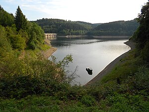
The Olef Dam (German: Oleftalsperre) is located in the vicinity of the Eifel National Park near Hellenthal within the High Fens-Eifel Nature Park in the county of Euskirchen in the German state of North Rhine-Westphalia. Its reservoir stores around 20 million cubic metres and is fed by the River Olef.

Kuttenbach
River in Euskirchen, Germany
Distance: Approx. 5233 meters
Latitude and longitude: 50.4789453,6.5261704
The Kuttenbach is a 5.3 kilometre-long, orographically left-hand tributary of the Urft in North Rhine-Westphalia, Germany, in the municipality of Kall.

Reifferscheid Castle
Distance: Approx. 3306 meters
Latitude and longitude: 50.47680556,6.46638889
The ruins of Reifferscheid Castle (German: Burg Reifferscheid) stand at a height of 450 metres above sea level (NN) near the German-Belgian border between the mountains of the Eifel and the Ardennes in the municipality of Hellenthal. Its name probably comes from a forest clearing that belonged to a man called Rifhari, the names Rifersceith or Rifheres-sceit mean "woodland strip of Rifhari". All that has survived of the medieval hill castle are the remains of the curtain walls, a gatehouse with two flanking round towers, a gabled entrance and a round, white-plastered bergfried made of rubble stone.

Scheuren (Schleiden)
Ortsteil of Schleiden in North Rhine-Westphalia, Germany
Distance: Approx. 3262 meters
Latitude and longitude: 50.5358,6.4658
Scheuren is a village in the west of Schleiden borough in the county of Euskirchen in the German state of North Rhine-Westphalia. In the village there is a community centre and a Roman Catholic chapel. The Höddelbach stream flows by to the north.
Weather in this IP's area
overcast clouds
1 Celsius
-2 Celsius
0 Celsius
2 Celsius
1027 hPa
98 %
1027 hPa
978 hPa
10000 meters
2.51 m/s
6.09 m/s
236 degree
99 %

