Country:
Region:
City:
Latitude and Longitude:
Time Zone:
Postal Code:
IP information under different IP Channel
ip-api
Country
Region
City
ASN
Time Zone
ISP
Blacklist
Proxy
Latitude
Longitude
Postal
Route
IPinfo
Country
Region
City
ASN
Time Zone
ISP
Blacklist
Proxy
Latitude
Longitude
Postal
Route
MaxMind
Country
Region
City
ASN
Time Zone
ISP
Blacklist
Proxy
Latitude
Longitude
Postal
Route
Luminati
Country
Region
mex
ASN
Time Zone
America/Mexico_City
ISP
Megacable Comunicaciones de Mexico, S.A. de C.V.
Latitude
Longitude
Postal
db-ip
Country
Region
City
ASN
Time Zone
ISP
Blacklist
Proxy
Latitude
Longitude
Postal
Route
ipdata
Country
Region
City
ASN
Time Zone
ISP
Blacklist
Proxy
Latitude
Longitude
Postal
Route
Popular places and events near this IP address
Secretariat of National Defense
National Defense of Mexico
Distance: Approx. 997 meters
Latitude and longitude: 19.44,-99.216
The Mexican Secretariat of National Defense (SEDENA); Spanish: Secretaría de la Defensa Nacional is the government department responsible for managing Mexico's Army and Air Forces. Its head is the Secretary of National Defense who, like the co-equal Secretary of the Navy, is directly answerable to the President. Before 1937, the position was called the Secretary of War and Navy (Secretaría de Guerra y Marina).

Lomas de Chapultepec
Neighborhood of Mexico City in Miguel Hidalgo
Distance: Approx. 1391 meters
Latitude and longitude: 19.42055556,-99.21888889
Lomas de Chapultepec (English: "Chapultepec Hills") is a colonia, or officially recognized neighborhood, located in the Miguel Hidalgo borough of Mexico City. It dates back to the 1920s, when it was founded with the name Chapultepec Heights. Its main entrance is through Paseo de la Reforma.
Hipódromo de las Américas
Distance: Approx. 1315 meters
Latitude and longitude: 19.43861111,-99.22277778
Hipódromo de las Américas is a thoroughbred and quarter-horse race track in Mexico City, Mexico that had its inaugural meeting on March 6, 1943. It is located approximately four and one-half miles from the downtown district, on Lomas de Sotelo, Mexico City. It is operated by Grupo CIE. Facilities include the original club-house and grandstand, with seating for 20,000 persons, as well a stable area which can accommodate 1700 horses.

Polanco, Mexico City
Neighborhood in Mexico City
Distance: Approx. 1347 meters
Latitude and longitude: 19.43333333,-99.2
Polanco is a neighborhood in the Miguel Hidalgo borough of Mexico City. Polanco is an affluent colonia, noted for its luxury shopping along Presidente Masaryk Avenue, the most expensive street in Mexico, as well as for the numerous prominent cultural institutions located within the neighborhood. Originally a residential area of large single-family homes, the land use of the neighborhood began to change in the second half of the 20th century.

Antara Polanco
Building in Mexico City, Mexico
Distance: Approx. 1372 meters
Latitude and longitude: 19.4393,-99.2025
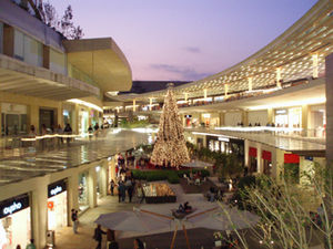
Antara, previously branded as Antara Polanco and Antara Fashion Hall, is an upscale open-air shopping center in the Nuevo Polanco section of the upscale district of Polanco, Mexico City. It hosts a concentration of boutiques of global luxury brands and is anchored by a Casa Palacio department store and a Cinemex multicinema.

2008 Mexico City Learjet crash
2008 aviation accident in Mexico
Distance: Approx. 1117 meters
Latitude and longitude: 19.42638889,-99.20361111
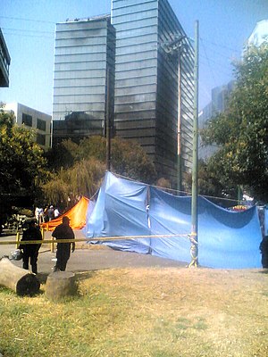
On 4 November 2008 an official Mexican Secretariat of the Interior aircraft crashed in central Mexico City at around 18:45 local time. There were sixteen fatalities—all nine people on board and seven people on the ground. The plane, a Learjet 45, was carrying Mexican Secretary of the Interior Juan Camilo Mouriño.
Escuela Médico Militar
Distance: Approx. 384 meters
Latitude and longitude: 19.4346,-99.2145
The Escuela Médico Militar is a medical school of the Mexican army and Mexican air force for medical training. The school is located in Mexico City, Mexico.
Museo Soumaya
Art museum in Nuevo Polanco, Mexico City
Distance: Approx. 1314 meters
Latitude and longitude: 19.44069444,-99.20472222
The Museo Soumaya is a private museum in Mexico City and a non-profit cultural institution with two museum buildings in Mexico City — Plaza Carso and Plaza Loreto. It has over 66,000 works from 30 centuries of art including sculptures from Pre-Hispanic Mesoamerica, 19th- and 20th-century Mexican art and an extensive repertoire of works by European old masters and masters of modern western art such as Auguste Rodin, Salvador Dalí, Bartolomé Esteban Murillo and Tintoretto. It is called one of the most complete collections of its kind.
Embassy of Sweden, Mexico City
Diplomatic mission
Distance: Approx. 1363 meters
Latitude and longitude: 19.42414,-99.22299
The Embassy of Sweden in Mexico City is Sweden's diplomatic mission in Mexico. The mission of the embassy is to represent Swedish interests in Mexico, as well as to strengthen bilateral relations within the governmental, commercial, business, academic, cultural and civil society spheres, with a particular emphasis on cooperation for sustainable development.
Hospital Central Militar Mexico
Hospital in Mexico
Distance: Approx. 743 meters
Latitude and longitude: 19.4374,-99.2162
Central Military Hospital is a third level medical institution, highly specialized, with extensive experience, that provides services not only to military and rights holders, but also to people outside this medical unit, which belongs to and depends directly from the Secretaría De La Defensa Nacional (SEDENA) through the Directorate General of Health. Within the ladder Health Services is located on the highest level, also has 48 medical specialties.

Nuevo Polanco
Place in Mexico City, Mexico
Distance: Approx. 1315 meters
Latitude and longitude: 19.440693,-99.2047
Nuevo Polanco (English, "New Polanco") is an area of Mexico City formerly consisting of warehouses and factories, bordering the upscale Polanco on the north across Avenida Ejército Nacional. Officially it consists of two colonias, Granada and Ampliación Granada. This area is undergoing an accelerated process of re-conversion and development.

Acuario Inbursa
Aquarium in Mexico City
Distance: Approx. 1251 meters
Latitude and longitude: 19.4401,-99.2049
The Acuario Inbursa is an aquarium in the Nuevo Polanco area of Miguel Hidalgo district, Mexico City. It is the largest in Mexico with 3500 square meters of exhibition space and 1.6 million liters of ocean water. The project of billionaire Carlos Slim, it cost 250 million Mexican pesos, or 19 million US dollars, to build.
Weather in this IP's area
light rain
13 Celsius
13 Celsius
13 Celsius
14 Celsius
1015 hPa
88 %
1015 hPa
778 hPa
10000 meters
3.6 m/s
350 degree
100 %
06:23:18
18:45:44

