185.68.114.38 - IP Lookup: Free IP Address Lookup, Postal Code Lookup, IP Location Lookup, IP ASN, Public IP
Country:
Region:
City:
Location:
Time Zone:
Postal Code:
ISP:
ASN:
language:
User-Agent:
Proxy IP:
Blacklist:
IP information under different IP Channel
ip-api
Country
Region
City
ASN
Time Zone
ISP
Blacklist
Proxy
Latitude
Longitude
Postal
Route
db-ip
Country
Region
City
ASN
Time Zone
ISP
Blacklist
Proxy
Latitude
Longitude
Postal
Route
IPinfo
Country
Region
City
ASN
Time Zone
ISP
Blacklist
Proxy
Latitude
Longitude
Postal
Route
IP2Location
185.68.114.38Country
Region
wales
City
newbridge
Time Zone
Europe/London
ISP
Language
User-Agent
Latitude
Longitude
Postal
ipdata
Country
Region
City
ASN
Time Zone
ISP
Blacklist
Proxy
Latitude
Longitude
Postal
Route
Popular places and events near this IP address

Crumlin, Caerphilly
Human settlement in Wales
Distance: Approx. 1478 meters
Latitude and longitude: 51.6798,-3.1368
Crumlin (Welsh: Crymlyn) is a town, community and electoral ward in Caerphilly county borough in South Wales. It is situated in the Ebbw River valley, 5 miles (8 km) west of Pontypool, within the historic boundaries of Monmouthshire.

Newbridge, Caerphilly
Town in Caerphilly, Wales
Distance: Approx. 412 meters
Latitude and longitude: 51.67,-3.136
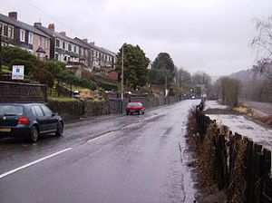
Newbridge (Welsh: Trecelyn) is a town and community in the county borough of Caerphilly, south Wales. It lies within the historic boundaries of the county of Monmouthshire.

Ebbw Valley Railway
Commuter railway line in Cardiff, Wales
Distance: Approx. 1038 meters
Latitude and longitude: 51.675,-3.14016
The Ebbw Valley Railway (Welsh: Rheilffordd Cwm Ebwy) is a branch line of the South Wales Main Line in South Wales. Transport for Wales Rail provides an hourly passenger service each way between Ebbw Vale Town and Cardiff Central, and an hourly service each way between Ebbw Vale Town and Newport. The line was opened by the Monmouthshire Railway and Canal Company and the Great Western Railway (GWR) operated a passenger service from the 1850s between Newport and Ebbw Vale.

Newbridge railway station (Wales)
Railway station in Caerphilly, Wales
Distance: Approx. 664 meters
Latitude and longitude: 51.66580833,-3.14281389
Newbridge railway station (Welsh: Trecelyn) is on the Ebbw Valley Railway and serves the towns of Newbridge and Blackwood in south east Wales. The current station is on the site of the former station and coal yard in the town centre opposite the former Co-op Food store and existing council car park. The station car park and access to platform 2 is off a signalised junction on Bridge Street, with pedestrian access to platform 1 via Celynen Road.
Crumlin Arm (Monmouthshire canal)
Distance: Approx. 1478 meters
Latitude and longitude: 51.6798,-3.1368
The Crumlin Arm of the Monmouthshire canal is part of the Monmouthshire & Brecon Canal network in South Wales. It connected Crumlin and its tramways to the Docks at Newport.

Crumlin Viaduct
Former viaduct crossing the Ebbw River and Crumlin
Distance: Approx. 1586 meters
Latitude and longitude: 51.6804,-3.1396
The Crumlin Viaduct was a railway viaduct located above the village of Crumlin in South Wales, originally built to carry the Taff Vale Extension of the Newport, Abergavenny and Hereford Railway (NA&HR) across the Ebbw River. Hailed as "one of the most significant examples of technological achievement during the Industrial Revolution", in its 107 years of service until being dismantled in 1965, it remained: the least expensive bridge for its size ever constructed; the tallest railway viaduct in the United Kingdom; the third tallest viaduct in the world, after the aqueduct at Spoleto, Italy, and the timber viaduct in Portage, New York state.
Treowen Stars F.C.
Association football club in Wales
Distance: Approx. 1211 meters
Latitude and longitude: 51.66927778,-3.15033333
Treowen Stars F.C. are a Welsh football club from the village of Treowen near Newbridge, Caerphilly. The club plays in the Ardal SE League. Treowen Stars were formed in 1926 in the village of Treowen, near Newbridge, and played most of their early football in the Abertillery & District and West Monmouthshire Leagues.

Swffryd
Human settlement in Wales
Distance: Approx. 1757 meters
Latitude and longitude: 51.682482,-3.133626
Swffryd (or Sofrydd) is a Welsh community on the boundary of Blaenau Gwent County Borough Council.
Hafodyrynys Platform railway station
Disused railway station in Hafodyrynys, Caerphilly
Distance: Approx. 1716 meters
Latitude and longitude: 51.6816,-3.1269
Hafodyrynys Platform railway station was a station on the former Taff Vale Extension of the Newport, Abergavenny and Hereford Railway. It served the village of Hafodyrynys, and was located near to the western portal of the 280 yd Glyn Tunnel.
Celynen North Halt railway station
Disused railway station in Abercarn, Carrphilly
Distance: Approx. 651 meters
Latitude and longitude: 51.671,-3.1397
Celynen North Halt railway station served the town of Abercarn, in the historical county of Glamorganshire, from 1936 to 1962 on the Monmouthshire Railway.
Treowen Halt railway station
Disused railway station in Wonastow, Monmouthshire
Distance: Approx. 1030 meters
Latitude and longitude: 51.6672,-3.1482
Treowen Halt railway station served the village of Wonastow, Monmouthshire, Wales, from 1927 to 1960 on the Newport, Abergavenny and Hereford Railway.
Pwll-y-Pant railway station
Disused railway station in Pwll-y-Pant, Caerphilly
Distance: Approx. 645 meters
Latitude and longitude: 51.6626,-3.1399
Pwll-y-Pant railway station served the suburb of Pwll-y-Pant, in the historical county of Glamorgan, Wales, from 1871 to 1893 on the Rhymney Railway.
Weather in this IP's area
overcast clouds
4 Celsius
0 Celsius
4 Celsius
4 Celsius
1021 hPa
85 %
1021 hPa
997 hPa
10000 meters
4.58 m/s
6.15 m/s
64 degree
94 %