185.67.144.70 - IP Lookup: Free IP Address Lookup, Postal Code Lookup, IP Location Lookup, IP ASN, Public IP
Country:
Region:
City:
Location:
Time Zone:
Postal Code:
IP information under different IP Channel
ip-api
Country
Region
City
ASN
Time Zone
ISP
Blacklist
Proxy
Latitude
Longitude
Postal
Route
Luminati
Country
Region
naq
City
larochelle
ASN
Time Zone
Europe/Paris
ISP
Saclak Network Sarl
Latitude
Longitude
Postal
IPinfo
Country
Region
City
ASN
Time Zone
ISP
Blacklist
Proxy
Latitude
Longitude
Postal
Route
IP2Location
185.67.144.70Country
Region
auvergne-rhone-alpes
City
vaulx-en-velin
Time Zone
Europe/Paris
ISP
Language
User-Agent
Latitude
Longitude
Postal
db-ip
Country
Region
City
ASN
Time Zone
ISP
Blacklist
Proxy
Latitude
Longitude
Postal
Route
ipdata
Country
Region
City
ASN
Time Zone
ISP
Blacklist
Proxy
Latitude
Longitude
Postal
Route
Popular places and events near this IP address

Villeurbanne
Commune in Auvergne-Rhône-Alpes, France
Distance: Approx. 3566 meters
Latitude and longitude: 45.7667,4.8803
Villeurbanne (French pronunciation: [vilœʁban] ; Arpitan: Velorbana) is a commune in the Metropolis of Lyon in the Auvergne-Rhône-Alpes region in eastern France. It is situated northeast of Lyon, with which it forms the heart of the second-largest metropolitan area in France after that of Paris. Villeurbanne is the second-largest commune in the metropolitan area of Lyon and the 20th most populated in France, and the most populous commune that is neither a prefecture nor a sub-prefecture.
Neyron
Commune in Auvergne-Rhône-Alpes, France
Distance: Approx. 3621 meters
Latitude and longitude: 45.8136,4.9306
Neyron (French pronunciation: [neʁɔ̃] ) is a commune in the Ain department in eastern France.
Vaulx-en-Velin
Commune in Auvergne-Rhône-Alpes, France
Distance: Approx. 582 meters
Latitude and longitude: 45.7768,4.9186
Vaulx-en-Velin (French pronunciation: [vo ɑ̃ v(ə)lɛ̃] ) is a commune in the Metropolis of Lyon, Auvergne-Rhône-Alpes, eastern France. It is the third-largest suburb of the city of Lyon, and is located to its northeast, on the river Rhône.
Décines-Charpieu
Commune in Auvergne-Rhône-Alpes, France
Distance: Approx. 3300 meters
Latitude and longitude: 45.7694,4.9594
Décines-Charpieu (French pronunciation: [desinʃaʁpjø] ; Arpitan: Dessines) is a commune in the Metropolis of Lyon in the Auvergne-Rhône-Alpes region in central-eastern France. The name of the city is often shortened and simply called Décines.
Uthman Mosque
Mosque in Villeurbanne, Lyon Metropolis, France
Distance: Approx. 2465 meters
Latitude and longitude: 45.779,4.8893
Uthman Mosque (also known as 'Othman' Mosque or 'Mosquée de Othmane') is a mosque for Muslims of all traditions and ethnic groups inaugurated on 1 April 2006 in Villeurbanne, France, near Lyon. It is a three-storey building paid for by contributions from French Muslims, covering 1200 square metres and including a large library and an Arabic school catering for 250 students.
Hawaii-sur-Rhone
Sports venue in Lyon
Distance: Approx. 3605 meters
Latitude and longitude: 45.79176667,4.87661944
Hawaiï-sur-Rhône is a freestyle kayaking venue and natural standing wave on the River Rhône.

École nationale des travaux publics de l'État
French engineering school
Distance: Approx. 359 meters
Latitude and longitude: 45.77888889,4.92277778
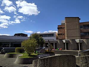
The École nationale des travaux publics de l'État or ENTPE (English: National School of Public Works of the State) is an engineering school part of the French Grandes Écoles founded in 1954 in Paris by the Ministry of Public Works and Transport and located since 1976 in Lyon Metropolitan Area (Vaulx-en-Velin). The main vocation of ENTPE is to train engineers who will serve as technical managers within the French civil service into the State Public Works Engineering Corps or "Ingénieurs des Travaux Publics de l'Etat (ITPE)", even though nowadays half of the students are intended for the private sector, in particular in large French companies in the construction or transport sectors (Eiffage, Bouygues, Vinci, Keolis ...).

Institute of Analytical Sciences
Distance: Approx. 3530 meters
Latitude and longitude: 45.7791,4.8755
Located within the Cité lyonnaise de l’environnement et de l’analyse, the Institute of Analytical Sciences (UMR 5280) is a French research, training and expertise center specializing in analytical chemistry. It is a Joint Research Unit (French: Unité mixte de recherche or UMR) affiliated with the National Centre for Scientific Research (CNRS), Claude Bernard University Lyon 1, and École normale supérieure de Lyon.
Grand parc de Miribel-Jonage
Distance: Approx. 2933 meters
Latitude and longitude: 45.8058,4.9364
The Grand parc de Miribel-Jonage (French pronunciation: [ɡʁɑ̃ paʁk də miʁibɛl ʒɔnaʒ]) is an urban park covering almost 2,200 hectares on the outskirts of Lyon. It covers most of the Island of Miribel-Jonage on the Rhône. This island was created in the 19th century with the digging of the Miribel and Jonage canals to help control the flooding of the Rhône.

Astroballe
Sports venue in Lyon
Distance: Approx. 2014 meters
Latitude and longitude: 45.76638889,4.90722222
Astroballe, or L'Astroballe is an indoor sports arena that is located in the Cusset neighborhood of Villeurbanne, Lyon, France. The arena is primarily used to host basketball games. The arena has a seating capacity of 5,556.

Mini World Lyon
Miniature park in France
Distance: Approx. 2004 meters
Latitude and longitude: 45.763929,4.923937
Mini World Lyon is an animated miniature park of 4,500 square metres (1.1 acres) in the leisure center of Carré de Soie in Vaulx-en-Velin, a commune in the Metropolis of Lyon, in France. This park has been open since June 30, 2016. It is to date the largest amusement park of its kind in France.
Vaulx-en-Velin fire
Fire in Vaulx-en-Velin, France
Distance: Approx. 560 meters
Latitude and longitude: 45.78222222,4.91361111
On 16 December 2022, a fire ravaged a residential building at 12 chemin des Barques in Vaulx-en-Velin, Auvergne-Rhône-Alpes, France. It resulted in killing 10 people, including five children, and injured 14.
Weather in this IP's area
clear sky
4 Celsius
4 Celsius
3 Celsius
5 Celsius
1028 hPa
79 %
1028 hPa
999 hPa
10000 meters
1.03 m/s
10 degree


