185.66.254.201 - IP Lookup: Free IP Address Lookup, Postal Code Lookup, IP Location Lookup, IP ASN, Public IP
Country:
Region:
City:
Location:
Time Zone:
Postal Code:
IP information under different IP Channel
ip-api
Country
Region
City
ASN
Time Zone
ISP
Blacklist
Proxy
Latitude
Longitude
Postal
Route
Luminati
Country
Region
gb
City
bishkek
ASN
Time Zone
Asia/Bishkek
ISP
OJSC Kyrgyztelecom
Latitude
Longitude
Postal
IPinfo
Country
Region
City
ASN
Time Zone
ISP
Blacklist
Proxy
Latitude
Longitude
Postal
Route
IP2Location
185.66.254.201Country
Region
naryn
City
naryn
Time Zone
Asia/Bishkek
ISP
Language
User-Agent
Latitude
Longitude
Postal
db-ip
Country
Region
City
ASN
Time Zone
ISP
Blacklist
Proxy
Latitude
Longitude
Postal
Route
ipdata
Country
Region
City
ASN
Time Zone
ISP
Blacklist
Proxy
Latitude
Longitude
Postal
Route
Popular places and events near this IP address

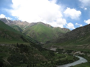
Naryn
City in Naryn Region, Kyrgyzstan
Distance: Approx. 904 meters
Latitude and longitude: 41.43333333,76
Naryn ( nə-RIN; Kyrgyz: Нарын [nɑrɯ́n]) is the regional administrative center of Naryn Region in central Kyrgyzstan. Its area is 84 square kilometres (32 sq mi), and its estimated population was 41,178 as of January 2021. The town was established as a fortress on the caravan route in 1868.

Naryn District
District in Naryn Region, Kyrgyzstan
Distance: Approx. 904 meters
Latitude and longitude: 41.43333333,76
Naryn District (Kyrgyz: Нарын району, romanized: Naryn rayonu, before 2004: Tyanshan District) is a district of Naryn Region in central-southern Kyrgyzstan. The administrative seat lies at the city of Naryn, which is not part of the district. Naryn District was established in its borders in 1930.

Aigyr-Zhal 2
Distance: Approx. 904 meters
Latitude and longitude: 41.43333333,76
Aigyr-Zhal 2 is a historical site in Naryn city on the territory of University of Central Asia (UCA), Kyrgyzstan. It is a part of a bigger and more complex site Aigyr-Zhal. It is dated between Mesolithic time and the Middle Ages.
Alamyshyk Too
Distance: Approx. 8967 meters
Latitude and longitude: 41.404,75.888855
The Alamyshyk Too (or Alamyshyk Range, Kyrgyz: Аламышык Тоосу) is a mountain range in the internal Tien-Shan to the west of Naryn Too between Naryn Valley and At-Bashy Valley. The range is located in At-Bashi District of Naryn Region. The length of the range is 35 km (22 mi) and the width ranges from 6 km (3.7 mi) to 20 km (12 mi).
Weather in this IP's area
clear sky
-19 Celsius
-26 Celsius
-19 Celsius
-19 Celsius
1057 hPa
79 %
1057 hPa
775 hPa
10000 meters
3.92 m/s
3.49 m/s
83 degree
1 %