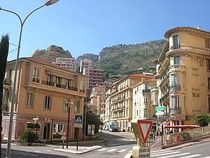
Country:
 France
Region:
City:
Latitude and Longitude:
Time Zone:
Postal Code:
IP information under different IP Channel
ip-api
Country
Region
City
ASN
Time Zone
ISP
Blacklist
Proxy
Latitude
Longitude
Postal
Route
IPinfo
Country
Region
City
ASN
Time Zone
ISP
Blacklist
Proxy
Latitude
Longitude
Postal
Route
MaxMind
Country
Region
City
ASN
Time Zone
ISP
Blacklist
Proxy
Latitude
Longitude
Postal
Route
Luminati
Country
FRASN
Time Zone
Europe/Paris
ISP
Nameshield SAS
Latitude
Longitude
Postal
db-ip
Country
Region
City
ASN
Time Zone
ISP
Blacklist
Proxy
Latitude
Longitude
Postal
Route
ipdata
Country
Region
City
ASN
Time Zone
ISP
Blacklist
Proxy
Latitude
Longitude
Postal
Route
Popular places and events near this IP address
Les Moneghetti
Ward of Monaco
Distance: Approx. 1582 meters
Latitude and longitude: 43.735,7.415
Les Moneghetti (Monégasque: Muneghëti [muneˈɡeti]) is the north-central ward in the Principality of Monaco, bordering neighboring France. Moneghetti was incorporated in La Condamine.

Beausoleil, Alpes-Maritimes
Commune in Provence-Alpes-Côte d'Azur, France
Distance: Approx. 1592 meters
Latitude and longitude: 43.7425,7.4244
Beausoleil (French: [bosɔlɛj]; Occitan: Bèusoleu [ˌbɛwsuˈlew]; lit. 'Beautiful Sun') is a commune in the Alpes-Maritimes department in the Provence-Alpes-Côte d'Azur region in Southeastern France. It adjoins the Principality of Monaco to its south. The commune of Beausoleil was established in 1904; it was supposed to be named Monte-Carlo Supérieur (French: [mɔ̃t kaʁlɔ sypeʁjœʁ]; lit. 'Upper Monte Carlo') for a time but the idea was abandoned after protests from Monégasque authorities.

La Turbie
Commune in Provence-Alpes-Côte d'Azur, France
Distance: Approx. 364 meters
Latitude and longitude: 43.7464,7.4017
La Turbie (French pronunciation: [la tyʁbi]; Occitan: A Torbia; Italian: Turbia) is a commune in the Alpes-Maritimes department in southeastern France.
Chemin des Révoires
Distance: Approx. 1555 meters
Latitude and longitude: 43.73456944,7.41286111
The Chemin des Révoires (Monégasque: Cami̍n d’ë Revëre) is a pathway within Les Révoires district of the Principality of Monaco. It is the highest point in Monaco.

Tropaeum Alpium
Roman monument in La Turbie, Alpes-Maritimes, France
Distance: Approx. 456 meters
Latitude and longitude: 43.74477778,7.40180278
The Tropaeum Alpium (English: Trophy of the Alps; French: Trophée des Alpes) is a Roman trophy (tropaeum) celebrating the emperor Augustus's decisive victory over the tribes who populated the Alps. The monument's ruins are in La Turbie (France), a few kilometers from the Principality of Monaco.

Saint Michel, Monaco
Former ward of Monaco
Distance: Approx. 1634 meters
Latitude and longitude: 43.7405,7.4237
Saint Michel (Monégasque: Santu Michê [ˈsaŋtu miˈkeː]) is a northern-central residential area in the Principality of Monaco, part of the traditional Quartier of Monte Carlo. It was also one of the ten modern administrative wards of Monaco until the 2013 redistricting process.

Sainte-Dévote Chapel
Distance: Approx. 1652 meters
Latitude and longitude: 43.7375063,7.4209764
The Chapel of Sainte—Dévote (French: Chapelle Sainte Dévote; Ligurian: Geija de Santa Devotâ) is a Roman Catholic chapel dedicated to Saint Devota, the patron saint of Monaco, which lies in the Monégasque ward of Ravin de Sainte-Dévote. The chapel was first mentioned in archived documents dated 1070, built against the wall of Vallon des Gaumates, on the space now occupied by the Chapel of Relics. It was restored in the 16th century.

Princess Antoinette Park
Distance: Approx. 1718 meters
Latitude and longitude: 43.73368889,7.41516389
The Princess Antoinette Park on the Boulevard de Jardin Exotique is a municipal park in the Jardin Exotique ward of Monaco. It is named for Princess Antoinette of Monaco, the elder sister of Rainier III, Prince of Monaco. The garden is dedicated to the sacred olive tree.

Monaco-Monte-Carlo station
Railway station serving the Principality of Monaco
Distance: Approx. 1462 meters
Latitude and longitude: 43.73861111,7.41916667
Monaco-Monte-Carlo station (French: Gare de Monaco-Monte-Carlo; Monégasque: Staçiun de Munegu-Munte-Carlu) is the sole railway station in the Principality of Monaco, though part of it is located in Beausoleil, France. It is served by trains of the French state-owned operator SNCF, on the Marseille–Ventimiglia railway line. The station, along with the entire railway line in the principality, is located underground.

Monte Carlo View
Distance: Approx. 1649 meters
Latitude and longitude: 43.7339,7.4137
The Monte Carlo View, also known as the Teotista, is a residential high-rise building in Monaco. The building was developed by the Michel Pastor Group. Construction began in 2008, and it was completed in 2012.

Canton of Beausoleil
Canton in Provence-Alpes-Côte d'Azur, France
Distance: Approx. 1164 meters
Latitude and longitude: 43.75,7.42
The canton of Beausoleil is an administrative division of the Alpes-Maritimes department, southeastern France. Its borders were modified at the French canton reorganisation which came into effect in March 2015. Its seat is in Beausoleil.

Ravin de Sainte-Dévote
Secteur réservé in Monaco
Distance: Approx. 1645 meters
Latitude and longitude: 43.7375,7.42083333
Ravin de Sainte-Dévote (French pronunciation: [ʁavɛ̃ də sɛ̃t devɔt]; Monégasque: Valu̍n de Santa Devota, English: Ravine of Saint Devota) is a ward in the Principality of Monaco.
Weather in this IP's area
clear sky
17 Celsius
17 Celsius
16 Celsius
17 Celsius
1015 hPa
68 %
1015 hPa
969 hPa
10000 meters
1.54 m/s
07:49:45
18:40:29