185.65.249.41 - IP Lookup: Free IP Address Lookup, Postal Code Lookup, IP Location Lookup, IP ASN, Public IP
Country:
Region:
City:
Location:
Time Zone:
Postal Code:
IP information under different IP Channel
ip-api
Country
Region
City
ASN
Time Zone
ISP
Blacklist
Proxy
Latitude
Longitude
Postal
Route
Luminati
Country
ASN
Time Zone
Europe/Paris
ISP
SEWAN SAS
Latitude
Longitude
Postal
IPinfo
Country
Region
City
ASN
Time Zone
ISP
Blacklist
Proxy
Latitude
Longitude
Postal
Route
IP2Location
185.65.249.41Country
Region
occitanie
City
villemoustaussou
Time Zone
Europe/Paris
ISP
Language
User-Agent
Latitude
Longitude
Postal
db-ip
Country
Region
City
ASN
Time Zone
ISP
Blacklist
Proxy
Latitude
Longitude
Postal
Route
ipdata
Country
Region
City
ASN
Time Zone
ISP
Blacklist
Proxy
Latitude
Longitude
Postal
Route
Popular places and events near this IP address

Pont Marengo
Distance: Approx. 3984 meters
Latitude and longitude: 43.2175,2.35194444
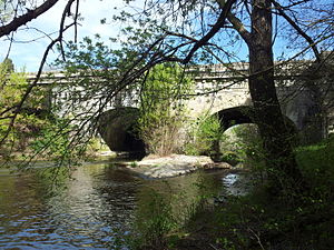
The Pont Marengo (Marengo bridge) crosses the Canal du Midi and links Carcassonne to the local railway station. The busy canal lock at Port Marengo is a tourist attraction as the canal boats work their way along the canal. The bridge is named after the Battle of Marengo at which Napoleon defeated the Austrians in 1800, and a plaque on the bridge dates the construction to that year (or year 8, as it is given in the French Republican calendar).

Arrondissement of Carcassonne
Arrondissement in Occitania, France
Distance: Approx. 3767 meters
Latitude and longitude: 43.22,2.35
The arrondissement of Carcassonne is an arrondissement of France in the Aude department in the Occitanie région. Its INSEE code is 111 and its capital city is Carcassonne. It has 186 communes.

Stade Albert Domec
Municipal stadium
Distance: Approx. 3799 meters
Latitude and longitude: 43.21777778,2.36444444
Stade Albert Domec is a multi-use municipal stadium in Carcassonne, France. It has a capacity of 10,000 spectators. It is the home ground of Pro D2 rugby union club Union Sportive Carcassonnaise and Elite One Championship rugby league club Association Sportive de Carcassonne XIII. It is also used by the association football club Football Agglomération Carcassonne for their big matches.

Roman Catholic Diocese of Carcassonne-Narbonne
Latin Catholic diocese in France
Distance: Approx. 4164 meters
Latitude and longitude: 43.21555556,2.35333333
The Diocese of Carcassonne and Narbonne (Latin: Dioecesis Carcassonensis et Narbonensis; French: Diocèse de Carcassonne et Narbonne) is a Latin Church ecclesiastical jurisdiction or diocese of the Catholic Church in France. The diocese comprises the entire department of Aude. It is suffragan to the Archdiocese of Montpellier.

Conques-sur-Orbiel
Commune in Occitanie, France
Distance: Approx. 3651 meters
Latitude and longitude: 43.2706,2.4025
Conques-sur-Orbiel (French pronunciation: [kɔ̃k syʁ ɔʁbjɛl] ; Occitan: Concas) is a commune in the Aude department in southern France.

Pennautier
Commune in Occitanie, France
Distance: Approx. 3804 meters
Latitude and longitude: 43.2464,2.3192
Pennautier (French pronunciation: [pɛnotje]; Occitan: Puègnautièr) is a commune in the Aude department in southern France.
Villalier
Commune in Occitanie, France
Distance: Approx. 3936 meters
Latitude and longitude: 43.2581,2.4133
Villalier (French pronunciation: [vilalje] ; Occitan: Vilalièr) is a commune in the Aude department in southern France.

Villegailhenc
Commune in Occitanie, France
Distance: Approx. 2178 meters
Latitude and longitude: 43.27,2.3553
Villegailhenc (French pronunciation: [vilɡajɛ̃k] ; Occitan: Vilagalhenc) is a commune in the Aude department in southern France. In mid-October 2018, Villegailhenc, Conques-sur-Orbiel, and Villardonnel, and Trèbes, along with nearby areas along the river Aude, were devastated when the river flooded after intense rain. 12 people were killed, including a nun.

Villemoustaussou
Commune in Occitanie, France
Distance: Approx. 135 meters
Latitude and longitude: 43.2531,2.3653
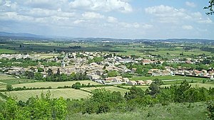
Villemoustaussou (French pronunciation: [vilmustosu] ; Languedocien: Vilamostausson) is a commune in the Aude department in southern France.

Fresquel Aqueduct
Bridge in Carcassonne
Distance: Approx. 1711 meters
Latitude and longitude: 43.23758889,2.37321111
The Fresquel Aqueduct (French: Pont-canal du Fresquel) is one of several aqueducts on the Canal du Midi. Until its building, the canal crossed the River Fresquel on the level. Built in 1802–1810, the structure is near Carcassonne.

Carcassonne station
Railway station in Occitanie, France
Distance: Approx. 3925 meters
Latitude and longitude: 43.21805556,2.35194444
Carcassonne is a railway station in Carcassonne, Occitanie, France, on the Bordeaux–Sète and Carcassonne–Rivesaltes lines.

Canton of La Vallée de l'Orbiel
Canton in Occitania, France
Distance: Approx. 422 meters
Latitude and longitude: 43.25,2.37
The canton of La Vallée de l'Orbiel is an administrative division of the Aude department, southern France. It was created at the French canton reorganisation which came into effect in March 2015. Its seat is in Villemoustaussou.
Weather in this IP's area
overcast clouds
3 Celsius
2 Celsius
3 Celsius
3 Celsius
1025 hPa
93 %
1025 hPa
993 hPa
10000 meters
1.54 m/s
160 degree
100 %