185.65.248.220 - IP Lookup: Free IP Address Lookup, Postal Code Lookup, IP Location Lookup, IP ASN, Public IP
Country:
Region:
City:
Location:
Time Zone:
Postal Code:
IP information under different IP Channel
ip-api
Country
Region
City
ASN
Time Zone
ISP
Blacklist
Proxy
Latitude
Longitude
Postal
Route
Luminati
Country
ASN
Time Zone
Europe/Paris
ISP
SEWAN SAS
Latitude
Longitude
Postal
IPinfo
Country
Region
City
ASN
Time Zone
ISP
Blacklist
Proxy
Latitude
Longitude
Postal
Route
IP2Location
185.65.248.220Country
Region
centre-val de loire
City
amboise
Time Zone
Europe/Paris
ISP
Language
User-Agent
Latitude
Longitude
Postal
db-ip
Country
Region
City
ASN
Time Zone
ISP
Blacklist
Proxy
Latitude
Longitude
Postal
Route
ipdata
Country
Region
City
ASN
Time Zone
ISP
Blacklist
Proxy
Latitude
Longitude
Postal
Route
Popular places and events near this IP address
Château d'Amboise
Château in the Indre-et-Loire, France
Distance: Approx. 273 meters
Latitude and longitude: 47.41333333,0.98611111
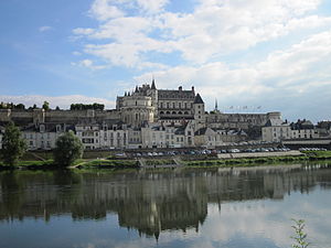
The Château d'Amboise is a château in Amboise, located in the Indre-et-Loire département of the Loire Valley in France. Confiscated by the monarchy in the 15th century, it became a favoured royal residence and was extensively rebuilt. King Charles VIII died at the château in 1498 after hitting his head on a door lintel.

Clos Lucé
Château in Amboise, France
Distance: Approx. 711 meters
Latitude and longitude: 47.4102299,0.9915248
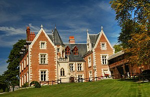
The Château du Clos Lucé (French pronunciation: [ʃato dy klo lyse]; or simply Clos Lucé), formerly called Manoir du Cloux, is a large château located in the center of Amboise, in the department of Indre-et-Loire, in the Centre-Val de Loire region of France. It is located in the natural Val de Loire (formerly called Touraine) region. Built by Hugues d'Amboise in 1471, the palace has known several famous owners such as the French king Charles VIII and Leonardo da Vinci.
Amboise
Commune in Centre-Val de Loire, France
Distance: Approx. 946 meters
Latitude and longitude: 47.4042,0.98
Amboise (US: ; French: [ɑ̃bwaz] ) is a commune in the Indre-et-Loire department in central France. Today a small market town, it was once home of the French royal court.

Nazelles-Négron
Commune in Centre-Val de Loire, France
Distance: Approx. 3117 meters
Latitude and longitude: 47.4328,0.9542
Nazelles-Négron (French pronunciation: [nazɛl neɡʁɔ̃] ) is a commune in the Indre-et-Loire department in central France.
Pocé-sur-Cisse
Commune in Centre-Val de Loire, France
Distance: Approx. 3714 meters
Latitude and longitude: 47.4453,0.9917
Pocé-sur-Cisse (French pronunciation: [pɔse syʁ sis] , literally Pocé on Cisse) is a commune in the Indre-et-Loire department in central France.
Chargé
Commune in Centre-Val de Loire, France
Distance: Approx. 4183 meters
Latitude and longitude: 47.4322,1.03
Chargé (French pronunciation: [ʃaʁʒe] ) is a commune in the Indre-et-Loire department in central France. Chargé is a small town near Amboise. The Rock 'in Chargé festival has revitalized the village since 2006.

Saint-Ouen-les-Vignes
Commune in Centre-Val de Loire, France
Distance: Approx. 6537 meters
Latitude and longitude: 47.4706,0.9953
Saint-Ouen-les-Vignes (French pronunciation: [sɛ̃.t‿wɛ̃ le viɲ] ) is a commune in the Indre-et-Loire department in central France.
Lussault-sur-Loire
Commune in Centre-Val de Loire, France
Distance: Approx. 5089 meters
Latitude and longitude: 47.3975,0.9189
Lussault-sur-Loire (French pronunciation: [lyso syʁ lwaʁ] , literally Lussault on Loire) is a commune in the Indre-et-Loire department in central France.
Saint-Règle
Commune in Centre-Val de Loire, France
Distance: Approx. 5399 meters
Latitude and longitude: 47.4092,1.0542
Saint-Règle (French pronunciation: [sɛ̃ ʁɛɡl]) is a commune in the Indre-et-Loire department in central France.

Amboise station
Railway station in Amboise, France
Distance: Approx. 997 meters
Latitude and longitude: 47.42138889,0.98111111
Amboise station (French: Gare d'Amboise) is a railway station serving the town Amboise, Indre-et-Loire department, central France. It is situated on the Paris–Bordeaux railway.
Canton of Amboise
Distance: Approx. 345 meters
Latitude and longitude: 47.41,0.98
The canton of Amboise is an administrative division of the Indre-et-Loire department, central France. Its borders were modified at the French canton reorganisation which came into effect in March 2015. Its seat is in Amboise.

Château de Chanteloup
Building in Amboise, France
Distance: Approx. 2127 meters
Latitude and longitude: 47.39548,0.96988
The Château de Chanteloup was an imposing 18th-century French château with elaborate gardens, compared by some contemporaries to Versailles. It was located in the Loire Valley on the south bank of the river Loire, downstream from the town of Amboise and about 2.3 kilometres (1.4 mi) southwest of the royal Château d'Amboise. From 1761 to 1785 Chanteloup belonged to King Louis XV's prime minister, the Duke of Choiseul.
Weather in this IP's area
overcast clouds
3 Celsius
0 Celsius
1 Celsius
3 Celsius
1032 hPa
86 %
1032 hPa
1025 hPa
10000 meters
2.06 m/s
130 degree
100 %


