Country:
Region:
City:
Latitude and Longitude:
Time Zone:
Postal Code:
IP information under different IP Channel
ip-api
Country
Region
City
ASN
Time Zone
ISP
Blacklist
Proxy
Latitude
Longitude
Postal
Route
Luminati
Country
Region
ib
City
soller
ASN
Time Zone
Europe/Madrid
ISP
Vall De Soller Telecomunicacions Slu
Latitude
Longitude
Postal
IPinfo
Country
Region
City
ASN
Time Zone
ISP
Blacklist
Proxy
Latitude
Longitude
Postal
Route
db-ip
Country
Region
City
ASN
Time Zone
ISP
Blacklist
Proxy
Latitude
Longitude
Postal
Route
ipdata
Country
Region
City
ASN
Time Zone
ISP
Blacklist
Proxy
Latitude
Longitude
Postal
Route
Popular places and events near this IP address

Deià
Municipality in Balearic Islands, Spain
Distance: Approx. 5865 meters
Latitude and longitude: 39.75,2.65
Deià (Catalan pronunciation: [dəˈja]) is a municipality and small coastal village in the Serra de Tramuntana, which forms the northern ridge of the Spanish island of Mallorca. It is located about 16 kilometres (10 mi) north of Valldemossa, and it is known for its literary and musical residents. Its idyllic landscape, orange and olive groves on steep cliffs overlooking the Mediterranean, served as a draw for German, English, and American expatriates after the First World War.

Sóller
Municipality in Balearic Islands, Spain
Distance: Approx. 183 meters
Latitude and longitude: 39.76755,2.71398889
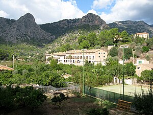
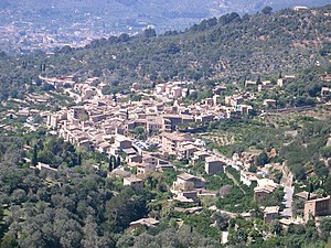
Sóller (Catalan pronunciation: [ˈso.ʎə]) is a town and municipality near the north west coast of the Balearic Island of Mallorca, Spain, 3 km inland from Port de Sóller, in a large, bowl-shaped valley that also includes the village of Fornalutx and the hamlets of Biniaraix and Binibassi. The population is around 14,000. The Tranvía de Sóller tram links Sóller to Port de Sóller.

Bunyola
Municipality and town in Balearic Islands, Spain
Distance: Approx. 7853 meters
Latitude and longitude: 39.69666667,2.69972222
Bunyola (Catalan pronunciation: [buˈɲɔ.lə]) is a municipality of the island of Mallorca, Spain, located in the spurs of the Serra de Tramuntana, at a distance of 9 miles (14 km) from Palma. The municipality has an area of 32.67 square miles (84.6 km2) and a population of 6,636 inhabitants,INE Instituto Nacional Estadística and the Ferrocarril de Sóller passes through it on the way to Palma. (INE 2018).

Fornalutx
Municipality in Balearic Islands, Spain
Distance: Approx. 2458 meters
Latitude and longitude: 39.78333333,2.73333333
Fornalutx (Catalan pronunciation: [foɾnəˈlutʃ]) is a mountainous municipality and village on Majorca (Mallorca), one of the Balearic Islands, in Spain. The nearest town is Sóller, which can be reached by foot via a series of footpaths and pathways and the hamlet of Binibassi. Surrounding mountains include the Alfabia Mountains and the Els Cornadors.
Port de Sóller
Village in Balearic Islands, Spain
Distance: Approx. 4054 meters
Latitude and longitude: 39.79861111,2.69361111
Port de Sóller (Catalan pronunciation: [ˈpɔɾd də ˈsoʎə]) is a village and the port of the town of Sóller, in Mallorca, in the Balearic Islands, Spain. Along with the village of Fornalutx and the hamlet of Biniaraix they combine to form Sóller. The combined population is around 12,000.

Alfabia Mountains
Mountain range in the Serra de Tramuntana mountains of Mallorca, Balearic Islands
Distance: Approx. 3449 meters
Latitude and longitude: 39.73527778,2.71277778
The Alfabia Mountains are a mountain range in Majorca located in the municipality of Fornalutx. Water from the Alfabia Mountains nourishes these unique gardens, showcasing a remarkable array of Renaissance and Baroque elements. Notable features include a cistern topped by a semi-circular vault, providing an excellent viewpoint to appreciate the vast landscape, and an expansive pergola adorned with giochi d'acqua (hidden water jets designed to surprise visitors) in traditional Renaissance fashion, leading to the orange grove.

Els Cornadors
Distance: Approx. 2558 meters
Latitude and longitude: 39.76,2.744
Els Cornadors is a mountain range in Majorca in the municipality of Sóller. 3,136-ft. island mountain with corner-shaped twin peaks & dramatic landscape.

Serra de Tramuntana
Mountain range in Mallorca, Spain
Distance: Approx. 4310 meters
Latitude and longitude: 39.73083333,2.69472222
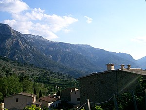
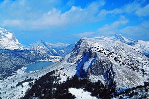
The Serra de Tramuntana (Balearic Catalan: [ˈsɛrə ðə tɾəmunˈtanə]; Spanish: Sierra de Tramontana [ˈsjera ðe tɾamonˈtana]) is a mountain range running southwest–northeast which forms the northern backbone of the Spanish island of Mallorca. It is also the name given to the comarca of the same area. On 27 June 2011, the Tramuntana Range was awarded World Heritage Status by UNESCO as an area of great physical and cultural significance.

Puig Major
Peak in Majorca, Spain
Distance: Approx. 8171 meters
Latitude and longitude: 39.8,2.8
Puig Major is the highest peak on the Spanish island of Majorca. With an elevation of 1,436 m (4,711 ft) above sea level. It is situated in the Serra de Tramuntana mountains.

Tranvía de Sóller
Distance: Approx. 1489 meters
Latitude and longitude: 39.7772,2.7053
The Tranvía de Sóller (Catalan: Tramvia de Sóller) is a Spanish heritage tramway serving the town of Sóller and the coastal village of Port de Sóller, in the island of Majorca. It is owned by Ferrocarril de Sóller S.A. (FS), the same company operating the heritage rail line linking the town to the city of Palma. The Tranvía de Sóller is one of only two first generation tramways to survive in Spain, along with the Tramvia Blau in the city of Barcelona.

Cúber
Reservoir in Balearic Islands, Spain
Distance: Approx. 6609 meters
Latitude and longitude: 39.784,2.7889
Cúber is an artificial water reservoir located at the valleys of Puig Major and Morro de Cúber, on the island of Mallorca, Spain. With the Gorg Blau, they provide water to the city of Palma de Mallorca and the surrounding areas by the Almandrà torrent. Cúber receives its name by the "possessió" near the reservoir: el Morro de Cúber.

Puig de Sant Miquel (Alaró)
Distance: Approx. 8323 meters
Latitude and longitude: 39.748474,2.809692
Puig de Sant Miquel is a 661-metre (2,169 ft) mountain in the Serra de Tramuntana of Majorca. It is included in the municipality of Alaró of the autonomous community of the Balearic Islands. The Puig de Sant Miquel is located between s'Alcadena and the Finca Solleric, near the old path to Orient.
Weather in this IP's area
few clouds
15 Celsius
14 Celsius
13 Celsius
15 Celsius
1022 hPa
79 %
1022 hPa
1017 hPa
10000 meters
1.79 m/s
3.58 m/s
44 degree
11 %
07:34:11
17:33:38
