Country:
 Italy
ItalyRegion:
City:
Latitude and Longitude:
Time Zone:
Postal Code:
IP information under different IP Channel
ip-api
Country
Region
City
ASN
Time Zone
ISP
Blacklist
Proxy
Latitude
Longitude
Postal
Route
IPinfo
Country
Region
City
ASN
Time Zone
ISP
Blacklist
Proxy
Latitude
Longitude
Postal
Route
MaxMind
Country
Region
City
ASN
Time Zone
ISP
Blacklist
Proxy
Latitude
Longitude
Postal
Route
Luminati
Country
ITASN
Time Zone
Europe/Rome
ISP
Webcom TLC srl
Latitude
Longitude
Postal
db-ip
Country
Region
City
ASN
Time Zone
ISP
Blacklist
Proxy
Latitude
Longitude
Postal
Route
ipdata
Country
Region
City
ASN
Time Zone
ISP
Blacklist
Proxy
Latitude
Longitude
Postal
Route
Popular places and events near this IP address

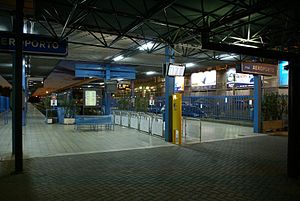
Pisa International Airport
International airport serving Pisa, Italy
Distance: Approx. 3028 meters
Latitude and longitude: 43.68388889,10.3925
Pisa International Airport (Italian: Aeroporto Internazionale di Pisa) (IATA: PSA, ICAO: LIRP), also named Galileo Galilei Airport, is an airport located in Pisa, Italy. It is one of the two major airports in Tuscany, the other being Florence Airport. Pisa is ranked 10th in Italy in terms of passenger numbers.
Pisa Aeroporto railway station
Distance: Approx. 2724 meters
Latitude and longitude: 43.69833333,10.39833333
Pisa Aeroporto railway station (Italian: Stazione di Pisa Aeroporto) was a railway station within Pisa International Airport, Italy. A shuttle train service operated between it and the nearby main railway station in Pisa, Pisa Centrale railway station, although there were also a few direct services to Florence. It was closed on 15 December 2013 to make way for the construction of a fully automated people mover, called PisaMover, which operates services to Pisa Centrale every five minutes.
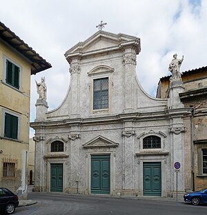
San Silvestro, Pisa
Distance: Approx. 3246 meters
Latitude and longitude: 43.71423889,10.40979444
San Silvestro is a former church in Pisa, Italy, facing piazza San Silvestro. It is now deconsecrated.

San Michele degli Scalzi
Distance: Approx. 2086 meters
Latitude and longitude: 43.706,10.4192
San Michele degli Scalzi is a church located in Piazza San Michele degli Scalzi, in the eastern part of Pisa, Italy. It had also been known as the church of San Michele degli Scalzi in Orticaia, referring to the swampy nature of the site at the time of its founding. The term Scalzi refers to the barefoot monks linked to the church.

Santi Jacopo e Filippo, Pisa
Distance: Approx. 2531 meters
Latitude and longitude: 43.70879444,10.41453889
Santi Jacopo e Filippo or Santi Iacopo e Filippo (or San Iacopo in Orticaia) is an ancient church found in Via San Michele degli Scalzi in Pisa, Italy. Documents exist as belonging to an Augustinian abbey by 1110, but it is believed that a church was situated at the site just after the year 1000. The Romanesque architecture includes a half-finished facade.

Cittadella Nuova
Distance: Approx. 3078 meters
Latitude and longitude: 43.71103056,10.40676667
The Cittadella Nuova (New Citadel), now called the Giardino di Scotto or Giardino Scotto (Scotto's Garden) is an old fortress in Pisa.

Ponte della Vittoria, Pisa
Bridge in Pisa
Distance: Approx. 2907 meters
Latitude and longitude: 43.71,10.4084
The Ponte della Vittoria (Bridge of Victory) is a bridge over the Arno in Pisa.

Santa Croce in Fossabanda, Pisa
Distance: Approx. 2797 meters
Latitude and longitude: 43.7116,10.4149
Santa Croce in Fossabanda is a Renaissance-style Roman Catholic church and monastery in Pisa, region of Tuscany, Italy.
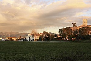
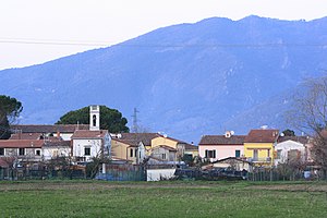
Montione
Frazione in Tuscany, Italy
Distance: Approx. 2887 meters
Latitude and longitude: 43.6925,10.465
Montione, also called Badia, is a village in Tuscany, central Italy, administratively a frazione of the comune of Cascina, province of Pisa. Montione is about 8 km from Pisa and from Cascina.
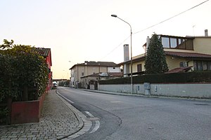
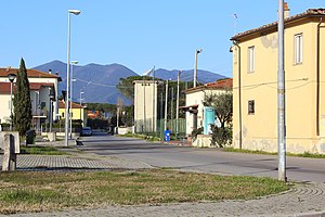
Pettori
Frazione in Tuscany, Italy
Distance: Approx. 2935 meters
Latitude and longitude: 43.70194444,10.46111111
Pettori is a village in Tuscany, central Italy, administratively a frazione of the comune of Cascina, province of Pisa. Pettori is about 8 km from Pisa and 10 km from Cascina.
San Sisto al Pino
Frazione in Tuscany, Italy
Distance: Approx. 2941 meters
Latitude and longitude: 43.70916667,10.45277778
San Sisto al Pino is a village in Tuscany, central Italy, administratively a frazione of the comune of Cascina, province of Pisa. San Sisto al Pino is about 6 km southeast of Pisa and 11 km northwest of Cascina.
Titignano, Cascina
Frazione in Tuscany, Italy
Distance: Approx. 2304 meters
Latitude and longitude: 43.69027778,10.45805556
Titignano is a village in Tuscany, central Italy, administratively a frazione of the comune of Cascina, province of Pisa. Titignano is about 5 km from Pisa and 8 km from Cascina.
Weather in this IP's area
clear sky
15 Celsius
15 Celsius
15 Celsius
17 Celsius
1016 hPa
86 %
1016 hPa
1016 hPa
10000 meters
0.89 m/s
0.89 m/s
45 degree
07:03:29
19:19:51