185.6.71.232 - IP Lookup: Free IP Address Lookup, Postal Code Lookup, IP Location Lookup, IP ASN, Public IP
Country:
Region:
City:
Location:
Time Zone:
Postal Code:
ISP:
ASN:
language:
User-Agent:
Proxy IP:
Blacklist:
IP information under different IP Channel
ip-api
Country
Region
City
ASN
Time Zone
ISP
Blacklist
Proxy
Latitude
Longitude
Postal
Route
db-ip
Country
Region
City
ASN
Time Zone
ISP
Blacklist
Proxy
Latitude
Longitude
Postal
Route
IPinfo
Country
Region
City
ASN
Time Zone
ISP
Blacklist
Proxy
Latitude
Longitude
Postal
Route
IP2Location
185.6.71.232Country
Region
nordrhein-westfalen
City
lierenfeld
Time Zone
Europe/Berlin
ISP
Language
User-Agent
Latitude
Longitude
Postal
ipdata
Country
Region
City
ASN
Time Zone
ISP
Blacklist
Proxy
Latitude
Longitude
Postal
Route
Popular places and events near this IP address

Duchy of Berg
State of the Holy Roman Empire (1101–1815)
Distance: Approx. 1069 meters
Latitude and longitude: 51.20722222,6.8125
Berg was a state—originally a county, later a duchy—in the Rhineland of Germany. Its capital was Düsseldorf. It existed as a distinct political entity from the early 12th to the 19th centuries.
Mitsubishi Electric Halle
Indoor arena in Düsseldorf, Germany
Distance: Approx. 1354 meters
Latitude and longitude: 51.20638889,6.80861111
The Mitsubishi Electric Halle (formerly Philips Halle) is an indoor arena located in Düsseldorf, Germany. It opened in 1971 and has a capacity of 7,500 people. It was originally named after Dutch electronics conglomerate Philips.

Paul-Janes-Stadion
Association football stadium in Düsseldorf, Germany
Distance: Approx. 1759 meters
Latitude and longitude: 51.225,6.82722222
The Paul-Janes-Stadion in Düsseldorf-Flingern is one of the home grounds of Fortuna Düsseldorf (1930–1972, early 2002-2005). It is located at 87 Flinger Broich, to the east of the city centre in the Nord Flingern district. The stadium was built in 1930 by the team; now city-owned, it has been named since 1990 after the long-standing Düsseldorf and national football player Paul Janes.

Düsseldorf-Eller
City district of Düsseldorf, Germany
Distance: Approx. 1423 meters
Latitude and longitude: 51.2,6.84166667
Eller is an urban quarter of Düsseldorf, part of Borough 8. It is located southeast of the city centre. Eller has been a part of Düsseldorf since the year 1909.

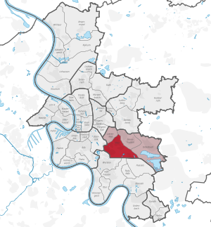
Lierenfeld
City district of Düsseldorf, Germany
Distance: Approx. 20 meters
Latitude and longitude: 51.20916667,6.82777778
Lierenfeld is an urban quarter of Düsseldorf, part of Borough 8. It borders on Eller, Oberbilk, Flingern and Wersten. It has an area of 2.44 km2 (0.94 sq mi), and 11,108 inhabitants (2020).

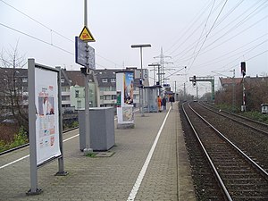
Düsseldorf-Oberbilk station
Railway station in Düsseldorf, Germany
Distance: Approx. 1285 meters
Latitude and longitude: 51.20805556,6.80916667
Düsseldorf-Oberbilk (Oberbilk Bf./PhilipsHalle for the subway station) is an interchange railway station situated at Oberbilk, Düsseldorf in western Germany. It is served by the S1, S6 and S68 lines of Rhine-Ruhr S-Bahn, lines U76 and U79 of Düsseldorf Stadtbahn (light rail), and Tram line 701.

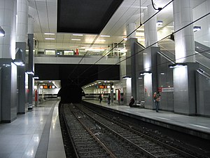
Ellerstraße station
Subway station in Düsseldorf, Germany
Distance: Approx. 1392 meters
Latitude and longitude: 51.21111111,6.80777778
Ellerstraße is an underground station on the Düsseldorf Stadtbahn lines U74, U77 and U79 in Düsseldorf. The station lies on Ellerstraße in the district of Oberbilk. The station was opened on 15 June 2002; it consists of two side-platform with two rail tracks.

Düsseldorf-Eller Süd station
Railway station in Düsseldorf, Germany
Distance: Approx. 1399 meters
Latitude and longitude: 51.19791667,6.83633333
Düsseldorf-Eller Süd station is located approximately 5 kilometres south of Düsseldorf Hauptbahnhof in the district of Eller in the city of Düsseldorf in the German state of North Rhine-Westphalia. It is on the Cologne–Duisburg line and is classified by Deutsche Bahn as a category 5 station. It is served by Rhine-Ruhr S-Bahn lines S 6 every 20 minutes and by a few services of S 68 in the peak hour.

Düsseldorf-Eller Mitte station
Railway station in Düsseldorf, Germany
Distance: Approx. 1211 meters
Latitude and longitude: 51.20249,6.841162
Düsseldorf-Eller Mitte station is located in the district of Eller in the German city of Düsseldorf in the German state of North Rhine-Westphalia. It is on the Düsseldorf–Solingen line and is classified by Deutsche Bahn as a category 5 station. It is served by Rhine-Ruhr S-Bahn line S 1 every 20 minutes, Stadbahn line U75, operating every 10 minutes, tram line 701, operating every 10 minutes and two bus routes: 723 (every 30 minutes) and 724 (every 20 minutes), operated by Rheinbahn.

Ickbach
River in Germany
Distance: Approx. 1396 meters
Latitude and longitude: 51.20416667,6.80916667
Ickbach is a river of Düsseldorf, North Rhine-Westphalia, Germany.

Kiefernstraße
Distance: Approx. 1672 meters
Latitude and longitude: 51.2192,6.8096
Kiefernstraße ( pronounced ['ki:fɐn'ʃtra:sə]) is a street in the Flingern-Süd district of Düsseldorf that became notorious in the 1980s for squatting. In the mid-1980s there were connections to the Baader–Meinhof Gang. Nowadays, the former squatters have regular leases.

Borough 8 (Düsseldorf)
Borough of Düsseldorf in North Rhine-Westphalia, Germany
Distance: Approx. 4 meters
Latitude and longitude: 51.20916667,6.8275
Borough 8 (German: Stadtbezirk 8) is a southeastern borough of Düsseldorf, the state capital of North Rhine-Westphalia, Germany. The borough covers an area of 20.96 square kilometres and (as of December 2020) has about 61,000 inhabitants. The borough borders with the Düsseldorf boroughs 2, 3, 7 and 9.
Weather in this IP's area
mist
2 Celsius
0 Celsius
2 Celsius
3 Celsius
1033 hPa
94 %
1033 hPa
1025 hPa
2000 meters
2.06 m/s
160 degree
100 %
