Country:
Region:
City:
Latitude and Longitude:
Time Zone:
Postal Code:
IP information under different IP Channel
ip-api
Country
Region
City
ASN
Time Zone
ISP
Blacklist
Proxy
Latitude
Longitude
Postal
Route
Luminati
Country
ASN
Time Zone
Europe/Zagreb
ISP
Croatian Regulatory Authority for Network Industries
Latitude
Longitude
Postal
IPinfo
Country
Region
City
ASN
Time Zone
ISP
Blacklist
Proxy
Latitude
Longitude
Postal
Route
db-ip
Country
Region
City
ASN
Time Zone
ISP
Blacklist
Proxy
Latitude
Longitude
Postal
Route
ipdata
Country
Region
City
ASN
Time Zone
ISP
Blacklist
Proxy
Latitude
Longitude
Postal
Route
Popular places and events near this IP address

Jarun
Neighbourhood of Zagreb, Croatia
Distance: Approx. 1526 meters
Latitude and longitude: 45.78333333,15.91666667
Jarun (pronounced [jaˈrun]) is a neighborhood in the southwestern part of Zagreb, Croatia. It was named after Lake Jarun, formed by the Sava River, now located on the southern edge of the neighborhood.

Trešnjevka
Distance: Approx. 2536 meters
Latitude and longitude: 45.79404,15.944164
Trešnjevka is a neighborhood of Zagreb, Croatia. Forming one of the city's inner neighborhoods, it is located in the city's southwestern area. At approximately 15.67 km2 in area and a population of slightly over 121,000, it is one of the most densely populated areas of the country.

Vrapče
Distance: Approx. 2296 meters
Latitude and longitude: 45.815,15.89833333
Vrapče (pronounced [ʋrǎptʃe]) is a neighborhood of western Zagreb, the capital of Croatia. It is administratively part of the district Podsused—Vrapče. Vrapče consists of Donje Vrapče (lit.

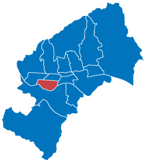
Trešnjevka – jug
City district of Zagreb, Croatia
Distance: Approx. 625 meters
Latitude and longitude: 45.79255278,15.90611111
Trešnjevka – jug (Croatian pronunciation: [trêʃɲeːʋka jûg], "Trešnjevka – south") is a district of Zagreb, Croatia. It is in the western part of the city and has 66,674 inhabitants (2011 census). The district encompasses the southern (Croatian: jug) part of the traditional Trešnjevka neighbourhood, separated from the northern part (Croatian: sjever) by the Zagrebačka Avenue.

Trešnjevka – sjever
City district of Zagreb, Croatia
Distance: Approx. 1243 meters
Latitude and longitude: 45.80050278,15.92671111
Trešnjevka – sjever (Croatian pronunciation: [trêʃɲeːʋka sjêʋer], "Trešnjevka – north") is one of the districts of Zagreb, Croatia. It is located in the western part of the city and has 55,425 inhabitants according to the 2011 census. The district encompasses the northern (Croatian: sjever) part of the traditional Trešnjevka neighbourhood, separated from the southern part (Croatian: jug) by the Zagrebačka Avenue.

Vrbani, Zagreb
Distance: Approx. 981 meters
Latitude and longitude: 45.79,15.90333333
Vrbani is a neighborhood in Trešnjevka - jug city district in the southwestern part of Zagreb, Croatia. The area covered by the local city council Vrbani has around 10,093 inhabitants. The borders of Vrbani are Horvaćanska Street on the south with Jarun, Hrvatski Sokol Street with Staglišće on the east, Zagrebačka Avenue with Rudeš on the north and Petrovaradinska Street on the west with Prečko.
Sky Office Tower
Office building in Zagreb, Croatia
Distance: Approx. 4 meters
Latitude and longitude: 45.79657,15.911716
Sky Office Tower is a dual business tower, elliptically shaped, located in Zagreb, Croatia, north of the Zagrebačka Avenue, near the intersection with Zagrebačka cesta. The office tower was completed in 2012. It is one of the few high-rise construction projects in Zagreb that persisted throughout the economic crisis in 2010.
Ljubljanska Avenue
Distance: Approx. 2310 meters
Latitude and longitude: 45.79722222,15.88194444
Ljubljanska Avenue (Croatian: Ljubljanska avenija) is one of the most travelled thoroughfares in Zagreb, Croatia. It is a four-lane divided avenue that runs from the Savska Opatovina rotary (located in the western part of the Trešnjevka - sjever district) in the east to the Jankomir interchange with the Zagreb bypass in the west. The road uses the recently upgraded Jankomir bridge over the Sava river and it is fully grade-separated.

Zagrebačka Avenue
Distance: Approx. 2110 meters
Latitude and longitude: 45.79388889,15.93861111
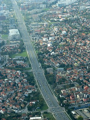
Zagrebačka Avenue (Croatian: Zagrebačka avenija) is an important east–west avenue in western Zagreb, Croatia. It is a dual carriageway with three lanes in each direction that starts as a continuation of the Slavonska Avenue under the intersection with the Savska Road, ending at the Savska Opatovina roundabout. It was previously part of Ljubljanska Avenue, which used to span from the Jankomir interchange to Savska Road in the outer city center, but in 2006 a part of Ljubljanska Avenue was widened and separated from the old avenue to be named to Zagrebačka Avenue at the proposal of Mayor Milan Bandić.
Jarun Bridge
Planned bridge in Croatia
Distance: Approx. 1845 meters
Latitude and longitude: 45.78166667,15.90138889
Jarun Bridge (Croatian: Jarunski most) is a planned bridge that will cross the Sava River in Zagreb, the capital of Croatia. The bridge will be located in the western part of the city, Trešnjevka near Lake Jarun. The city of Zagreb organized a tender for the design of the Jarun Bridge in 2006, and accepted the project in 2007.

Špansko
Neighbourhood in Zagreb, Croatia
Distance: Approx. 984 meters
Latitude and longitude: 45.8,15.9
Špansko is a neighbourhood in the western part of Zagreb, Croatia. It has about 24,000 inhabitants. It belongs to Stenjevec district.

Grmoščica
Hill in Zagreb, Croatia
Distance: Approx. 2415 meters
Latitude and longitude: 45.818021,15.916657
Grmoščica or Grmošćica is a hill on Medvednica mountain in central Croatia, just north of Zagreb. Its highest peak is 239 m.
Weather in this IP's area
overcast clouds
3 Celsius
-1 Celsius
2 Celsius
3 Celsius
1028 hPa
81 %
1028 hPa
1013 hPa
10000 meters
4.12 m/s
40 degree
100 %
06:55:15
16:26:37
