185.58.103.225 - IP Lookup: Free IP Address Lookup, Postal Code Lookup, IP Location Lookup, IP ASN, Public IP
Country:
 Slovakia
Region:
City:
Location:
Time Zone:
Postal Code:
ISP:
ASN:
language:
User-Agent:
Proxy IP:
Blacklist:
IP information under different IP Channel
ip-api
Country
Region
City
ASN
Time Zone
ISP
Blacklist
Proxy
Latitude
Longitude
Postal
Route
db-ip
Country
Region
City
ASN
Time Zone
ISP
Blacklist
Proxy
Latitude
Longitude
Postal
Route
IPinfo
Country
Region
City
ASN
Time Zone
ISP
Blacklist
Proxy
Latitude
Longitude
Postal
Route
IP2Location
185.58.103.225Country
skRegion
kosicky kraj
City
krompachy
Time Zone
Europe/Bratislava
ISP
Language
User-Agent
Latitude
Longitude
Postal
ipdata
Country
Region
City
ASN
Time Zone
ISP
Blacklist
Proxy
Latitude
Longitude
Postal
Route
Popular places and events near this IP address

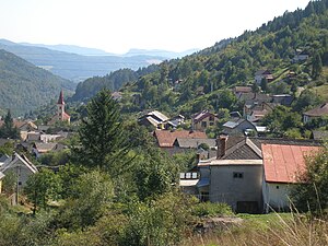
Krompachy
Municipality in Košice Region, Slovakia
Distance: Approx. 625 meters
Latitude and longitude: 48.91,20.87
Krompachy (German: Krombach, Hungarian: Korompa) is a town in Slovakia, with a rich mining and metallurgical history, well-known both in Slovakia and in its close neighboring countries for its Plejsy ski center.

Kluknava
Municipality in Košice Region, Slovakia
Distance: Approx. 5513 meters
Latitude and longitude: 48.92,20.95
Kluknava (Hungarian: Kluknó) is a village and municipality in the Gelnica District in the Košice Region of eastern Slovakia. In 2011 had been total municipality population 1604 inhabitants.

Vojkovce
Village and municipality in Slovakia
Distance: Approx. 3969 meters
Latitude and longitude: 48.95,20.87
Vojkovce (Hungarian: Vojkfalva) is a village and municipality in the Spišská Nová Ves District in the Košice Region of eastern Slovakia. It lies in the eastern part of Spišská Nová Ves District. In 2011 it had 443 inhabitants.

Hrišovce
Municipality in Košice Region, Slovakia
Distance: Approx. 5138 meters
Latitude and longitude: 48.95,20.92
Hrišovce (Hungarian: Gyónfalva) is a village and municipality in the Gelnica District in the Košice Region of eastern Slovakia. The municipality had, in 2019, a population of 303 inhabitants.

Richnava
Municipality in Košice Region, Slovakia
Distance: Approx. 3710 meters
Latitude and longitude: 48.93,20.92
Richnava (Hungarian: Rihnó) is a village and municipality in the Gelnica District in the Košice Region of eastern Slovakia. Total municipality population in 2011 was 2,494 inhabitants.
Žakarovce
Municipality in Košice Region, Slovakia
Distance: Approx. 5558 meters
Latitude and longitude: 48.88,20.93
Žakarovce (Hungarian: Zakárfalva) is a village and municipality in the Gelnica District in the Košice Region of eastern Slovakia. In 2011 the village had 723 inhabitants.

Spišské Vlachy
Town in Slovakia
Distance: Approx. 6766 meters
Latitude and longitude: 48.95,20.8
Spiśské Vlachy (Hungarian: Szepesolaszi, German: Wlachi, Wlachy or Wallendorf, Latin: Villa Latina) is a town in eastern Slovakia. It is in the Spiš region (Szepes in Hungarian or Zips in German). It is now administratively in the district of Spišská Nová Ves, which is part of the Košice Region.

Kaľava
Municipality in Košice Region, Slovakia
Distance: Approx. 1765 meters
Latitude and longitude: 48.93,20.87
Kaľava (Hungarian: Szepeskárolyfalva, until 1899 Kalyava) is a village and municipality in the Spišská Nová Ves District in the Košice Region of central-eastern Slovakia. The village is situated on the southern side of the mountains Branisko.
Kolinovce
Village and municipality in Slovakia
Distance: Approx. 2520 meters
Latitude and longitude: 48.93,20.85
Kolinovce (Hungarian: Kolinfalva) is a village and municipality in the Spišská Nová Ves District in the Košice Region of central-eastern Slovakia.

Oľšavka, Spišská Nová Ves District
Municipality in Slovakia
Distance: Approx. 7003 meters
Latitude and longitude: 48.97,20.83
Oľšavka (Hungarian: Kisolsva) is a village and municipality in the Spišská Nová Ves District in the Košice Region of central-eastern Slovakia.
Slatvina
Municipality in Košice Region, Slovakia
Distance: Approx. 6445 meters
Latitude and longitude: 48.97,20.85
Slatvina (Hungarian: Szlatvin) is a village and municipality in the Spišská Nová Ves District in the Košice Region of central-eastern Slovakia. It has a population of 334 inhabitants as of 2017.

Slovinky
Village and municipality in Slovakia
Distance: Approx. 4257 meters
Latitude and longitude: 48.88,20.85
Slovinky (Hungarian: Szalánk) is a village and municipality in the Spišská Nová Ves District in the Košice Region of central-eastern Slovakia. In 2011, it had a population of 1,911 inhabitants.
Weather in this IP's area
overcast clouds
-1 Celsius
-1 Celsius
-1 Celsius
-1 Celsius
1037 hPa
54 %
1037 hPa
956 hPa
10000 meters
1.21 m/s
1.67 m/s
137 degree
100 %