185.57.229.193 - IP Lookup: Free IP Address Lookup, Postal Code Lookup, IP Location Lookup, IP ASN, Public IP
Country:
Region:
City:
Location:
Time Zone:
Postal Code:
IP information under different IP Channel
ip-api
Country
Region
City
ASN
Time Zone
ISP
Blacklist
Proxy
Latitude
Longitude
Postal
Route
Luminati
Country
Region
71
City
celechovicenahane
ASN
Time Zone
Europe/Prague
ISP
Sprintel s.r.o.
Latitude
Longitude
Postal
IPinfo
Country
Region
City
ASN
Time Zone
ISP
Blacklist
Proxy
Latitude
Longitude
Postal
Route
IP2Location
185.57.229.193Country
Region
olomoucky kraj
City
bedihost'
Time Zone
Europe/Prague
ISP
Language
User-Agent
Latitude
Longitude
Postal
db-ip
Country
Region
City
ASN
Time Zone
ISP
Blacklist
Proxy
Latitude
Longitude
Postal
Route
ipdata
Country
Region
City
ASN
Time Zone
ISP
Blacklist
Proxy
Latitude
Longitude
Postal
Route
Popular places and events near this IP address

Vrahovice
Village in Czech Republic
Distance: Approx. 3850 meters
Latitude and longitude: 49.48083333,17.14833333
Vrahovice is a village and administrative part of Prostějov in the Olomouc Region of the Czech Republic. It has about 3,300 inhabitants.

Bedihošť
Municipality in Olomouc, Czech Republic
Distance: Approx. 4 meters
Latitude and longitude: 49.44833333,17.16638889
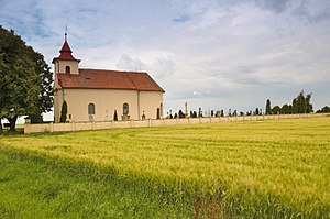
Bedihošť (Czech pronunciation: [ˈbɛɟɪɦoʃc]) is a municipality and village in Prostějov District in the Olomouc Region of the Czech Republic. It has about 1,100 inhabitants. Bedihošť lies approximately 5 kilometres (3 mi) south-east of Prostějov, 18 km (11 mi) south of Olomouc, and 210 km (130 mi) east of Prague.

Hrubčice
Municipality in Olomouc, Czech Republic
Distance: Approx. 1938 meters
Latitude and longitude: 49.45,17.19305556
Hrubčice is a municipality and village in Prostějov District in the Olomouc Region of the Czech Republic. It has about 900 inhabitants. Hrubčice lies approximately 8 km (5 mi) east of Prostějov, 17 km (11 mi) south of Olomouc, and 213 km (132 mi) east of Prague.

Výšovice
Municipality in Olomouc, Czech Republic
Distance: Approx. 4063 meters
Latitude and longitude: 49.41638889,17.13916667
Výšovice is a municipality and village in Prostějov District in the Olomouc Region of the Czech Republic. It has about 600 inhabitants. Výšovice lies approximately 8 kilometres (5 mi) south of Prostějov, 22 km (14 mi) south of Olomouc, and 210 km (130 mi) east of Prague.

Čehovice
Municipality in Olomouc, Czech Republic
Distance: Approx. 1866 meters
Latitude and longitude: 49.4325,17.175
Čehovice is a municipality and village in Prostějov District in the Olomouc Region of the Czech Republic. It has about 500 inhabitants. Čehovice lies approximately 7 kilometres (4 mi) south-east of Prostějov, 19 km (12 mi) south of Olomouc, and 212 km (132 mi) east of Prague.

Čelčice
Municipality in Olomouc, Czech Republic
Distance: Approx. 4473 meters
Latitude and longitude: 49.41222222,17.19361111
Čelčice is a municipality and village in Prostějov District in the Olomouc Region of the Czech Republic. It has about 500 inhabitants. Čelčice lies approximately 9 kilometres (6 mi) south-east of Prostějov, 21 km (13 mi) south of Olomouc, and 213 km (132 mi) east of Prague.
Kralice na Hané
Market town in Olomouc, Czech Republic
Distance: Approx. 1936 meters
Latitude and longitude: 49.46305556,17.18055556
Kralice na Hané is a market town in Prostějov District in the Olomouc Region of the Czech Republic. It has about 1,700 inhabitants.

Čechůvky
Village in Olomouc, Czech Republic
Distance: Approx. 2045 meters
Latitude and longitude: 49.46666667,17.16666667
Čechůvky is a small village, one of the administrative parts of Prostějov in the Czech Republic. It has population of 163.

Kraličky (Kralice na Hané)
Distance: Approx. 4088 meters
Latitude and longitude: 49.48333333,17.18333333
Kraličky (former name Sajlerov was used to 1950; German name: Seilerndorf) is a little village in the Czech Republic. It is administrative part of Kralice na Hané and lies in Okres Prostějov. Kraličky lies on the railway between Nezamylice and Olomouc.

St. Bartholomew's Church, Vrahovice
Distance: Approx. 3924 meters
Latitude and longitude: 49.48166667,17.14888889
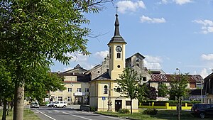
St. Bartholomew's Church (Czech: Kostel svatého Bartoloměje) is a baroque building which was built from 1831 to 1836 and which is used by a Catholic Church. It lies at the main square in Vrahovice.

Arboretum Vrahovice
Arboretum in Vrahovice, Czech Republic
Distance: Approx. 3813 meters
Latitude and longitude: 49.4796,17.145
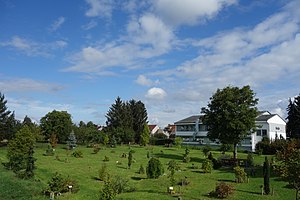
The Arboretum Vrahovice is a small arboretum in Vrahovice, Czech Republic. The Arboretum Vrahovice was established by Spolek za staré Vrahovice in 2010 and developed between 2010 and 2015. The Arboretum contains trees and bushes originating from North America, Europe and Asia.

Beth ha-midrash synagogue
Former synagogue in the Czech Republic
Distance: Approx. 4630 meters
Latitude and longitude: 49.47186,17.11367
The Beth ha-midrash synagogue (Hebrew: בית המדרש, Czech: synagoga Bet ha-midraš) is a former Jewish synagogue and bet midrash, located in Prostějov, in the Olomouc Region of the Czech Republic.
Weather in this IP's area
clear sky
2 Celsius
1 Celsius
1 Celsius
2 Celsius
1038 hPa
80 %
1038 hPa
1004 hPa
10000 meters
1.51 m/s
2.58 m/s
17 degree
6 %
