185.56.155.131 - IP Lookup: Free IP Address Lookup, Postal Code Lookup, IP Location Lookup, IP ASN, Public IP
Country:
Region:
City:
Location:
Time Zone:
Postal Code:
IP information under different IP Channel
ip-api
Country
Region
City
ASN
Time Zone
ISP
Blacklist
Proxy
Latitude
Longitude
Postal
Route
Luminati
Country
Region
idf
City
suresnes
ASN
Time Zone
Europe/Paris
ISP
F5 Networks SARL
Latitude
Longitude
Postal
IPinfo
Country
Region
City
ASN
Time Zone
ISP
Blacklist
Proxy
Latitude
Longitude
Postal
Route
IP2Location
185.56.155.131Country
Region
lisboa
City
olival do basto
Time Zone
Europe/Lisbon
ISP
Language
User-Agent
Latitude
Longitude
Postal
db-ip
Country
Region
City
ASN
Time Zone
ISP
Blacklist
Proxy
Latitude
Longitude
Postal
Route
ipdata
Country
Region
City
ASN
Time Zone
ISP
Blacklist
Proxy
Latitude
Longitude
Postal
Route
Popular places and events near this IP address

Odivelas
Municipality in Lisbon, Portugal
Distance: Approx. 1175 meters
Latitude and longitude: 38.79027778,-9.17972222
Odivelas (European Portuguese pronunciation: [ɔðiˈvɛlɐʃ] ) is a city and a municipality in Lisbon metropolitan area, Portugal, in the Lisbon District and the historical and cultural Estremadura Province. The municipality is located 10 km northwest of Lisbon. The present mayor is Hugo Martins, elected by the Socialist Party.
Ameixoeira
Civil parish in Lisbon, Portugal
Distance: Approx. 1271 meters
Latitude and longitude: 38.788,-9.152
Ameixoeira (Portuguese pronunciation: [ɐmɐjʃuˈɐjɾɐ]) was a Portuguese parish, located in the municipality of Lisbon. It had a population of 9,644 inhabitants and a total area of 1.62 km². With the 2012 Administrative Reform, the parish merged with the Charneca parish into a new one named Santa Clara.

National Museum of Costume (Portugal)
Palace in Lisbon, Lisbon District, Portugal
Distance: Approx. 1744 meters
Latitude and longitude: 38.775163,-9.164985
The Museu Nacional do Traje e da Moda is located in Monteiro-Mor Palace, in Lisbon, Portugal. It has a collection of more than 33,000 items, which includes mainly masculine and feminine costumes from the 18th and 19th centuries.

Monastery of São Dinis de Odivelas
Building in Lisbon District, Portugal
Distance: Approx. 1446 meters
Latitude and longitude: 38.7913451,-9.1828498
The Monastery of Saint Denis (Portuguese: Mosteiro de São Dinis) is located in the city of Odivelas, near Lisbon, in Portugal. The feminine Cistercian convent was founded by King Dinis I and was built during the 14th century in Gothic style. It is the burial place of the king.
Charneca, Lisbon
Civil parish in Lisbon, Portugal
Distance: Approx. 1939 meters
Latitude and longitude: 38.7853,-9.145
Charneca or Charneca do Lumiar (English: Lumiar heathland), was a Portuguese parish (freguesia) in the municipality of Lisbon. It was created in 1585. Between 1852 and 1886 this parish was part of the former municipality of Olivais.

Igreja da Póvoa de Santo Adrião
Distance: Approx. 1204 meters
Latitude and longitude: 38.800379,-9.159763
Igreja da Póvoa de Santo Adrião is a church in Portugal. It is classified as a National Monument.
Odivelas (parish)
Civil parish in Lisbon, Portugal
Distance: Approx. 1201 meters
Latitude and longitude: 38.79,-9.18
Odivelas is a civil parish in the municipality of Odivelas, Portugal. The population in 2011 was 59,546, in an area of 5.04 km².
Instituto de Odivelas
Distance: Approx. 1551 meters
Latitude and longitude: 38.7912702,-9.184071
The Instituto de Odivelas (IO) was a Portuguese military school for young girls, located at Odivelas. It was founded in 1900 and closed in 2015. The last official full name of the school was Instituto de Odivelas (Infante Dom Afonso) (Portuguese for "Institute of Odivelas (Prince Alfonse)").

Senhor Roubado Station
Metro station in Lisbon, Portugal
Distance: Approx. 723 meters
Latitude and longitude: 38.78555556,-9.17111111
Senhor Roubado station is part of the Yellow Line of the Lisbon Metro.
Ameixoeira Station
Metro station in Lisbon, Portugal
Distance: Approx. 723 meters
Latitude and longitude: 38.78555556,-9.17111111
Ameixoeira station is part of the Yellow Line of the Lisbon Metro.
Odivelas Station
Metro station in Lisbon, Portugal
Distance: Approx. 624 meters
Latitude and longitude: 38.79305556,-9.17277778
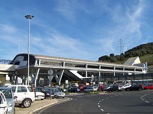
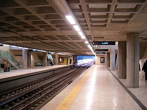
Odivelas station is the northern terminus on the Yellow Line of the Lisbon Metro in the Odivelas neighbourhood, north west of central Lisbon.
Fort of Ameixoeira
19th-century fort near Lisbon, Portugal
Distance: Approx. 1301 meters
Latitude and longitude: 38.786793,-9.152114
The Fort of Ameixoeira, also known as the King Carlos I Fort, is located in the former parish of Ameixoeira, now part of the Santa Clara parish of Lisbon, capital of Portugal. It currently serves as the headquarters of the Serviço de Informações de Segurança (SIS), the Portuguese Security and Intelligence Service. It was constructed as part of the Campo Entrincheirado (Entrenched Field), a group of fortifications built at the end of the 19th century and beginning of the 20th century to protect Lisbon against possible invasion.
Weather in this IP's area
few clouds
11 Celsius
10 Celsius
10 Celsius
13 Celsius
1032 hPa
70 %
1032 hPa
1020 hPa
10000 meters
4.63 m/s
330 degree
20 %

