Country:
 Ireland
Region:
City:
Latitude and Longitude:
Time Zone:
Postal Code:
IP information under different IP Channel
ip-api
Country
Region
City
ASN
Time Zone
ISP
Blacklist
Proxy
Latitude
Longitude
Postal
Route
IPinfo
Country
Region
City
ASN
Time Zone
ISP
Blacklist
Proxy
Latitude
Longitude
Postal
Route
MaxMind
Country
Region
City
ASN
Time Zone
ISP
Blacklist
Proxy
Latitude
Longitude
Postal
Route
Luminati
Country
IEASN
Time Zone
Europe/Dublin
ISP
Liberty Global B.V.
Latitude
Longitude
Postal
db-ip
Country
Region
City
ASN
Time Zone
ISP
Blacklist
Proxy
Latitude
Longitude
Postal
Route
ipdata
Country
Region
City
ASN
Time Zone
ISP
Blacklist
Proxy
Latitude
Longitude
Postal
Route
Popular places and events near this IP address

Royal Canal
19th century construction in Ireland
Distance: Approx. 916 meters
Latitude and longitude: 53.35,-6.23333333
The Royal Canal (Irish: An Chanáil Ríoga) is a canal originally built for freight and passenger transportation from Dublin to Longford in Ireland. It is one of two canals from Dublin to the River Shannon and was built in direct competition to the Grand Canal. The canal fell into disrepair in the late 20th century, but much of it has since been restored for navigation.

Dublin Port Tunnel
Distance: Approx. 856 meters
Latitude and longitude: 53.36118,-6.2341
The Dublin Tunnel (Irish: Tollán Bhaile Átha Cliath), originally and still commonly known as the Port Tunnel, is a road traffic tunnel in Dublin, Ireland, that forms part of the M50 motorway. The twin tunnels form a two-lane dual carriageway connecting Dublin Port, which lies to the east of central Dublin, and the M50 motorway at junction 2, close to Dublin Airport. The tunnels are 4.5 km (2.8 mi) in length and total project length of 5.6 km (3.5 mi).

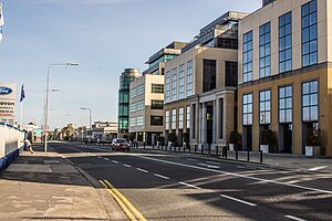
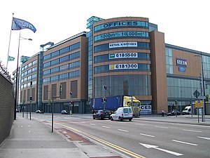
East Point Business Park
Campus in northern docklands of Dublin, Ireland
Distance: Approx. 145 meters
Latitude and longitude: 53.357,-6.226
East Point Office Park (Irish: Gnó na Rinne Thoir) in the docklands area of Dublin, Ireland is one of the country's largest business parks, being the place of employment for thousands of people. It is situated in the East Wall area on reclaimed land. There are over 50 companies in the park with 6,000 employees.
East Wall
Northern inner city area of Dublin, Ireland
Distance: Approx. 753 meters
Latitude and longitude: 53.354,-6.235
East Wall (Irish: An Port Thoir) is an inner city area of the Northside of Dublin, Ireland. Built on reclaimed ground in the 1820s, the area is also 30 minutes walk from Dublin's main thoroughfare, O'Connell Street.

Clontarf Road railway station
Railway station in Dublin, Ireland
Distance: Approx. 789 meters
Latitude and longitude: 53.3631,-6.227
Clontarf Road railway station (Irish: Bóthar Chluain Tarbh) is a railway station in Dublin, Ireland, on the DART commuter rail line.
Point Village
Mixed-use development in the northern Docklands of Dublin
Distance: Approx. 965 meters
Latitude and longitude: 53.348,-6.229
The Point Village is a commercial and residential development in the North Wall area of Dublin, Ireland. The elements of the €800 million development completed to date include offices and residential and hotel accommodation, a small shopping centre, a cinema, a museum and a five-level underground car park. The development ran into a number of problems and was taken over by NAMA in April 2013.

East Wall Road
Road in Dublin, Ireland
Distance: Approx. 357 meters
Latitude and longitude: 53.355,-6.22925556
East Wall Road (Irish: Bóthar an Phoirt Thoir) runs from the junction of the East-Link drawbridge and North Wall Quay, along the side of the northern part of Dublin port to the junction of the North Strand Road and Poplar Row.
Abbotstown (townland)
Area between Castleknock and Blanchardstown, Dublin, Ireland
Distance: Approx. 916 meters
Latitude and longitude: 53.35,-6.23333333
Abbotstown (Irish: Baile an Aba) is a townland in the civil parish of Castleknock in Fingal, Ireland. It is also the name of an historical demesne and country estate that is close to Blanchardstown. Historically the estate belonged to a number of aristocratic families.

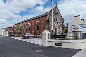
St. Joseph's Church, East Wall
Church in Dublin, Ireland
Distance: Approx. 846 meters
Latitude and longitude: 53.3543,-6.23661
St. Joseph's Church is a Catholic church situated on Church Road in the East Wall area of Dublin, Ireland.

Marino Crescent
Georgian crescent in Dublin 3, Ireland
Distance: Approx. 980 meters
Latitude and longitude: 53.36452222,-6.22908056
Marino Crescent (Irish: An Corrán, meaning 'The Sickle') is a Georgian crescent of 26 houses at the junction of Marino, Fairview and Clontarf in Dublin 3, Ireland. It is the only Georgian crescent in Dublin.

The Point Luas stop
Tram stop in Dublin, Ireland
Distance: Approx. 937 meters
Latitude and longitude: 53.3483313,-6.2292788
The Point (Irish: Iosta na Rinne) is a stop on the Luas light-rail tram system in Dublin, Ireland. It opened in 2009 as the terminus of an extension of the Red Line. Named after the nearby Point Depot, it serves the surrounding Point Village area and is situated in the middle of a plaza at the end of Mayor Street Upper, near Point Square, Host Point Student accommodation, and the 3Arena.
St Anthony's Hall, Clontarf
Municipal building in Clontarf, Dublin, Ireland
Distance: Approx. 856 meters
Latitude and longitude: 53.3627,-6.2174
St Anthony's Hall (Irish: Halla Naomh Antaine), previously known as St Anthony's Parish Church (Irish: Eaglais Pharóiste Naomh Antaine) and, before that, Contarf Town Hall (Irish: Halla an Bhaile Cluain Tarbh) is a former ecclesiastical building and, before that, municipal building in Clontarf Road, Clontarf, Dublin, Ireland. It is now used as a parish hall for St Anthony's Parish Church.
Weather in this IP's area
scattered clouds
16 Celsius
15 Celsius
14 Celsius
17 Celsius
1030 hPa
72 %
1030 hPa
1030 hPa
10000 meters
3.09 m/s
140 degree
40 %
07:00:52
19:38:37