185.52.62.79 - IP Lookup: Free IP Address Lookup, Postal Code Lookup, IP Location Lookup, IP ASN, Public IP
Country:
Region:
City:
Location:
Time Zone:
Postal Code:
IP information under different IP Channel
ip-api
Country
Region
City
ASN
Time Zone
ISP
Blacklist
Proxy
Latitude
Longitude
Postal
Route
Luminati
Country
ASN
Time Zone
Europe/Amsterdam
ISP
Fundaments B.V.
Latitude
Longitude
Postal
IPinfo
Country
Region
City
ASN
Time Zone
ISP
Blacklist
Proxy
Latitude
Longitude
Postal
Route
IP2Location
185.52.62.79Country
Region
noord-brabant
City
steenbergen
Time Zone
Europe/Amsterdam
ISP
Language
User-Agent
Latitude
Longitude
Postal
db-ip
Country
Region
City
ASN
Time Zone
ISP
Blacklist
Proxy
Latitude
Longitude
Postal
Route
ipdata
Country
Region
City
ASN
Time Zone
ISP
Blacklist
Proxy
Latitude
Longitude
Postal
Route
Popular places and events near this IP address

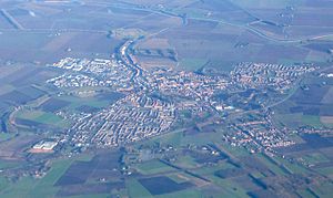
Steenbergen
Municipality in North Brabant, Netherlands
Distance: Approx. 212 meters
Latitude and longitude: 51.58333333,4.31666667
Steenbergen (Dutch pronunciation: [ˈsteːmbɛrɣə(n)] ) is a municipality and a town in the province of North Brabant in the south of the Netherlands. The municipality had a population of 24,310 in 2021 and covers an area of 159.14 km2 (61.44 sq mi) of which 12.71 km2 (4.91 sq mi) is water. The municipality is mainly agricultural including a strongly growing greenhouse sector, but Steenbergen and the nearby town of Dinteloord also contain some light industry.

Lepelstraat
Village in North Brabant, Netherlands
Distance: Approx. 4552 meters
Latitude and longitude: 51.55,4.28333333
Lepelstraat (Dutch pronunciation: [ˈleːpəlstraːt]) is a Dutch village six kilometres north of the city of Bergen op Zoom, and part of the municipality with that name. Its earliest records of history date back to 1298 where in a manuscript of landrights it was mentioned as "Den Leepel Straet." Lepelstraat has always been important in its region's religious history. In 1612, a little church was created in the attic of a farmhouse that was kept from the knowledge of authorities because Roman Catholicism was forbidden at that time.
Eendracht
Canal
Distance: Approx. 6816 meters
Latitude and longitude: 51.56666667,4.225
The Eendracht is a former tidal branch of river Scheldt that has been channelised to form the northern stretch of the Scheldt-Rhine Canal. It flows from the Zoommeer lake (formerly part of the Oosterschelde) near Bergen op Zoom past the town and eponymous island of Tholen towards the former island of Sint Philipsland, where it used to end in the Krabbenkreek estuary. The passage to the estuary has been closed off, however, and an additional stretch of canal was dug to connect the Eendracht to the Krammer lake, itself a former estuary closed off from the sea during the Delta Works.

Dinteloord
Village in North Brabant, Netherlands
Distance: Approx. 6619 meters
Latitude and longitude: 51.635,4.36916667
Dinteloord is a village in the Dutch province of North Brabant. Dinteloord is known for its sugar factory, and the Muza festivals that have been held here for over 50 years.

Dinteloord en Prinsenland
Distance: Approx. 6551 meters
Latitude and longitude: 51.634428,4.368782
Dinteloord en Prinsenland is a former municipality in the Dutch province of North Brabant, now part of the municipality of Steenbergen. The main town of the municipality was Dinteloord. Dinteloord en Prinsenland was a separate municipality until 1997.

Nieuw-Vossemeer
Village in North Brabant, Netherlands
Distance: Approx. 7107 meters
Latitude and longitude: 51.58333333,4.21666667
Nieuw-Vossemeer is a village in the Dutch province of North Brabant. It is located in the municipality of Steenbergen, about 10 km northeast of Bergen op Zoom.
't Haantje, North Brabant
Hamlet in North Brabant, Netherlands
Distance: Approx. 4729 meters
Latitude and longitude: 51.56916667,4.38333333
't Haantje (Dutch pronunciation: [ət ˈɦaːɲtɕə]) is a hamlet in the Dutch province of North Brabant. It is located in the municipality of Steenbergen, about 2 km west of Kruisland. 't Haantje is not a statistical entity, and the postal authorities have placed it under Steenbergen.
Steenbergse Vliet
Distance: Approx. 6946 meters
Latitude and longitude: 51.6313,4.2535
The Steenbergse Vliet is a small river in North Brabant, the Netherlands. It rises near Steenbergen and flows into the Volkerak, which is part of the Rhine–Meuse–Scheldt delta.
Hoogerheide
Village in North Brabant, Netherlands
Distance: Approx. 6619 meters
Latitude and longitude: 51.635,4.36916667
Hoogerheide is a village in the municipality of Woensdrecht, North Brabant, Netherlands. The name "Hoogerheide" means "High Heath" in English. The Grand Prix Adri van der Poel cyclo-cross race is held annually in Hoogerheide.

Fort de Roovere
Fort in The Netherlands
Distance: Approx. 6286 meters
Latitude and longitude: 51.52888889,4.30111111
Fort De Roovere is an earthen fort, constructed as part of the Dutch Water Line, (Hollandse Waterlinie), a series of water-based defences conceived by Maurice of Nassau in 1628 during the Eighty Years War where it defended against Spanish attackers. It is located near Halsteren. In 1747, during the Austrian War of Succession (1740–1748) the fort was under siege by the French.

Kruisland
Village in North Brabant, Netherlands
Distance: Approx. 5908 meters
Latitude and longitude: 51.56666667,4.4
Kruisland is a village in the municipality of Steenbergen in the province of North Brabant, in the Netherlands. It is located between Roosendaal and Steenbergen. The village was first mentioned in 1501 as Cruyslande, and is named after the polder in which it is situation.

St Mary's Church, Rotterdam
Distance: Approx. 5690 meters
Latitude and longitude: 51.542,4.273
St Mary's Church or the English Church (Dutch: Engelse Kerk) is an Anglican church in Rotterdam in the Netherlands. It is part of the Archdeaconry of North West Europe in the Diocese in Europe of the Church of England.
Weather in this IP's area
overcast clouds
8 Celsius
8 Celsius
8 Celsius
9 Celsius
1031 hPa
92 %
1031 hPa
1030 hPa
1200 meters
1.54 m/s
210 degree
100 %
