185.51.254.26 - IP Lookup: Free IP Address Lookup, Postal Code Lookup, IP Location Lookup, IP ASN, Public IP
Country:
Region:
City:
Location:
Time Zone:
Postal Code:
ISP:
ASN:
language:
User-Agent:
Proxy IP:
Blacklist:
IP information under different IP Channel
ip-api
Country
Region
City
ASN
Time Zone
ISP
Blacklist
Proxy
Latitude
Longitude
Postal
Route
db-ip
Country
Region
City
ASN
Time Zone
ISP
Blacklist
Proxy
Latitude
Longitude
Postal
Route
IPinfo
Country
Region
City
ASN
Time Zone
ISP
Blacklist
Proxy
Latitude
Longitude
Postal
Route
IP2Location
185.51.254.26Country
Region
england
City
west drayton
Time Zone
Europe/London
ISP
Language
User-Agent
Latitude
Longitude
Postal
ipdata
Country
Region
City
ASN
Time Zone
ISP
Blacklist
Proxy
Latitude
Longitude
Postal
Route
Popular places and events near this IP address

Yiewsley
Suburban village in the United Kingdom
Distance: Approx. 1478 meters
Latitude and longitude: 51.513,-0.471
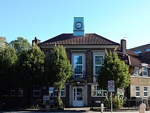
Yiewsley ( YOOZ-lee) is a large suburban village in the London Borough of Hillingdon, England, 2 miles (3 km) south of Uxbridge, the borough's commercial and administrative centre. Yiewsley was a chapelry in the ancient parish of Hillingdon, Middlesex. The population of the ward was 12,979 at the 2011 Census.

London Borough of Hillingdon
London borough in United Kingdom
Distance: Approx. 1157 meters
Latitude and longitude: 51.5,-0.45
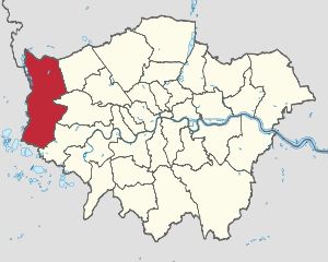
The London Borough of Hillingdon () is a London borough in Greater London, England. It forms part of outer London and West London, being the westernmost London borough. It was formed in 1965 from the districts of Hayes and Harlington, Ruislip-Northwood, Uxbridge, and Yiewsley and West Drayton.

West Drayton
Area of the London Borough of Hillingdon
Distance: Approx. 500 meters
Latitude and longitude: 51.5043,-0.4646
West Drayton is a suburban town in the London Borough of Hillingdon. It was an ancient parish in the county of Middlesex and from 1929 was part of the Yiewsley and West Drayton Urban District, which became part of Greater London in 1965. The settlement is near the Colne Valley Regional Park and its centre lies 1.9 miles (3 km) north of Heathrow Airport.
RAF West Drayton
Former RAF Base in Middlesex, England
Distance: Approx. 654 meters
Latitude and longitude: 51.5049,-0.4615
RAF West Drayton was a non-flying Royal Air Force station in West Drayton, within the London Borough of Hillingdon, which served as the main centre for military air traffic control in the United Kingdom. It was co-located with the civilian London Air Traffic Control Centre to provide a vital link between civil and military flying and airspace requirements. Following the departure of the remaining civil and military air traffic control systems by 2008, the site was closed and demolished for a new residential development.

West Drayton railway station
Railway station in the United Kingdom serving Yiewsley and West Drayton
Distance: Approx. 1172 meters
Latitude and longitude: 51.50994167,-0.47226389
West Drayton railway station serves West Drayton and Yiewsley, western suburbs of London. It is served and managed by the Elizabeth line. It is 13 miles 71 chains (22.3 km) down the line from London Paddington and is situated between Hayes & Harlington to the east and Iver to the west.

Yiewsley and West Drayton Urban District
Distance: Approx. 1369 meters
Latitude and longitude: 51.5117,-0.4728
Yiewsley and West Drayton was a local government district in Middlesex, England from 1929 to 1965. Its area became the south-west of the London Borough of Hillingdon.
London Terminal Control Centre
Aviation guidance facility in West Drayton, UK
Distance: Approx. 751 meters
Latitude and longitude: 51.5053,-0.46
The London Terminal Control Centre (LTCC) was an air traffic control centre based in West Drayton, in the London Borough of Hillingdon, England, approximately 2.5 miles (4.0 km) north of London Heathrow Airport. Operated by National Air Traffic Services (NATS) it provided air traffic control services to aircraft arriving and departing from six London airports, one Royal Air Force station, plus en-route services to other aircraft that entered its airspace. Internally within NATS it is usually known by the initials TC. The civilian part of the West Drayton site closed in November 2007, when its functions moved to Swanwick, Hampshire.

Heathrow Junction railway station
Former railway station in England
Distance: Approx. 1274 meters
Latitude and longitude: 51.5033,-0.4491
Heathrow Junction was a short-lived railway station built to serve London Heathrow Airport in the United Kingdom.

Otter Dock
Former arm of the Grand Junction Canal in Yiewsley, United Kingdom
Distance: Approx. 1426 meters
Latitude and longitude: 51.5127,-0.4694
Otter Dock was a branch of the Grand Junction Canal (renamed Grand Union Canal from 1929) in Yiewsley, Middlesex. In March 1818, permission was obtained from the Grand Junction Canal Company by a Mr John Mills for a dock to be built to service Yiewsley's brickmaking industry. Otter Dock would be the longest of nine arms and docks that served Yiewsley's industries.

Harmondsworth Great Barn
Grade I listed building in Harmondsworth, UK
Distance: Approx. 1467 meters
Latitude and longitude: 51.4897,-0.4799
Harmondsworth Great Barn (also known as Manor Farm Barn) is a medieval barn on the former Manor Farm in the village of Harmondsworth, in the London Borough of Hillingdon, England. It is north-west of fields and the A4 next to Heathrow Airport. Built in the early 15th century by Winchester College, it is the largest timber-framed building in England and is regarded as an outstanding example of medieval carpentry.

Grow Heathrow
Land squat in west London
Distance: Approx. 1257 meters
Latitude and longitude: 51.4900715,-0.4580583
Grow Heathrow was a land squat and community garden in Sipson, west London. It was occupied in 2010 by local people concerned about the possibility of the expansion of Heathrow Airport. It was part of the Transition Network.

St Catherine's Church, West Drayton
Church in West Drayton, England
Distance: Approx. 820 meters
Latitude and longitude: 51.5043,-0.4763
St Catherine's Church or St Catherine of Alexandria Church is a Catholic parish church in West Drayton, Borough of Hillingdon, London. It was built from 1868 to 1869 and designed by Thomas John Willson and Samuel Joseph Nicholl. It is architecturally in the Gothic Revival style.
Weather in this IP's area
overcast clouds
6 Celsius
2 Celsius
5 Celsius
7 Celsius
998 hPa
81 %
998 hPa
993 hPa
10000 meters
6.69 m/s
150 degree
100 %