Country:
Region:
City:
Latitude and Longitude:
Time Zone:
Postal Code:
IP information under different IP Channel
ip-api
Country
Region
City
ASN
Time Zone
ISP
Blacklist
Proxy
Latitude
Longitude
Postal
Route
Luminati
Country
Region
55
City
bastiaumbra
ASN
Time Zone
Europe/Rome
ISP
Connesi s.p.a.
Latitude
Longitude
Postal
IPinfo
Country
Region
City
ASN
Time Zone
ISP
Blacklist
Proxy
Latitude
Longitude
Postal
Route
db-ip
Country
Region
City
ASN
Time Zone
ISP
Blacklist
Proxy
Latitude
Longitude
Postal
Route
ipdata
Country
Region
City
ASN
Time Zone
ISP
Blacklist
Proxy
Latitude
Longitude
Postal
Route
Popular places and events near this IP address
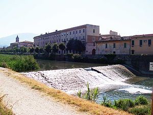
Bastia Umbra
Comune in Umbria, Italy
Distance: Approx. 3364 meters
Latitude and longitude: 43.07333333,12.55111111
Bastia Umbra (Italian pronunciation: [baˈstiːa ˈumbra]) is a comune (municipality) in the Province of Perugia in the Italian region Umbria, located about 15 km southeast of Perugia. As of 31 December 2004, it had a population of 20,523 and an area of 27.6 km2. Bastia Umbra borders the following municipalities: Assisi, Bettona, Perugia, and Torgiano.
Santa Maria degli Angeli, Assisi
Frazione in Umbria, Italy
Distance: Approx. 5649 meters
Latitude and longitude: 43.05888889,12.57805556
Santa Maria degli Angeli is a frazione of the comune of Assisi in the Province of Perugia, Umbria, central Italy. It stands at an elevation of 218 metres above sea level. At the time of the Istat census of 2001 it had 6,665 inhabitants, and is located c.

Petrignano
Frazione in Umbria, Italy
Distance: Approx. 4394 meters
Latitude and longitude: 43.10388889,12.53638889
Petrignano is a frazione of the comune of Assisi in the Province of Perugia, Umbria, central Italy. It stands at an elevation of 212 metres above sea level on the right bank of the Chiascio River, c. 8 km east to Assisi.

Topino
Stream in Umbria, Italy
Distance: Approx. 4593 meters
Latitude and longitude: 43.0287,12.5008
The Topino is a river in Umbria, central Italy. It was known in ancient times as Supunna by Umbri and later in Latin as Tinia and is mentioned by Dante Alighieri in the Canto XI of the Paradise. It is the main tributary of the Chiascio, in the Tiber basin.
Ponte San Giovanni
Frazione in Umbria, Italy
Distance: Approx. 5715 meters
Latitude and longitude: 43.08972222,12.44555556
Ponte San Giovanni is a frazione of the city of Perugia, Italy. It has 13,296 inhabitants and is one of the largest and most populated neighbourhoods in the capital city of Umbria. It is also the seat of the eighth ward of the city of Perugia.

Ose (torrent)
Stream in Umbria, Italy
Distance: Approx. 4979 meters
Latitude and longitude: 43.0253,12.5203
The Ose is a torrent in Umbria, central Italy. Its spring is on the comune of Spello, in the territory of Umbria. Ose is affluent of Topino.
Tordandrea
Frazione in Umbria, Italy
Distance: Approx. 5224 meters
Latitude and longitude: 43.03666667,12.55611111
Tordandrea is a frazione of the comune of Assisi in the Province of Perugia, Umbria, central Italy. It stands at an elevation of 190 metres above sea level. At the time of the Istat census of 2001 it had 898 inhabitants.
Costano
Frazione in Umbria, Italy
Distance: Approx. 3475 meters
Latitude and longitude: 43.04333333,12.53361111
Costano is a frazione of the comune of Bastia Umbra in the Province of Perugia, Umbria, central Italy. It stands at an elevation of 191 metres above sea level. At the time of the Istat census of 2001 it had 782 inhabitants.

Ospedalicchio
Frazione in Umbria, Italy
Distance: Approx. 1398 meters
Latitude and longitude: 43.08111111,12.50388889
Ospedalicchio is a borough of the municipality of Bastia Umbra in the Province of Perugia, Umbria, central Italy. It stands at an elevation of 199 metres above sea level. At the time of the Istat census of 2001 it had 1139 inhabitants.
Passaggio, Bettona
Frazione in Umbria, Italy
Distance: Approx. 4976 meters
Latitude and longitude: 43.02472222,12.50833333
Passaggio is a frazione of the comune of Bettona in the Province of Perugia, Umbria, central Italy. It stands at an elevation of 202 metres above sea level. At the time of the Istat census of 2001 it had 896 inhabitants.
Assisi (meteorite)
Meteorite found in Italy
Distance: Approx. 5163 meters
Latitude and longitude: 43.03333333,12.55
Assisi is an H chondrite meteorite that fell to earth at 7:00 am on May 24, 1886, in Perugia, Umbria, Italy. Only one single 2 kilograms (4.4 lb) stone was found.

Santa Croce, Bastia Umbria
Italian historic church
Distance: Approx. 3244 meters
Latitude and longitude: 43.06785,12.54993
Santa Croce is a Gothic style, Roman Catholic church in Piazza Mazzini, in the center of Bastia Umbra, in the region of Umbria, Italy.
Weather in this IP's area
clear sky
10 Celsius
9 Celsius
9 Celsius
12 Celsius
1025 hPa
88 %
1025 hPa
1002 hPa
10000 meters
2.06 m/s
30 degree
1 %
06:48:42
16:58:19


