Country:
 Great Britain
Region:
City:
Latitude and Longitude:
Time Zone:
Postal Code:
IP information under different IP Channel
ip-api
Country
Region
City
ASN
Time Zone
ISP
Blacklist
Proxy
Latitude
Longitude
Postal
Route
IPinfo
Country
Region
City
ASN
Time Zone
ISP
Blacklist
Proxy
Latitude
Longitude
Postal
Route
MaxMind
Country
Region
City
ASN
Time Zone
ISP
Blacklist
Proxy
Latitude
Longitude
Postal
Route
Luminati
Country
GBRegion
eng
City
eyke
ASN
Time Zone
Europe/London
ISP
MLL Telecom Ltd.
Latitude
Longitude
Postal
db-ip
Country
Region
City
ASN
Time Zone
ISP
Blacklist
Proxy
Latitude
Longitude
Postal
Route
ipdata
Country
Region
City
ASN
Time Zone
ISP
Blacklist
Proxy
Latitude
Longitude
Postal
Route
Popular places and events near this IP address

Acle
Town in Norfolk, England
Distance: Approx. 228 meters
Latitude and longitude: 52.638,1.555
Acle ( AY-kəl) is a market town on the River Bure on the Norfolk Broads in Norfolk, located halfway between Norwich and Great Yarmouth. It has the only bridge across the River Bure between Wroxham and Great Yarmouth. The civil parish has an area of 9.46 km2 (3.65 sq mi) and in 2001 had a population of 2,732 in 1,214 households, increasing to a population of 2,824 in 1,285 households at the Census 2011.

Upton, Norfolk
Village in Norfolk, England
Distance: Approx. 2580 meters
Latitude and longitude: 52.658164,1.543149
Upton is a village on the River Bure in Norfolk, England within the Broads national park. The villages name means 'higher farm/settlement'. Administratively it comes under the civil parish of Upton with Fishley which in turn comes under the district of Broadland.
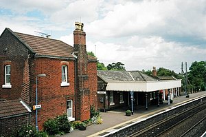
Acle railway station
Railway station in Norfolk, England
Distance: Approx. 743 meters
Latitude and longitude: 52.63444444,1.54361111
Acle railway station is on the Wherry Lines in the east of England, serving the town of Acle, Norfolk. It is 10 miles 34 chains (16.8 km) down the line from Norwich on the route to Great Yarmouth.
Stokesby with Herringby
Human settlement in England
Distance: Approx. 2534 meters
Latitude and longitude: 52.63864,1.59155
Stokesby with Herringby is a civil parish in the English county of Norfolk. It comprises the village of Stokesby and the surrounding rural area. It is situated on the banks of the River Bure, some 10 km west of the town of Great Yarmouth and 25 km east of the city of Norwich.

Fishley
Village in Norfolk, England
Distance: Approx. 1486 meters
Latitude and longitude: 52.64801,1.544695
Fishley is a village in the English county of Norfolk, forming part of the civil parish of Upton with Fishley. The village is located 0.5 miles (0.80 km) north of Acle and 11 miles (18 km) east of Norwich.

Palmer's Drainage Windmill
Distance: Approx. 2580 meters
Latitude and longitude: 52.658164,1.54315
Palmer's Drainage Windmill is located to the north of Upton Dyke close to the village of Upton in the English county of Norfolk. Upton Dyke runs westerly from the River Bure in the civil parish of Upton with Fishley . The Drainage mill can be found to the east of the village of Upton.
Upton with Fishley
Civil parish in Norfolk, England
Distance: Approx. 2148 meters
Latitude and longitude: 52.65452,1.545382
Upton with Fishley is a civil parish in the English county of Norfolk, consisting of the former parishes of Upton and Fishley. It covers an area of 8.93 km2 (3.45 sq mi) and had a population of 660 in 272 households at the 2001 census, increasing to a population of 702 also in 272 households at the 2011 Census. For the purposes of local government, it falls within the district of Broadland.
Acle Academy
Academy in Acle, Norfolk, England
Distance: Approx. 1108 meters
Latitude and longitude: 52.6423,1.5416
The Acle Academy, formerly known as Acle High School, is a secondary school which is located in Acle, Norfolk, England. This is in the centre of the Norfolk Broads. The academy status school has 700 pupils, ranging in age from 11 to 16 years old.

Tunstall, Norfolk
Village in Norfolk, England
Distance: Approx. 2438 meters
Latitude and longitude: 52.616,1.569
Tunstall is a village and former civil parish, now in the parish of Halvergate, in the Broadland district of Norfolk, England. It lies some 14 miles (22.5 km) south-east of Norwich alongside the River Bure. In 1931 the parish had a population of 94.

Blofield and Flegg Rural District
Distance: Approx. 728 meters
Latitude and longitude: 52.63,1.55
Blofield and East and West Flegg Rural Districts were adjacent rural districts in Norfolk, England from 1894 to 1935. They were formed under the Local Government Act 1894 based on rural sanitary districts of the same names, and lay between Norwich and Great Yarmouth. East and West Flegg RD included a detached portion, itself an outlying part of Runham parish.

Damgate Marshes, Acle
UK Site of Special Scientific Interest
Distance: Approx. 809 meters
Latitude and longitude: 52.631,1.563
Damgate Marshes, Acle is a 64.7-hectare (160-acre) biological Site of Special Scientific Interest between Norwich and Great Yarmouth in Norfolk. It is part of the Broadland Ramsar site and The Broads Special Area of Conservation. These traditionally managed grazing marshes and dykes are a nationally important wetland site.

Decoy Carr, Acle
Protected area in Norfolk, England
Distance: Approx. 1234 meters
Latitude and longitude: 52.625,1.552
Decoy Carr, Acle is a 56-hectare (140-acre) biological Site of Special Scientific Interest south of Acle in Norfolk. It is part of the Broadland Ramsar site and Special Protection Area, and The Broads Special Area of Conservation. This area of wet carr woodland, fen, reedbeds and open water, is spring fed.
Weather in this IP's area
light rain
14 Celsius
14 Celsius
12 Celsius
14 Celsius
1010 hPa
94 %
1010 hPa
1010 hPa
10000 meters
3.09 m/s
180 degree
40 %
07:26:57
17:50:06