185.48.201.98 - IP Lookup: Free IP Address Lookup, Postal Code Lookup, IP Location Lookup, IP ASN, Public IP
Country:
Region:
City:
Location:
Time Zone:
Postal Code:
IP information under different IP Channel
ip-api
Country
Region
City
ASN
Time Zone
ISP
Blacklist
Proxy
Latitude
Longitude
Postal
Route
Luminati
Country
ASN
Time Zone
Europe/Paris
ISP
IT-Finance SARL
Latitude
Longitude
Postal
IPinfo
Country
Region
City
ASN
Time Zone
ISP
Blacklist
Proxy
Latitude
Longitude
Postal
Route
IP2Location
185.48.201.98Country
Region
ile-de-france
City
rueil-malmaison
Time Zone
Europe/Paris
ISP
Language
User-Agent
Latitude
Longitude
Postal
db-ip
Country
Region
City
ASN
Time Zone
ISP
Blacklist
Proxy
Latitude
Longitude
Postal
Route
ipdata
Country
Region
City
ASN
Time Zone
ISP
Blacklist
Proxy
Latitude
Longitude
Postal
Route
Popular places and events near this IP address

Château de Malmaison
Château in Rueil-Malmaison, France
Distance: Approx. 1769 meters
Latitude and longitude: 48.87083333,2.16694444
The Château de Malmaison (French pronunciation: [ʃɑto d(ə) malmɛzɔ̃]) is a French château situated near the left bank of the Seine, about 15 kilometres (9.3 mi) west of the centre of Paris, in the commune of Rueil-Malmaison. Formerly the residence of Empress Joséphine de Beauharnais, along with the Tuileries it was the headquarters of the French government from 1800 to 1802, and Napoleon's last residence in France at the end of the Hundred Days in 1815.

Rueil-Malmaison
Commune in Île-de-France, France
Distance: Approx. 620 meters
Latitude and longitude: 48.876,2.181
Rueil-Malmaison (French pronunciation: [ʁɥɛj malmɛzɔ̃] ) or simply Rueil is a commune in the western suburbs of Paris, in the Hauts-de-Seine department, Île-de-France region. It is located 12.6 kilometres (8 miles) from the centre of Paris. It is one of the wealthiest suburbs of Paris.

Battle of Buzenval (1871)
Part of the Franco-Prussian War
Distance: Approx. 606 meters
Latitude and longitude: 48.8778,2.1813
The (Second) Battle of Buzenval, also known as the Battle of Mont Valérien, was part of the siege of Paris during the Franco-Prussian War. On 19 January 1871, the day after Wilhelm I was proclaimed German Emperor, Louis Jules Trochu attacked the Germans west of Paris in Buzenval Park. The attackers seized the town of Saint-Cloud, coming close to the new Emperor's headquarters at Versailles.

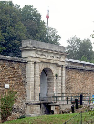
Fort Mont-Valérien
Fortress in Suresnes, Hauts-de-Seine, France
Distance: Approx. 1779 meters
Latitude and longitude: 48.87305556,2.21305556
Fort Mont-Valérien (French: Forteresse du Mont-Valérien) is a fortress in Suresnes, a western Paris suburb, built in 1841 as part of the city's ring of modern fortifications. It overlooks the Bois de Boulogne.

Nanterre Cathedral
Distance: Approx. 1648 meters
Latitude and longitude: 48.89083333,2.19611111
Nanterre Cathedral (French: Cathédrale Sainte-Geneviève-et-Saint-Maurice de Nanterre) is a Roman Catholic church located in the town of Nanterre, France. The cathedral is the seat of the Bishop of Nanterre. Formerly Nanterre Parish Church, it became the Nanterre Cathedral after the establishment of the diocese in 1966.
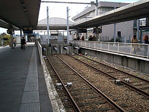
Rueil-Malmaison station
Railway station in France
Distance: Approx. 1769 meters
Latitude and longitude: 48.887,2.171
Rueil-Malmaison (French pronunciation: [ʁɥɛj malmɛzɔ̃] ) is a railway station at Rueil-Malmaison on the A1 branch of the Paris RER commuter rail line.

Roman Catholic Diocese of Nanterre
Catholic diocese in France
Distance: Approx. 1627 meters
Latitude and longitude: 48.8907,2.1958
The Diocese of Nanterre (Latin: Dioecesis Nemptodurensis; French: Diocèse de Nanterre) is a Latin diocese of the Catholic Church in France. Erected in 1966, the diocese was split off from the Diocese of Versailles and the Archdiocese of Paris. Currently the diocese remains a suffragan of the Archdiocese of Paris.

IFP School
Graduate engineering school near Paris
Distance: Approx. 1265 meters
Latitude and longitude: 48.8778,2.1722
The IFP School (French: ENSPM - École Nationale Supérieure du Pétrole et des Moteurs) is a graduate engineering school located in Rueil-Malmaison, France. Founded in 1954, IFP School is part of the IFP Energies nouvelles (IFPEN), a French public-sector research and training center. The school graduates approximately 600 students per year in 20 graduate programs (10 in English), employing 40 regular professors and 350 instructors from industry.

Battle of Buzenval (1870)
Distance: Approx. 606 meters
Latitude and longitude: 48.8778,2.1813
The (First) Battle of Buzenval was part of the siege of Paris during the Franco-Prussian War. The besieged troops in Paris, under the orders of General Louis Trochu, made a sortie in the direction of Versailles.

Château de Rueil
Building in Rueil-Malmaison , France
Distance: Approx. 823 meters
Latitude and longitude: 48.86997,2.18476
The Château de Rueil (formerly spelled Ruel, also referred to as the Château du Val de Ruel) was a 17th-century French château located in Rueil-Malmaison. It was especially famous for its gardens, created before those of Vaux-le-Vicomte and Versailles, and was the preferred residence of Cardinal Richelieu from at least 1633 (when he purchased it) until his death in 1642.
Canton of Rueil-Malmaison
Administrative division of Hauts-de-Seine, France
Distance: Approx. 780 meters
Latitude and longitude: 48.88,2.18
The canton of Rueil-Malmaison is an administrative division of the Hauts-de-Seine department in northern France. Its borders were modified at the French canton reorganisation which came into effect in March 2015. Its seat is in Rueil-Malmaison.
Stell Hospital
Hospital in Île-de-France, France
Distance: Approx. 186 meters
Latitude and longitude: 48.8760458,2.1870631
The Stell Hospital is a teaching hospital in Rueil-Malmaison. It is a teaching hospital of Sorbonne University. It was established in August 1903 by American philanthropist Edward Tuck and is named after his wife Julia Stell.
Weather in this IP's area
overcast clouds
10 Celsius
9 Celsius
9 Celsius
10 Celsius
1035 hPa
97 %
1035 hPa
1027 hPa
10000 meters
1.54 m/s
100 %

