185.46.70.206 - IP Lookup: Free IP Address Lookup, Postal Code Lookup, IP Location Lookup, IP ASN, Public IP
Country:
Region:
City:
Location:
Time Zone:
Postal Code:
ISP:
ASN:
language:
User-Agent:
Proxy IP:
Blacklist:
IP information under different IP Channel
ip-api
Country
Region
City
ASN
Time Zone
ISP
Blacklist
Proxy
Latitude
Longitude
Postal
Route
db-ip
Country
Region
City
ASN
Time Zone
ISP
Blacklist
Proxy
Latitude
Longitude
Postal
Route
IPinfo
Country
Region
City
ASN
Time Zone
ISP
Blacklist
Proxy
Latitude
Longitude
Postal
Route
IP2Location
185.46.70.206Country
Region
fryslan
City
sneek
Time Zone
Europe/Amsterdam
ISP
Language
User-Agent
Latitude
Longitude
Postal
ipdata
Country
Region
City
ASN
Time Zone
ISP
Blacklist
Proxy
Latitude
Longitude
Postal
Route
Popular places and events near this IP address

Sneek
City and former municipality in Friesland, Netherlands
Distance: Approx. 92 meters
Latitude and longitude: 53.0325,5.66
Sneek (Dutch pronunciation: [sneːk] ; West Frisian: Snits [snɪts]) is a city southwest of Leeuwarden and the seat of the former municipality of Sneek in the province of Friesland, Netherlands. As of 2011 it is the seat of the municipality of Súdwest-Fryslân (Southwest Friesland). The city had approximately 33,855 inhabitants in January 2017.

Ysbrechtum
Village in Friesland, Netherlands
Distance: Approx. 2012 meters
Latitude and longitude: 53.04222222,5.63305556
Ysbrechtum (Dutch: IJsbrechtum) is a village 1 km from the city of Sneek in Friesland, Netherlands. It had a population of around 690 in January 2017. Ysbrechtum contains the Epema State, an old estate.
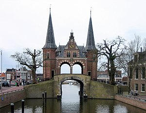
Waterpoort
Distance: Approx. 427 meters
Latitude and longitude: 53.02916667,5.65916667
The Waterpoort or Hoogendster Pijp is a water gate, a gate in a defensive wall that connects a city to a waterway. It is situated in Sneek, the Netherlands. In the 15th and 16th century, a defensive wall had been built around Sneek.
Offingawier
Neighbourhood and former village in Súdwest-Fryslân, Friesland, Netherlands
Distance: Approx. 2550 meters
Latitude and longitude: 53.03194444,5.69694444
Offingawier (West Frisian: Offenwier) is a neighbourhood of Sneek and former village in Súdwest-Fryslân municipality in the province of Friesland, the Netherlands. It had a population of around 205 in January 2017. In 1984, it was annexed by the city of Sneek and became a neighbourhood.
Loënga
Neighbourhood and former village in Súdwest-Fryslân, Friesland, Netherlands
Distance: Approx. 2501 meters
Latitude and longitude: 53.05,5.68333333
Loënga (West Frisian: Loaiïngea) is neighbourhood of Sneek and a former village in Súdwest-Fryslân municipality in the province of Friesland, the Netherlands. It has a population of around 95 in January 2017. In 1984, Loënga and Offingawier were annexed by Sneek and are no longer independent villages.

Goënga
Village in Friesland, Netherlands
Distance: Approx. 3280 meters
Latitude and longitude: 53.05444444,5.6925
Goënga (West Frisian: Goaiïngea) is a village in Súdwest-Fryslân municipality in the province of Friesland, the Netherlands. It had a population of around 240 in January 2017.

Scharnegoutum
Village in Friesland, Netherlands
Distance: Approx. 3303 meters
Latitude and longitude: 53.06027778,5.67833333
Scharnegoutum (West Frisian: Skearnegoutum) is a village in Súdwest Fryslân in the province of Friesland, the Netherlands. It had a population of around 1,660 in January 2017.

De Rat, IJlst
Distance: Approx. 3106 meters
Latitude and longitude: 53.01277778,5.62694444
De Rat (English: The Rat) is a smock mill in IJlst, Friesland, Netherlands, which was originally built in the seventeenth century at Zaanstreek, North Holland. In 1828 it was moved to IJlst, where it worked using wind power until 1920 and then by electric motor until 1950. The mill was bought by the town of IJlst in 1956 and restored in the mid-1960s.
Sneek railway station
Railway station in Sneek, Friesland, Netherlands
Distance: Approx. 492 meters
Latitude and longitude: 53.03222222,5.65166667
Sneek is a railway station in Sneek, Netherlands. The station opened on 16 June 1883 and is located on the Leeuwarden–Stavoren railway. Until the line was finished in 1885, this station was the terminus.

Sneek Noord railway station
Railway station in the Netherlands
Distance: Approx. 857 meters
Latitude and longitude: 53.04027778,5.66305556
Sneek Noord is a railway station in Sneek, Netherlands. The station opened on 3 June 1973 and is located on the Leeuwarden–Stavoren railway. The train services are operated by Arriva.
Súdwest-Fryslân
Municipality of Friesland in the northern Netherlands
Distance: Approx. 521 meters
Latitude and longitude: 53.03333333,5.66666667
Southwest Friesland (West Frisian: Súdwest-Fryslân [ˈsytʋɛst ˈfrislɔ̃ːn]) is a municipality in the northern Netherlands, located in the province of Friesland. It had a population of 89,999 in January 2021. Sneek is the municipal seat.

Fries Scheepvaart Museum
Museum in Sneek, Netherlands
Distance: Approx. 292 meters
Latitude and longitude: 53.0323,5.6631
The Fries Scheepvaart Museum (English: Frisian Ship Transport Museum) is a maritime museum in the Kleinzand area of Sneek, Netherlands. Located in the province of Friesland, it contains a library, film viewing room, and focuses on local seafaring life. It is housed in canal buildings dated to 1844 and offers collections of old sailing ships models, naval paintings, and silver pieces.
Weather in this IP's area
clear sky
1 Celsius
-2 Celsius
1 Celsius
1 Celsius
1023 hPa
65 %
1023 hPa
1023 hPa
10000 meters
2.01 m/s
4.84 m/s
157 degree


