Country:
 Netherlands
Region:
City:
Latitude and Longitude:
Time Zone:
Postal Code:
IP information under different IP Channel
ip-api
Country
Region
City
ASN
Time Zone
ISP
Blacklist
Proxy
Latitude
Longitude
Postal
Route
IPinfo
Country
Region
City
ASN
Time Zone
ISP
Blacklist
Proxy
Latitude
Longitude
Postal
Route
MaxMind
Country
Region
City
ASN
Time Zone
ISP
Blacklist
Proxy
Latitude
Longitude
Postal
Route
Luminati
Country
NLASN
Time Zone
Europe/Amsterdam
ISP
IP Visie Networking B.V.
Latitude
Longitude
Postal
db-ip
Country
Region
City
ASN
Time Zone
ISP
Blacklist
Proxy
Latitude
Longitude
Postal
Route
ipdata
Country
Region
City
ASN
Time Zone
ISP
Blacklist
Proxy
Latitude
Longitude
Postal
Route
Popular places and events near this IP address

Avans University of Applied Sciences
University in The Netherlands
Distance: Approx. 1025 meters
Latitude and longitude: 51.5839,4.7971
Avans University of Applied Sciences (Dutch: Avans Hogeschool) is a Dutch high ranked vocational university. It is located in three cities: Breda, 's-Hertogenbosch, and Tilburg. The school has over 30,000 students studying 40 courses in 18 institutes.
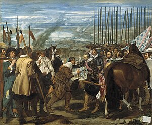
Siege of Breda (1624)
Siege within the Eighty Years' War
Distance: Approx. 1683 meters
Latitude and longitude: 51.58333056,4.78333056
The Siege of Breda of 1624–1625 occurred during the Eighty Years' War. The siege resulted in Breda, a Dutch fortified city, falling into the control of the Army of Flanders.

Breda railway station
Railway station in Netherlands
Distance: Approx. 1603 meters
Latitude and longitude: 51.595,4.78
Breda railway station is a railway station in Breda in North Brabant, Netherlands. It is situated on the Breda–Rotterdam railway, the Roosendaal–Breda railway and the Breda–Eindhoven railway.
Breda Oost railway station
Railway station in the Netherlands
Distance: Approx. 716 meters
Latitude and longitude: 51.59666667,4.81055556
Breda Oost is a proposed railway station in Breda, Netherlands.
Breda University of Applied Sciences
Vocational university in the Netherlands
Distance: Approx. 561 meters
Latitude and longitude: 51.590509,4.795288
Breda University of Applied Sciences (abbreviated as: BUas), is a Dutch university of applied sciences in Breda, the Netherlands. BUas caters for more than 7,000 Dutch and international students from over 80 countries. The institute offers professional and academic bachelor’s and master’s programmes in the domains of Data Science & AI, Creative Business, Games, Hotel, Facility, Logistics, Built Environment, Tourism, Leisure & Events.

Stedelijk Museum Breda
Museum for visual culture, National museum in Breda, Netherlands
Distance: Approx. 1533 meters
Latitude and longitude: 51.5896,4.7811
The Stedelijk Museum Breda, formerly the Museum of the Image (MOTI), is a national museum for visual culture in Breda in the Netherlands. The museum focuses on film, design, photography, fashion, visual arts, architecture, science, and gaming. MOTI closed from 1 January 2017 with the intention of reopening the building in spring 2017 as Stedelijk Museum Breda, a merger with Breda's Museum.
NAC Stadion t Ploegske
Dutch football stadium
Distance: Approx. 1729 meters
Latitude and longitude: 51.57916667,4.78972222
`t Ploegske was a football stadium in Breda, Netherlands. It was used for football matches and hosted the home matches of NAC Breda. The stadium was able to hold 3,000 people, including 150 seats.
Terrein achter de Watertoren
Distance: Approx. 1273 meters
Latitude and longitude: 51.58472222,4.78916667
Terrein achter de Watertoren (English: Terrain behind the Watertower) was a football stadium in Breda, Netherlands. It was used for football matches and hosted the home matches of NAC Breda. The stadium was opened in 1913 and demolished in 1916.

Koepelgevangenis (Breda)
Dutch panopticon prison built in 1886
Distance: Approx. 1103 meters
Latitude and longitude: 51.59027778,4.78722222
The Koepelgevangenis is a former prison in Breda, Netherlands, constructed in 1886, best known as the prison where convicted World War II collaborators and Nazi war criminals were housed (including The Breda Four).

St. Anthony of Padua Cathedral, Breda
Church in Breda, Netherlands
Distance: Approx. 1833 meters
Latitude and longitude: 51.5875,4.7775
The St. Anthony of Padua Cathedral (Dutch: Sint-Antoniuskathedraal) or Cathedral of St. Anthony, is the Roman Catholic cathedral of the Diocese of Breda, located in the city of Breda, in the Netherlands.
Siege of Breda (1813)
Distance: Approx. 1683 meters
Latitude and longitude: 51.58333306,4.78333306
The siege of Breda took place from 19 to 22 December 1813 and was a small yet important engagement between French and allied troops in the Liberation Wars. Breda was abandoned by its garrison early in December and occupied by a Russian force. With Breda being the strategic link between the French garrisons of Gorinchem and Antwerp, and to hold control over the main road between Breda and Antwerp, the French began a counterattack.

Siege of Breda (1793)
Siege of the War of the First Coalition
Distance: Approx. 1683 meters
Latitude and longitude: 51.58333056,4.78333056
The siege of Breda took place from 21 to 27 February 1793 in the course of the Flanders Campaign during the War of the First Coalition .
Weather in this IP's area
overcast clouds
15 Celsius
14 Celsius
14 Celsius
15 Celsius
1017 hPa
89 %
1017 hPa
1017 hPa
10000 meters
4.12 m/s
190 degree
100 %
08:12:03
18:39:01