Country:
Region:
City:
Latitude and Longitude:
Time Zone:
Postal Code:
IP information under different IP Channel
ip-api
Country
Region
City
ASN
Time Zone
ISP
Blacklist
Proxy
Latitude
Longitude
Postal
Route
IPinfo
Country
Region
City
ASN
Time Zone
ISP
Blacklist
Proxy
Latitude
Longitude
Postal
Route
MaxMind
Country
Region
City
ASN
Time Zone
ISP
Blacklist
Proxy
Latitude
Longitude
Postal
Route
Luminati
Country
Region
zh
City
rotterdam
ASN
Time Zone
Europe/Amsterdam
ISP
IP Visie Networking B.V.
Latitude
Longitude
Postal
db-ip
Country
Region
City
ASN
Time Zone
ISP
Blacklist
Proxy
Latitude
Longitude
Postal
Route
ipdata
Country
Region
City
ASN
Time Zone
ISP
Blacklist
Proxy
Latitude
Longitude
Postal
Route
Popular places and events near this IP address

Oceanium
Aquarium in Rotterdam, Netherlands
Distance: Approx. 1093 meters
Latitude and longitude: 51.9286,4.4454
The Oceanium is a public aquarium that opened in 2001 in Diergaarde Blijdorp, a zoo in Rotterdam, Netherlands. The Oceanium lies in the expansion area of the zoo, which includes a new entrance and parking area, and was the biggest project to date for the zoo. The area around the Oceanium is home to projects depicting the Americas.

Sparta Stadion Het Kasteel
Football stadium
Distance: Approx. 536 meters
Latitude and longitude: 51.919485,4.433619
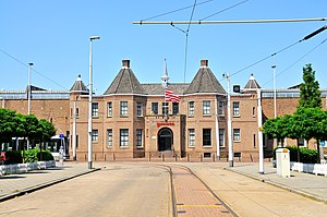
The Sparta Stadion, nicknamed Het Kasteel (Dutch pronunciation: [ət kɑsˈteːl]) (en. The Castle)) is a football stadium in Rotterdam, Netherlands. It is the home ground of Sparta Rotterdam.

Diergaarde Blijdorp
Zoo in the northwestern Rotterdam, Nederlands
Distance: Approx. 990 meters
Latitude and longitude: 51.9269605,4.4481325
Diergaarde Blijdorp (Dutch pronunciation: [ˈdiːrˌɣaːrdə ˈblɛidɔrp]; lit. 'Blijdorp Zoo'), officially Rotterdam Zoo, is a zoo located in the northwestern part of Rotterdam. It is one of the oldest zoos in the Netherlands, and has been operated by the Stichting Koninklijke Rotterdamse Diergaarde ("Royal Rotterdam Zoo Foundation"). Divided into several zoogeographic regions, the 26-hectare (64.25-acre) Blijdorp Zoo boasts 562 species.

Delfshaven metro station
Metro station in Rotterdam, the Netherlands
Distance: Approx. 1052 meters
Latitude and longitude: 51.91,4.44555556
Delfshaven is an underground subway station in the Dutch city of Rotterdam, served by lines A, B, and C of the Rotterdam Metro. The station is part of the two station long extension of the East-West Line (or Caland line), and it opened on 25 April 1986. This extension connected the line's former terminus Coolhaven with the new Marconiplein station.
Marconiplein metro station
Metro station in Rotterdam, the Netherlands
Distance: Approx. 877 meters
Latitude and longitude: 51.9133,4.43275
Marconiplein is an underground subway station in the Dutch city of Rotterdam, and is part of Rotterdam Metro lines A, B, and C. The station is part of the two station long extension of the East-West Line (also formerly called Caland line) and opened on 25 April 1986. This extension connected the new Marconiplein and Delfshaven stations with the line's former terminus Coolhaven. Until 4 November 2002 Marconiplein station was the western terminus of the East-West Line.

Van Nelle Factory
Former industrial complex in Rotterdam
Distance: Approx. 673 meters
Latitude and longitude: 51.92277778,4.43361111
The former Van Nelle Factory (Dutch: Van Nellefabriek) on the Schie in Rotterdam, is considered a prime example of the modernist and functionalist architecture. It has been a designated UNESCO World Heritage Site since 2014. Soon after it was built, prominent architects described the factory as "the most beautiful spectacle of the modern age" (Le Corbusier in 1932) and "a poem in steel and glass" (Robertson in 1930).

Mevlana Mosque, Rotterdam
Mosque in Rotterdam, South Holland, Netherlands
Distance: Approx. 234 meters
Latitude and longitude: 51.9212,4.4416
The Mevlana Mosque (Dutch: Mevlanamoskee; Turkish: Mevlana Camii) is a mosque in northwestern Rotterdam, Netherlands which serves mainly Turkish-Dutch Muslims. The mosque, named after Rumi, was built in 2001 and benefits from two minarets. The mosque was voted as Rotterdam's most attractive building in 2006.
Nieuwe Westen
Neighborhood of Rotterdam in South Holland, Netherlands
Distance: Approx. 871 meters
Latitude and longitude: 51.91305556,4.44944444
Nieuwe Westen is a pre-war neighbourhood in the west of Rotterdam, located between the Heemraadssingel and the Delfshavense Schie in the Delfshaven district. Nieuwe Westen was built in the early twentieth century. As in the neighbouring Middelland district, Nieuwe Westen is a district of contrasts: completely renovated streets can be found within 100 metres of the stately Heemraadssingel and Mathenesserlaan.
Spangen
Neighbourhood of Rotterdam in South Holland, Netherlands
Distance: Approx. 617 meters
Latitude and longitude: 51.91666667,4.43333333
Spangen is a neighborhood of Rotterdam, Netherlands. It is in the west of the city with about 10000 inhabitants. From the entrance of Spangen to the center is formed by the Mathenesserbrug across the Delfshavense Schie.

Beukelsdijk
Street in Rotterdam, the Netherlands
Distance: Approx. 997 meters
Latitude and longitude: 51.92111111,4.45555556
Beukelsdijk is a street in Rotterdam, connecting Rotterdam and Schiedam. It leads from the crossing with the Henegouwerlaan near the tunnel traverse (where it continues from the Weena), to the Burgemeester Meineszplein in the neighbourhood Middelland, where it continues as the Beukelsweg.

Richard Visser
Dutch pastry chef
Distance: Approx. 908 meters
Latitude and longitude: 51.91744,4.45435
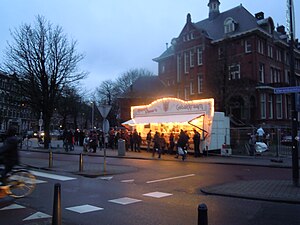
Richard Visser (1968/1969) is a Dutch pastry chef who runs a pastry stand (Dutch: Richard Visser's Gebakkraam) located on the corner of the Heemraadssingel and the Vierambachtsstraat in Rotterdam, which mainly sells oliebollen. In 2011 his oliebollen were named the best in the Netherlands by the Algemeen Dagblad national newspaper in their AD-Oliebollentest; this was his eighth win in nineteen years. He won again in 2013.
Sparta Youth Academy
Football club
Distance: Approx. 536 meters
Latitude and longitude: 51.919485,4.433619
The Sparta Youth Academy is a football youth academy based in Rotterdam, Netherlands, from where the organization manages a total of 13 youth teams (ages 7–18). The academy is the primary youth clinic of Dutch football club Sparta Rotterdam, the oldest professional football club in the Netherlands. The Academy received the four star academic sports certification, the highest possible rating for sports academies in the Netherlands, having won the best National football academy award on several occasions.
Weather in this IP's area
overcast clouds
20 Celsius
20 Celsius
19 Celsius
21 Celsius
1006 hPa
68 %
1006 hPa
1006 hPa
10000 meters
3.09 m/s
180 degree
91 %
07:06:08
20:13:53


