Country:
Region:
City:
Latitude and Longitude:
Time Zone:
Postal Code:
IP information under different IP Channel
ip-api
Country
Region
City
ASN
Time Zone
ISP
Blacklist
Proxy
Latitude
Longitude
Postal
Route
Luminati
Country
ASN
Time Zone
Europe/Berlin
ISP
Vodafone GmbH
Latitude
Longitude
Postal
IPinfo
Country
Region
City
ASN
Time Zone
ISP
Blacklist
Proxy
Latitude
Longitude
Postal
Route
db-ip
Country
Region
City
ASN
Time Zone
ISP
Blacklist
Proxy
Latitude
Longitude
Postal
Route
ipdata
Country
Region
City
ASN
Time Zone
ISP
Blacklist
Proxy
Latitude
Longitude
Postal
Route
Popular places and events near this IP address

Limburgerhof
Municipality in Rhineland-Palatinate, Germany
Distance: Approx. 1419 meters
Latitude and longitude: 49.41666667,8.4
Limburgerhof is a municipality in the Rhein-Pfalz-Kreis, in Rhineland-Palatinate, Germany, 7 km southwest of Ludwigshafen. It is known in the region because of an Agrochemical Center of the world's largest chemical company BASF, which has its headquarters in Ludwigshafen. The village with a population of about 10 000 was founded in 1930.

Mutterstadt
Municipality in Rhineland-Palatinate, Germany
Distance: Approx. 3193 meters
Latitude and longitude: 49.43333333,8.35
Mutterstadt is a municipality in the Rhein-Pfalz-Kreis, in Rhineland-Palatinate, Germany. Though classified as rural the municipality does contain urbanized areas. It is situated approximately 7 km southwest of the city center of Ludwigshafen.

Neuhofen
Municipality in Rhineland-Palatinate, Germany
Distance: Approx. 2145 meters
Latitude and longitude: 49.41666667,8.41666667
Neuhofen is a municipality in the Rhein-Pfalz-Kreis, in Rhineland-Palatinate, Germany. It is situated approximately 7 km south of Ludwigshafen.

Waldsee, Palatinate
Municipality in Rhineland-Palatinate, Germany
Distance: Approx. 4303 meters
Latitude and longitude: 49.4,8.43333333
Waldsee is a municipality in the Rhein-Pfalz-Kreis, in Rhineland-Palatinate, Germany. It is situated approximately 3 km north of Speyer. Waldsee is the seat of the Verbandsgemeinde ("collective municipality") Rheinauen.
Rheinauen (Verbandsgemeinde)
Distance: Approx. 4145 meters
Latitude and longitude: 49.4,8.43
Rheinauen is a Verbandsgemeinde ("collective municipality") in the district Rhein-Pfalz-Kreis, in Rhineland-Palatinate, Germany. The seat of the Verbandsgemeinde is in Waldsee. Before 1 January 2016, the Verbandsgemeinde was named Waldsee.

Golden Hat of Schifferstadt
Bronze Age artefact
Distance: Approx. 3751 meters
Latitude and longitude: 49.4,8.3664
The Golden Hat of Schifferstadt (German: Der Goldene Hut von Schifferstadt) was discovered in a field near the town of Schifferstadt in Southwest Germany in 1835. It is a Bronze Age artefact made of thin sheet gold and served as the external decoration of a head-dress, probably of an organic material, with a brim and a chin-strap. The hat is on display in the Historical Museum of the Palatinate in Speyer.

Rehbach (Palatinate)
River in Germany
Distance: Approx. 4196 meters
Latitude and longitude: 49.44638889,8.44472222
The Rehbach is a river in Rhineland-Palatinate. It is about 29 kilometres (18 mi) long and is a left tributary of the Rhine.

Schifferstadt station
Separation station in Schifferstadt, Rhineland-Palatinate, Germany
Distance: Approx. 4602 meters
Latitude and longitude: 49.39194444,8.36444444
Schifferstadt station is a separation station in the town of Schifferstadt in the German state of Rhineland-Palatinate, where the Speyer line branches off from the Mannheim–Saarbrücken railway.
Floßbach (Isenach)
River in Germany
Distance: Approx. 3127 meters
Latitude and longitude: 49.4006361,8.3916778
The Floßbach (also Floßgraben or Floßkanal, formerly Flotzbach or Flotzbachgraben) is a man-made river 16 kilometres (9.9 mi) long. It is an orographically right-hand tributary of the Isenach in the German state of Rhineland-Palatinate. It was built in the 18th century to enable the timber rafting of firewood.
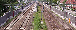
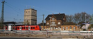
Limburgerhof station
Railway station in Limburgerhof, Germany
Distance: Approx. 542 meters
Latitude and longitude: 49.4242,8.39066
Limburgerhof station – called Mutterstadt until 1930 – is in the town of Limburgerhof in the German state of Rhineland-Palatinate. Deutsche Bahn classifies it as a category 4 station and it has two platform tracks and two through tracks. The station is located in the network of the Verkehrsverbund Rhein-Neckar (Rhine-Neckar transport association, VRN) and belongs to fare zone 123.
Ludwigshafen-Mundenheim station
Category 5 railway station in Germany
Distance: Approx. 4182 meters
Latitude and longitude: 49.461694,8.421167
Ludwigshafen-Mundenheim station—originally called Mundenheim—is in the Ludwigshafen suburb of Mundenheim in the German state of Rhineland-Palatinate. Deutsche Bahn classifies it as a category 5 station and it has three platform tracks and one through track without a platform. The station is located in the network of the Verkehrsverbund Rhein-Neckar (Rhine-Neckar transport association, VRN) and belongs to fare zone 103.
Battle of Maudach
Battle of the War of the First Coalition
Distance: Approx. 3013 meters
Latitude and longitude: 49.45416667,8.37944444
The Battle of Maudach occurred on 15 June 1796 between the French Revolutionary Army and the Army of the First Coalition. This was the opening action of the Rhine Campaign of 1796 on the Upper Rhine, slightly north of the town of Kehl. The Coalition, commanded by Franz Petrasch, lost 10 percent of its manpower missing, killed or wounded.
Weather in this IP's area
clear sky
5 Celsius
5 Celsius
4 Celsius
6 Celsius
1026 hPa
70 %
1026 hPa
1014 hPa
10000 meters
0.54 m/s
0.97 m/s
60 degree
4 %
07:21:36
16:58:26


