Country:
Region:
City:
Latitude and Longitude:
Time Zone:
Postal Code:
IP information under different IP Channel
ip-api
Country
Region
City
ASN
Time Zone
ISP
Blacklist
Proxy
Latitude
Longitude
Postal
Route
Luminati
Country
ASN
Time Zone
Europe/Lisbon
ISP
European Maritime Safety Agency
Latitude
Longitude
Postal
IPinfo
Country
Region
City
ASN
Time Zone
ISP
Blacklist
Proxy
Latitude
Longitude
Postal
Route
db-ip
Country
Region
City
ASN
Time Zone
ISP
Blacklist
Proxy
Latitude
Longitude
Postal
Route
ipdata
Country
Region
City
ASN
Time Zone
ISP
Blacklist
Proxy
Latitude
Longitude
Postal
Route
Popular places and events near this IP address

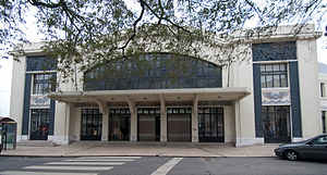
Teatro Nacional de São Carlos
Building in Lisbon, Portugal
Distance: Approx. 528 meters
Latitude and longitude: 38.70944444,-9.14166667
The Teatro Nacional de São Carlos (Portuguese pronunciation: [tiˈatɾu nɐsiuˈnal dɨ sɐ̃w ˈkaɾluʃ]) (National Theatre of Saint Charles) is an opera house in Lisbon, Portugal. It was opened on June 30, 1793 by Queen Maria I as a replacement for the Tejo Opera House, which was destroyed in the 1755 Lisbon earthquake. The theatre is located in the historical center of Lisbon, in the Chiado district.

European Union Drugs Agency
Agency on illicit drugs of the European Union, formerly "EMCDDA"
Distance: Approx. 127 meters
Latitude and longitude: 38.70572,-9.14307
The European Union Drugs Agency (EUDA), known until 2024 as the European Monitoring Centre for Drugs and Drug Addiction (EMCDDA), is an agency of the European Union headquartered in Lisbon, Portugal, and established in 1993. In June 2022, the Council of the European Union approved a reform of the organization which lead to an extension of its mandate. The EUDA strives to be the "reference point" on drug usage for the European Union's member states, and to deliver "factual, objective, reliable and comparable information" about drug usage, drug addiction and related health complications, including hepatitis, HIV/AIDS and tuberculosis.

National Museum of Contemporary Art of Chiado
Art museum in Lisbon, Portugal
Distance: Approx. 500 meters
Latitude and longitude: 38.7089,-9.1411
The National Museum of Contemporary Art of Chiado (Chiado Museum, in Portuguese: Museu Nacional de Arte Contemporânea do Chiado – MNAC) is an art museum located in the Chiado neighbourhood of Lisbon, Portugal. It was created in 1911 and re-inaugurated, in new installations, in 1994. The museum covers the period between 1850 and 1950, with works by the foremost Portuguese artists of the period, as well as some foreigners.

European Maritime Safety Agency
Distance: Approx. 198 meters
Latitude and longitude: 38.70564,-9.14216
The European Maritime Safety Agency (EMSA) is a European Union agency charged with reducing the risk of maritime accidents, marine pollution from ships and the loss of human lives at sea by helping to enforce the pertinent EU legislation. It is headquartered in Lisbon.

Cais do Sodré railway station
Railway station in Portugal
Distance: Approx. 73 meters
Latitude and longitude: 38.70583333,-9.14416667
The Cais do Sodré Railway Station (European Portuguese: [ˈkajʒ ðu suˈðɾɛ]) is an intermodal railway station in the civil parish of Misericórdia, in the municipality of Lisbon, serving as the terminus of the suburban route to the resort town Cascais.
Mártires, Lisbon
Civil parish in Lisbon, Portugal
Distance: Approx. 470 meters
Latitude and longitude: 38.709,-9.142
Mártires (Portuguese pronunciation: [ˈmaɾtiɾɨʃ]) is a former civil parish (freguesia) in the city and municipality of Lisbon, Portugal. It was one of the oldest civil parishes of Lisbon, dated from 1147. It had less than 400 inhabitants, and its area was 0.10 km2.
Ascensor da Bica
Funicular railway in Lisbon, Portugal
Distance: Approx. 441 meters
Latitude and longitude: 38.70861111,-9.14694444
The Bica Funicular (Portuguese: Ascensor da Bica), sometimes known as the Elevador da Bica (Bica Lift), is a funicular railway line in the civil parish of Misericórdia, in the municipality of Lisbon, Portugal. It connects the Rua de São Paulo with Calçada do Combro/Rua do Loreto, operated by Carris. The line conforms to the funicular principle, with two cars permanently attached to opposite ends of a haulage cable, which is looped over a pulley at the upper end of the track.
Verride Palace
Historic site in Lisbon, Portugal
Distance: Approx. 561 meters
Latitude and longitude: 38.7098,-9.147
Verride Palace, or the Palace of Santa Catarina, (Portuguese: Palácio de Verride; Palácio de Santa Catarina) is an 18th-century Portuguese palace located in Lisbon, Portugal.

Time Out Market Lisboa
Food hall in Lisbon, Portugal
Distance: Approx. 220 meters
Latitude and longitude: 38.70694444,-9.14555556
Time Out Market Lisboa is a food hall located in the Mercado da Ribeira at Cais do Sodré in Lisbon, Portugal.

Cais do Sodré Station
Metro station in Lisbon, Portugal
Distance: Approx. 77 meters
Latitude and longitude: 38.70583333,-9.14472222
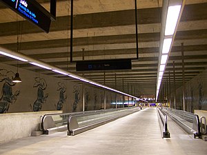
Cais do Sodré is a station on the Green Line of the Lisbon Metro. It is located in the Praça Duque da Terceira, connecting to the Cais do Sodré railway station and a boat port (allowing for quick travel between Lisbon and the cities of Cacilhas, Seixal, and Montijo).

Pillory of Lisbon
Pillory in Santa Maria Maior, Portugal
Distance: Approx. 553 meters
Latitude and longitude: 38.70805556,-9.13916667
The Pillory of Lisbon (Portuguese: Pelourinho de Lisboa) is a pillory situated in the municipal square of the Portuguese capital (in the civil parish of Santa Maria Maior in the municipality of Lisbon), classified as a National Monument (Monumento Nacional).

British School of Lisbon
British international school in Lisbon, Lisbon District, Portugal
Distance: Approx. 386 meters
Latitude and longitude: 38.70841,-9.14606
The British School of Lisbon (alternatively known as BSL) is a British international school in Lisbon, Portugal. Founded in 2019, it is among the newest in the network of international schools run since 2005 by The Schools Trust, a British non-profit organization.
Weather in this IP's area
clear sky
17 Celsius
17 Celsius
17 Celsius
18 Celsius
1018 hPa
80 %
1018 hPa
1018 hPa
10000 meters
3.6 m/s
30 degree
07:21:29
17:22:01

