Country:
Region:
City:
Latitude and Longitude:
Time Zone:
Postal Code:
IP information under different IP Channel
ip-api
Country
Region
City
ASN
Time Zone
ISP
Blacklist
Proxy
Latitude
Longitude
Postal
Route
Luminati
Country
Region
ri
City
autol
ASN
Time Zone
Europe/Madrid
ISP
Free Technologies Excom S.L.
Latitude
Longitude
Postal
IPinfo
Country
Region
City
ASN
Time Zone
ISP
Blacklist
Proxy
Latitude
Longitude
Postal
Route
db-ip
Country
Region
City
ASN
Time Zone
ISP
Blacklist
Proxy
Latitude
Longitude
Postal
Route
ipdata
Country
Region
City
ASN
Time Zone
ISP
Blacklist
Proxy
Latitude
Longitude
Postal
Route
Popular places and events near this IP address

Calahorra
City and Municipality in La Rioja, Spain
Distance: Approx. 9863 meters
Latitude and longitude: 42.3,-1.96666667
Calahorra (Spanish: [kalaˈora]; Aragonese: Calagorra; Latin: Calagurris) is a municipality in the Spanish autonomous community and province of La Rioja. During Ancient Roman times, Calahorra was a municipium known as Calagurris Nassica Iulia.

Roman Catholic Diocese of Calahorra y La Calzada-Logroño
Roman Catholic diocese in Spain
Distance: Approx. 9996 meters
Latitude and longitude: 42.2989,-1.9575
The Diocese of Calahorra and La Calzada-Logroño (Latin: Dioecesis Calaguritanus et Calceatensis – Lucroniensis )) is a Latin diocese of the Catholic Church located in the cities of Calahorra, Santo Domingo de la Calzada, and Logroño in the ecclesiastical province of Pamplona y Tudela in Spain. There are cathedrals in Calahorra, Santo Domingo de la Calzada and Logroño.

Aldeanueva de Ebro
Municipality in La Rioja, Spain
Distance: Approx. 9536 meters
Latitude and longitude: 42.22972222,-1.88777778
Aldeanueva de Ebro is a town in La Rioja, in the Alfaro Comarca, located 10 kilometers from Calahorra and 59 from Logroño, in Spain. It has 2,774 inhabitants and is 39 km² in area. Its origin dates from the 11th century, when it was founded by shepherds from Tierra de Cameros and Calahorra after its reconquest by García Sánchez III of Navarre in 1045.

Autol
Municipality in La Rioja, Spain
Distance: Approx. 452 meters
Latitude and longitude: 42.21388889,-2.00694444
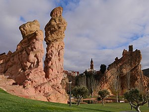
Autol is a village in the province and autonomous community of La Rioja, Spain. River Cidacos flows by the town. There are original rock formations close to Autol.
Quel, La Rioja
Municipality in La Rioja, Spain
Distance: Approx. 4230 meters
Latitude and longitude: 42.22888889,-2.04972222
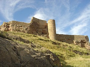
Quel is a village in the province and autonomous community of La Rioja, Spain. The municipality covers an area of 54.78 square kilometres (21.15 sq mi) and as of 2011 had a population of 2096 people. Quel is known for its castle, which overlooks the town from atop a steep hill.

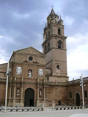
Calahorra Cathedral
Catholic church in Calahorra, Spain
Distance: Approx. 9995 meters
Latitude and longitude: 42.29888889,-1.9575
The Cathedral of Saint Mary (Spanish: Catedral de Santa María) is a cathedral located in Calahorra (in La Rioja, Spain). It is one of the cathedrals belonging to the Roman Catholic Diocese of Calahorra y La Calzada-Logroño. The building was given a heritage listing in 1931, and is currently protected as a Bien de Interés Cultural.

Castle of Quel
Castle in La Rioja, Spain
Distance: Approx. 4121 meters
Latitude and longitude: 42.2285,-2.0485
The castle of Quel is a fortress built in the year 1470. It is located in Quel, La Rioja (Spain).

Castle of Arnedo
Castle in La Rioja, Spain
Distance: Approx. 7933 meters
Latitude and longitude: 42.22885,-2.09627
The Castle of Arnedo is a fortification located in Arnedo in the autonomous community of La Rioja, Spain. It overlooks the city and the course of the Cidacos River. The first defensive structures built on the hill, where the castle is located now, date from ancient Roman times.
Weather in this IP's area
scattered clouds
3 Celsius
2 Celsius
3 Celsius
9 Celsius
1022 hPa
80 %
1022 hPa
971 hPa
10000 meters
1.62 m/s
1.65 m/s
130 degree
25 %
07:58:54
17:46:39