Country:
 Switzerland
Region:
City:
Latitude and Longitude:
Time Zone:
Postal Code:
IP information under different IP Channel
ip-api
Country
Region
City
ASN
Time Zone
ISP
Blacklist
Proxy
Latitude
Longitude
Postal
Route
IPinfo
Country
Region
City
ASN
Time Zone
ISP
Blacklist
Proxy
Latitude
Longitude
Postal
Route
MaxMind
Country
Region
City
ASN
Time Zone
ISP
Blacklist
Proxy
Latitude
Longitude
Postal
Route
Luminati
Country
CHRegion
tg
City
oberaach
ASN
Time Zone
Europe/Zurich
ISP
Quickline AG
Latitude
Longitude
Postal
db-ip
Country
Region
City
ASN
Time Zone
ISP
Blacklist
Proxy
Latitude
Longitude
Postal
Route
ipdata
Country
Region
City
ASN
Time Zone
ISP
Blacklist
Proxy
Latitude
Longitude
Postal
Route
Popular places and events near this IP address

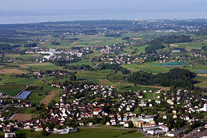
Amriswil
Municipality in Thurgau, Switzerland
Distance: Approx. 3162 meters
Latitude and longitude: 47.55,9.3
Amriswil (Low Alemannic: Amerschwiil) is a town and a municipality in Arbon District in the canton of Thurgau in Switzerland near the Lake Constance. The official language of Amriswil is (the Swiss variety of Standard) German, but the main spoken language is the local variant of the Alemannic Swiss German dialect.
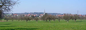
Erlen
Municipality in Thurgau, Switzerland
Distance: Approx. 2181 meters
Latitude and longitude: 47.55,9.23333333
Erlen is a municipality in Weinfelden District in the canton of Thurgau in Switzerland.
Zihlschlacht-Sitterdorf
Municipality in Thurgau, Switzerland
Distance: Approx. 4653 meters
Latitude and longitude: 47.51666667,9.26666667
Zihlschlacht-Sitterdorf is a municipality in Weinfelden District in the canton of Thurgau in Switzerland.
Dozwil
Municipality in Thurgau, Switzerland
Distance: Approx. 4382 meters
Latitude and longitude: 47.56666667,9.31666667
Dozwil is a municipality in the district of Arbon in the canton of Thurgau in Switzerland.

Hefenhofen
Municipality in Thurgau, Switzerland
Distance: Approx. 3162 meters
Latitude and longitude: 47.55,9.3
Hefenhofen is a municipality in the district of Arbon in the canton of Thurgau in Switzerland.
Sommeri
Municipality in Thurgau, Switzerland
Distance: Approx. 2010 meters
Latitude and longitude: 47.56666667,9.28333333
Sommeri is a municipality in the district of Arbon in the canton of Thurgau in Switzerland.
Langrickenbach
Municipality in Thurgau, Switzerland
Distance: Approx. 3367 meters
Latitude and longitude: 47.56666667,9.21666667
Langrickenbach is a municipality in the district of Kreuzlingen in the canton of Thurgau in Switzerland.

Hagenwil Castle
Distance: Approx. 4709 meters
Latitude and longitude: 47.529124,9.305224
Hagenwil Castle is a castle in the municipality of Amriswil of the Canton of Thurgau in Switzerland. It is a Swiss heritage site of national significance. It is the only remaining intact water castle in eastern Switzerland.

Amriswil railway station
Railway station in Amriswil, Switzerland
Distance: Approx. 3309 meters
Latitude and longitude: 47.55038889,9.30219444
Amriswil railway station (German: Bahnhof Amriswil) is a railway station in Amriswil, in the Swiss canton of Thurgau. It is an intermediate stop on the Winterthur–Romanshorn line and is served by local and long-distance trains.
Erlen railway station
Railway station in Switzerland
Distance: Approx. 2724 meters
Latitude and longitude: 47.55583333,9.22361111
Erlen railway station (German: Bahnhof Erlen) is a railway station in the municipality of Erlen, in the Swiss canton of Thurgau. It is an intermediate stop on the Winterthur–Romanshorn line and is served by local trains only.

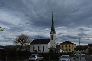
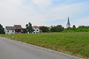
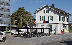
Oberaach railway station
Railway station in Switzerland
Distance: Approx. 315 meters
Latitude and longitude: 47.55805556,9.26388889
Oberaach railway station (German: Bahnhof Oberaach) is a railway station in the village of Oberaach, within the municipality of Amriswil, in the Swiss canton of Thurgau. It is an intermediate stop on the Winterthur–Romanshorn line and is served by local trains only.

Hudelmoos
Bog in eastern Switzerland
Distance: Approx. 4492 meters
Latitude and longitude: 47.52277778,9.28833333
Hudelmoos is a raised bog and nature reserve in the municipalities of Zihlschlacht-Sitterdorf and Amriswil (Thurgau), and Muolen (St. Gallen), in Switzerland. The bog encompasses 40 hectares (99 acres) and consists mostly of sparse birch forest, with a soft forest floor and multiple streams and ponds.
Weather in this IP's area
moderate rain
20 Celsius
20 Celsius
19 Celsius
21 Celsius
1008 hPa
82 %
1008 hPa
958 hPa
10000 meters
1.83 m/s
2.23 m/s
263 degree
100 %
06:51:24
19:50:04