185.39.203.81 - IP Lookup: Free IP Address Lookup, Postal Code Lookup, IP Location Lookup, IP ASN, Public IP
Country:
Region:
City:
Location:
Time Zone:
Postal Code:
IP information under different IP Channel
ip-api
Country
Region
City
ASN
Time Zone
ISP
Blacklist
Proxy
Latitude
Longitude
Postal
Route
Luminati
Country
Region
19
City
finnsnes
ASN
Time Zone
Europe/Oslo
ISP
Bredbandsfylket AS
Latitude
Longitude
Postal
IPinfo
Country
Region
City
ASN
Time Zone
ISP
Blacklist
Proxy
Latitude
Longitude
Postal
Route
IP2Location
185.39.203.81Country
Region
troms og finnmark
City
sorreisa
Time Zone
Europe/Oslo
ISP
Language
User-Agent
Latitude
Longitude
Postal
db-ip
Country
Region
City
ASN
Time Zone
ISP
Blacklist
Proxy
Latitude
Longitude
Postal
Route
ipdata
Country
Region
City
ASN
Time Zone
ISP
Blacklist
Proxy
Latitude
Longitude
Postal
Route
Popular places and events near this IP address

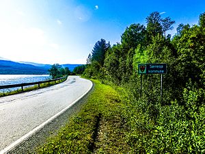
Sørreisa Municipality
Municipality in Troms, Norway
Distance: Approx. 6155 meters
Latitude and longitude: 69.09194444,18.19361111
Sørreisa (Northern Sami: Ráisavuona suohkan) is a municipality in Troms county, Norway. The administrative centre of the municipality is the village of Sørreisa. Other villages include Grunnreisa, Skøelva, and Smørsgård.

Sørreisa Church
Church in Troms, Norway
Distance: Approx. 4259 meters
Latitude and longitude: 69.175247,18.08599
Sørreisa Church or Tømmervik Church (Norwegian: Sørreisa kirke / Tømmervik kirke) is a parish church of the Church of Norway in Sørreisa Municipality in Troms county, Norway. It is located about 5 kilometres (3.1 mi) northwest of the village of Sørreisa at Tømmervika, near the shore of the Reisafjorden. It is one of the churches for the Sørreisa parish which is part of the Senja prosti (deanery) in the Diocese of Nord-Hålogaland.
Skøelv Chapel
Church in Troms, Norway
Distance: Approx. 4320 meters
Latitude and longitude: 69.130004,18.052747
Skøelv Chapel (Norwegian: Skøelv kapell) is a chapel of the Church of Norway in Sørreisa Municipality in Troms county, Norway. It is located in the village of Skøelva. It is an annex chapel for the Sørreisa parish which is part of the Senja prosti (deanery) in the Diocese of Nord-Hålogaland.
Straumen Chapel
Church in Troms, Norway
Distance: Approx. 483 meters
Latitude and longitude: 69.1413943,18.14757
Straumen Chapel (Norwegian: Straumen kapell) is a parish church of the Church of Norway in Sørreisa Municipality in Troms county, Norway. It is located in the village of Sørreisa. It is one of the churches for the Sørreisa parish which is part of the Senja prosti (deanery) in the Diocese of Nord-Hålogaland.
Sørreisa (village)
Village in Sørreisa Municipality, Norway
Distance: Approx. 5 meters
Latitude and longitude: 69.14526,18.15292
Sørreisa (Norwegian) or Orjješ-Ráisa (Northern Sami) is the administrative centre of Sørreisa Municipality in Troms county, Norway. The village (also known as Straumen) is located at the eastern end of the Reisafjorden, an arm off of the main Solbergfjorden, and north of the lake Reisvatnet. The village of Skøelva is located about 5 kilometres (3.1 mi) southwest of Sørreisa.
Skøelva
Village in Sørreisa Municipality, Norway
Distance: Approx. 4342 meters
Latitude and longitude: 69.13166667,18.05027778
Skøelva or Skøelv is the second largest village in Sørreisa Municipality in Troms county, Norway. The village is located along the Reisafjorden, about 5 kilometres (3.1 mi) west of the municipal centre of Sørreisa. The village is located along the mouth of the river Skøelva.

Finnfjordbotn
Village in Northern Norway, Norway
Distance: Approx. 9823 meters
Latitude and longitude: 69.23055556,18.08888889
Finnfjordbotn (Norwegian) or Vuotnabahta (Northern Sami), popularly known as Finnsnes Øst, is a village in Senja Municipality in Troms county, Norway. It is a suburb of the neighboring town of Finnsnes and is located 4 km (2.5 mi) east of the city center at the intersection where Norwegian County Road 86 and Norwegian County Road 855 meet. The district, which has approx.
Weather in this IP's area
scattered clouds
-13 Celsius
-13 Celsius
-13 Celsius
-13 Celsius
995 hPa
85 %
995 hPa
957 hPa
10000 meters
40 %