Country:
Region:
City:
Latitude and Longitude:
Time Zone:
Postal Code:
IP information under different IP Channel
ip-api
Country
Region
City
ASN
Time Zone
ISP
Blacklist
Proxy
Latitude
Longitude
Postal
Route
Luminati
Country
Region
wal
City
chatelet
ASN
Time Zone
Europe/Brussels
ISP
HUmani Society
Latitude
Longitude
Postal
IPinfo
Country
Region
City
ASN
Time Zone
ISP
Blacklist
Proxy
Latitude
Longitude
Postal
Route
db-ip
Country
Region
City
ASN
Time Zone
ISP
Blacklist
Proxy
Latitude
Longitude
Postal
Route
ipdata
Country
Region
City
ASN
Time Zone
ISP
Blacklist
Proxy
Latitude
Longitude
Postal
Route
Popular places and events near this IP address

Aiseau-Presles
Municipality in French Community, Belgium
Distance: Approx. 3265 meters
Latitude and longitude: 50.41666667,4.56666667
Aiseau-Presles (French pronunciation: [ezo pʁɛl]; Walloon: Åjhô-Préle) is a municipality of Wallonia located in the province of Hainaut, Belgium.[1] On 1 January 2018 Aiseau-Presles had a total population of 10,788. The total area is 22.19 km2 which gives a population density of 486 inhabitants per km2. It is located in the arrondissement of Charleroi.

Châtelet, Belgium
Municipality in French Community, Belgium
Distance: Approx. 1023 meters
Latitude and longitude: 50.4,4.51666667
Châtelet (French pronunciation: [ʃatlɛ] ; Walloon: Tcheslet) is a city and municipality of Wallonia located in the province of Hainaut, Belgium. It lies on the river Sambre. As of January 1, 2018, Châtelet had a total population of 36,101.

Farciennes
Municipality in French Community, Belgium
Distance: Approx. 3392 meters
Latitude and longitude: 50.43333333,4.55
Farciennes (French pronunciation: [faʁsjɛn]; Walloon: Fårcene) is a municipality of Wallonia located in the province of Hainaut, Belgium. On January 1, 2018, Farciennes had a total population of 11,247. The total area is 10.39 km2 which gives a population density of 1,083 inhabitants per km2.
Pironchamps
Distance: Approx. 1009 meters
Latitude and longitude: 50.41666667,4.51666667
Pironchamps (Walloon: Pirontchamp) is a town of Wallonia and a district of the municipality of Farciennes, located in the province of Hainaut, Belgium. It was a municipality before 1977.

Farciennes Castle
17th-century castle in Belgium
Distance: Approx. 3206 meters
Latitude and longitude: 50.427,4.557
Farciennes Castle (French: Château de Farciennes) is a derelict 17th-century castle in Farciennes in the province of Hainaut, Wallonia, Belgium. The present building stands on the site of an earlier castle of the 14th century.

Gilly metro station
Metro station in Charleroi, Belgium
Distance: Approx. 3509 meters
Latitude and longitude: 50.42361111,4.47916667
Gilly is a Charleroi Metro station, located in Gilly (part of the Charleroi municipality), in fare zone 2. Gilly is an underground station featuring a central platform Until the opening of the Soleilmont extension on 27 February 2012, Gilly was the terminus of former lines 54 and 55. Gilly station was opened on 28 August 1992, although it had been built in the eighties.
Soleilmont metro station
Metro station in Gilly, Belgium
Distance: Approx. 2809 meters
Latitude and longitude: 50.43027778,4.50277778
Soleilmont is a Charleroi Metro station located in Gilly, Belgium (part of the Charleroi municipality), opened on 27 February 2012 as part of the Soleilmont extension of the Gilly branch of the Charleroi Metro. The station, built at ground level, is the terminus of the Gilly branch (line M4) and is an intermodal transport hub served by trams and buses and featuring a 200 spaces car park. The station is located in TEC Charleroi fare zone 2.
Sart-Culpart metro station
Metro station in Gilly, Belgium
Distance: Approx. 3012 meters
Latitude and longitude: 50.42916667,4.49527778
Sart-Culpart is a Charleroi Metro station located in Gilly, Belgium (part of the Charleroi municipality), opened on 27 February 2012 as part of the Soleilmont extension of the Gilly branch of the Charleroi Pre-metro. The station is built at ground level and features a two lateral platforms. The station is located in TEC Charleroi fare zone 2.
Marabout metro station
Metro station in Charleroi, Belgium
Distance: Approx. 3244 meters
Latitude and longitude: 50.42694444,4.48722222
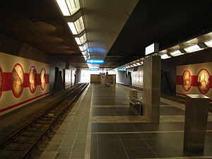
Marabout is a Charleroi Metro station located in Gilly, Belgium (part of the Charleroi municipality), opened on 27 February 2012 as part of the Soleilmont extension of the Gilly branch of the Charleroi Pre-metro. The station is entirely underground and features a central platform with street access at its western end. Decoration inside the station depicts old views of Charleroi.
Hanzinne
River in Belgium
Distance: Approx. 952 meters
Latitude and longitude: 50.4,4.52
The Hanzinne is a stream, and a tributary of the river Sambre, in Belgium. Its source is located in Hanzinne, a part of the Florennes municipality in the province of Namur. It passes through Hymiée, Gerpinnes, Acoz and Bouffioulx and is connected with river Sambre in Châtelet.

Coal mine du Gouffre
Mine in Châtelet
Distance: Approx. 2332 meters
Latitude and longitude: 50.4255,4.5035
The Coal mine du Gouffre (No. 10) is the main and last colliery company of Charbonnages du Gouffre. It is located at Châtelet Belgium, Walloon Region in the province of Hainaut.
Pont-de-Loup
Place in Wallonia, Belgium
Distance: Approx. 2164 meters
Latitude and longitude: 50.4,4.55
Pont-de-Loup (Walloon: Pondlô) is a village of Wallonia and a district of the municipality of Aiseau-Presles, located in the province of Hainaut, Belgium. The residents of Pont-de-Loup are referred to as "Lupipontain(e)." The village is officially a "lieu dit" ("named place") in the commune of Tourrettes-sur-Loup.[1]. The village is best known for an annual religious festival in honor of Our Lady Del Manock.
Weather in this IP's area
mist
5 Celsius
3 Celsius
4 Celsius
6 Celsius
1023 hPa
97 %
1023 hPa
1011 hPa
2500 meters
2.06 m/s
210 degree
20 %
07:39:49
17:11:11


