185.35.216.48 - IP Lookup: Free IP Address Lookup, Postal Code Lookup, IP Location Lookup, IP ASN, Public IP
Country:
Region:
City:
Location:
Time Zone:
Postal Code:
IP information under different IP Channel
ip-api
Country
Region
City
ASN
Time Zone
ISP
Blacklist
Proxy
Latitude
Longitude
Postal
Route
Luminati
Country
Region
nw
City
langenfeld
ASN
Time Zone
Europe/Berlin
ISP
Thuega SmartService GmbH
Latitude
Longitude
Postal
IPinfo
Country
Region
City
ASN
Time Zone
ISP
Blacklist
Proxy
Latitude
Longitude
Postal
Route
IP2Location
185.35.216.48Country
Region
nordrhein-westfalen
City
richrath
Time Zone
Europe/Berlin
ISP
Language
User-Agent
Latitude
Longitude
Postal
db-ip
Country
Region
City
ASN
Time Zone
ISP
Blacklist
Proxy
Latitude
Longitude
Postal
Route
ipdata
Country
Region
City
ASN
Time Zone
ISP
Blacklist
Proxy
Latitude
Longitude
Postal
Route
Popular places and events near this IP address
Langenfeld, Rhineland
Town in North Rhine-Westphalia, Germany
Distance: Approx. 1505 meters
Latitude and longitude: 51.11666667,6.95
Langenfeld (Ripuarian: Langefääl) is a town in North Rhine-Westphalia (Germany) in the district of Mettmann. The suburban city is located between Düsseldorf and Cologne. Langenfeld was formed from the two localities of Richrath and Reusrath and received city rights in 1948.
Baumberg
Distance: Approx. 4050 meters
Latitude and longitude: 51.1175,6.89111111
Baumberg (also Monheim-Baumberg) is part of the city of Monheim am Rhein in the district of Mettmann in North Rhine-Westphalia (Germany) at the southern border of Düsseldorf, placed on the eastern bank of the river Rhine. Baumberg consists of an area of about 6 km2, with about 14,000 residents in 2023 (one third of the 43,000 in Monheim am Rhein).

Düsseldorf-Garath
City district of Düsseldorf, Germany
Distance: Approx. 4014 meters
Latitude and longitude: 51.14666667,6.89472222
Garath (German pronunciation: [ˈga:ʁaːt]) is a suburb of Düsseldorf, Germany, south of the city centre and part of Borough 10. It has an area of 3.26 km2 (1.26 sq mi), and 19,048 inhabitants (2020).

Hellerhof
City district of Düsseldorf, Germany
Distance: Approx. 2751 meters
Latitude and longitude: 51.13222222,6.90638889
Hellerhof is a quarter of the city of Düsseldorf, part of Borough 10. Düsseldorf-Hellerhof is in the far southeast part of Düsseldorf. It connects Düsseldorf with the towns of Langenfeld and Monheim am Rhein.

Düsseldorf-Garath station
Railway station in Düsseldorf, Germany
Distance: Approx. 3668 meters
Latitude and longitude: 51.14347222,6.89775
Düsseldorf-Garath is a railway station situated at Garath, Düsseldorf in western Germany. It is served by the S6 and S68 lines of the Rhine-Ruhr S-Bahn.

Düsseldorf-Hellerhof station
Railway station in Germany
Distance: Approx. 2631 meters
Latitude and longitude: 51.13333333,6.90833333
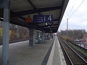
Düsseldorf-Hellerhof is a railway station situated at Hellerhof, Düsseldorf in western Germany. It is classified by Deutsche Bahn as a category 5 station. It is served by the S6 line of the Rhine-Ruhr S-Bahn at 20-minute intervals.

Langenfeld (Rheinland) station
Railway station in Langenfeld (Rheinland), Germany
Distance: Approx. 3069 meters
Latitude and longitude: 51.10273,6.93815
Langenfeld (Rheinland) station is located in the city of Langenfeld in the German state of North Rhine-Westphalia. It is on the Cologne–Duisburg line and is classified by Deutsche Bahn as a category 5 station. It is served by Rhine-Ruhr S-Bahn lines S 6 every 20 minutes and by a few services of S 68 (which start or finish in Langenfeld) in the peak hour.

Langenfeld-Berghausen station
Railway station in Langenfeld, Germany
Distance: Approx. 2058 meters
Latitude and longitude: 51.11724,6.924127
Langenfeld-Berghausen station is located in the city of Langenfeld in the German state of North Rhine-Westphalia. It is on the Cologne–Duisburg line and is classified by Deutsche Bahn as a category 5 station. It is served by Rhine-Ruhr S-Bahn lines S 6 every 20 minutes and by a few services of S 68 in the peak hour.

Hilden Süd station
Railway station in Hilden, Germany
Distance: Approx. 3789 meters
Latitude and longitude: 51.163549,6.937417
Hilden Süd station is in the city of Hilden in the German state of North Rhine-Westphalia. It is on the Düsseldorf–Solingen railway, which was opened on 3 January 1894 by the Prussian state railways. The station was also opened in 1976 or 1977 and it is classified by Deutsche Bahn as a category 5 station.

Galkhauser Bach
River in Germany
Distance: Approx. 2869 meters
Latitude and longitude: 51.1376,6.9064
Galkhauser Bach is a river of North Rhine-Westphalia, Germany. It is 9.8 km long and a left tributary of the Garather Mühlenbach, which in turn flows into Rhine.

Friedenskirche (Monheim-Baumberg)
Protestant church
Distance: Approx. 3828 meters
Latitude and longitude: 51.118,6.8942
The Friedenskirche (Peace Church) is a Protestant church in Monheim-Baumberg, Schellingstraße 13, built from 1968 to 1974 according to the plans of Walter Maria Foerderer in the Brutalist style.

Borough 10 (Düsseldorf)
Borough of Düsseldorf in North Rhine-Westphalia, Germany
Distance: Approx. 4101 meters
Latitude and longitude: 51.14888889,6.89527778
Borough 10 (German: Stadtbezirk 10) is a southeastern borough of Düsseldorf, the state capital of North Rhine-Westphalia, Germany. The borough covers an area of 5.30 square kilometres and (as of December 2020) has about 25,000 inhabitants, which makes it the smallest borough both by area and by population. The borough borders with the Düsseldorf borough 9 and with the rural district of Mettmann.
Weather in this IP's area
snow
2 Celsius
-3 Celsius
1 Celsius
2 Celsius
1019 hPa
90 %
1019 hPa
1013 hPa
2445 meters
4.75 m/s
11.45 m/s
258 degree
100 %
