Country:
Region:
City:
Latitude and Longitude:
Time Zone:
Postal Code:
IP information under different IP Channel
ip-api
Country
Region
City
ASN
Time Zone
ISP
Blacklist
Proxy
Latitude
Longitude
Postal
Route
Luminati
Country
Region
ct
City
barcelona
ASN
Time Zone
Europe/Madrid
ISP
Afr-ix Telecom Sau
Latitude
Longitude
Postal
IPinfo
Country
Region
City
ASN
Time Zone
ISP
Blacklist
Proxy
Latitude
Longitude
Postal
Route
db-ip
Country
Region
City
ASN
Time Zone
ISP
Blacklist
Proxy
Latitude
Longitude
Postal
Route
ipdata
Country
Region
City
ASN
Time Zone
ISP
Blacklist
Proxy
Latitude
Longitude
Postal
Route
Popular places and events near this IP address

Park Güell
Public park system in Barcelona, Spain
Distance: Approx. 315 meters
Latitude and longitude: 41.41361111,2.15277778
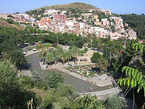
Park Güell (Catalan: Parc Güell [ˈpaɾɡ ˈɡweʎ]; Spanish: Parque Güell) is a privatized park system composed of gardens and architectural elements located on Turó del Carmel, in Barcelona, Catalonia, Spain. Turó del Carmel belongs to the mountain range of Collserola – the Parc del Carmel is located on the northern face. Park Güell is located in La Salut, a neighborhood in the Gràcia district of Barcelona.

El Carmel
Distance: Approx. 238 meters
Latitude and longitude: 41.41833611,2.15443611
El Carmel (Catalan pronunciation: [əl kəɾˈmɛl]), or simply Carmel, is a neighbourhood in the district of Horta-Guinardó, in Barcelona, Catalonia, Spain. Carmel is in the municipal district of Horta-Guinardó. The area was developed mainly in the 1960s and 1970s when immigrant workers, encouraged to move to Barcelona by the government of Francoist Spain, built housing for themselves.

Parc de la Creueta del Coll
Park in Barcelona, Spain
Distance: Approx. 704 meters
Latitude and longitude: 41.4189,2.14667
Parc de la Creueta del Coll (IPA: [ˈpaɾɡ də lə kɾəˈwɛtə ðəl ˈkɔʎ], 'Park of the Corner of the Hill') is a park in the Gràcia and Horta districts of Barcelona, Catalonia, Spain. The park was created from an abandoned quarry as part of the nou urbanisme developments during the 1992 Summer Olympics by architects Martorell, Bohigas and Mackay. The park contains the sculpture Elogi de l'Aigua, by Basque sculptor Eduardo Chillida, a massive concrete claw suspended by steel cables above a flooded quarry.

La Salut
Distance: Approx. 479 meters
Latitude and longitude: 41.41247778,2.15143056
La Salut is a neighborhood in the Gràcia district of Barcelona, Catalonia, Spain.

Can Baró
Neighborhood in Barcelona, Spain
Distance: Approx. 592 meters
Latitude and longitude: 41.41785278,2.16104444
Can Baró is a neighborhood in the Horta-Guinardó district of Barcelona, Catalonia (Spain). It is home to the Turó de la Rovira Museum of the History of Barcelona (MUHBA) heritage site, where anti-aircraft batteries were stationed during the Spanish Civil War. This heritage location also became a popular destination for crowds to gather at night-time, largely due to the peaceful location and panoramic view of the city.

El Coll – La Teixonera (Barcelona Metro)
Barcelona Metro station
Distance: Approx. 593 meters
Latitude and longitude: 41.42027778,2.14972222
El Coll | La Teixonera is a Barcelona metro station located in the Horta-Guinardó district. The station opened on 30 July 2010 as part of a 3 station extension to line 5. It is situated on the border between three neighbourhoods, El Carmel, La Teixonera and El Coll.

Travessera de Dalt
Distance: Approx. 779 meters
Latitude and longitude: 41.4092,2.1542
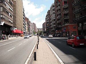
Travessera de Dalt is an important and much-used street in Barcelona (Catalonia, Spain). It spans a good deal of the city's district of Gràcia, starting at the tunnel entrances at Plaça de Lesseps, and running towards the tunnels system near Plaça Sanllehy, where it changes name and merges into Ronda del Guinardó. It's formally part of the ring road Ronda del Mig, which splits into several smaller roads.

Gaudí House Museum
Biographical museum in Spain
Distance: Approx. 345 meters
Latitude and longitude: 41.41355,2.15216111
The Gaudí House Museum (Catalan: Casa Museu Gaudí; Spanish: Casa-Museo Gaudí), located within the Park Güell in Barcelona, is a historic home museum that houses a collection of furniture and objects designed by the Spanish architect Antoni Gaudí. It was the residence of Gaudí for almost 20 years, from 1906 until the end of 1925. On 28 September 1963 it opened as a historic home museum.

Nou Sardenya
Distance: Approx. 775 meters
Latitude and longitude: 41.4118,2.1615
Nou Sardenya is a municipally-owned football stadium in the Gràcia district of Barcelona, Catalonia, Spain. It is currently used mostly for football matches and is the home ground of CE Europa. The stadium holds about 7,000.
Kostka College, Barcelona
Jesuit, catholic school in Gràcia, Barcelona, Spain
Distance: Approx. 251 meters
Latitude and longitude: 41.41461111,2.156425
Kostka College, Barcelona, Spain, was established in 1939 and became a work of the Jesuit Educational Foundation in 2012. It is currently situated in the Gràcia neighborhood of Barcelona, and includes classes from kindergarten through baccalaureate. The school was founded in 1939, in Roger de Llúria in Barcelona.

Kasa de la Muntanya
Squatted police station in Barcelona
Distance: Approx. 542 meters
Latitude and longitude: 41.41138889,2.15333333
Kasa de la Muntanya is a squatted former Guardia Civil (Civil Guard) barracks in Barcelona. It was built in 1909, by Eusebi Güell, abandoned by the police in 1983, and occupied in 1989. It became central to the squatter movement in Barcelona as a self-managed social centre.
Parc de Cervantes
Distance: Approx. 315 meters
Latitude and longitude: 41.41361111,2.15277778
The Parc de Cervantes (in Spanish: Parque de Cervantes) is located in the Pedralbes neighborhood, belonging to the Les Corts district, in Barcelona, Catalonia, Spain. It is located between Avinguda Diagonal and Avinguda de Esplugues (in a section that corresponds to Ronda de Dalt), right on the border with the municipality of Esplugas de Llobregat. Opened in 1965, it specializes in rosebushes.
Weather in this IP's area
few clouds
12 Celsius
11 Celsius
10 Celsius
14 Celsius
1022 hPa
79 %
1022 hPa
999 hPa
9000 meters
3.09 m/s
330 degree
20 %
07:41:31
17:31:10
