185.34.24.108 - IP Lookup: Free IP Address Lookup, Postal Code Lookup, IP Location Lookup, IP ASN, Public IP
Country:
Region:
City:
Location:
Time Zone:
Postal Code:
IP information under different IP Channel
ip-api
Country
Region
City
ASN
Time Zone
ISP
Blacklist
Proxy
Latitude
Longitude
Postal
Route
Luminati
Country
ASN
Time Zone
Europe/Riga
ISP
SIA Digitalas Ekonomikas Attistibas Centrs
Latitude
Longitude
Postal
IPinfo
Country
Region
City
ASN
Time Zone
ISP
Blacklist
Proxy
Latitude
Longitude
Postal
Route
IP2Location
185.34.24.108Country
Region
zuid-holland
City
sassenheim
Time Zone
Europe/Amsterdam
ISP
Language
User-Agent
Latitude
Longitude
Postal
db-ip
Country
Region
City
ASN
Time Zone
ISP
Blacklist
Proxy
Latitude
Longitude
Postal
Route
ipdata
Country
Region
City
ASN
Time Zone
ISP
Blacklist
Proxy
Latitude
Longitude
Postal
Route
Popular places and events near this IP address

Lisse
Municipality in South Holland, Netherlands
Distance: Approx. 3367 meters
Latitude and longitude: 52.25,4.55
Lisse (Dutch: [ˈlɪsə] ) is a town and municipality in the province of South Holland in the Western Netherlands. The municipality, which lies within the Duin- en Bollenstreek, covers an area of 16.05 km2 (6.20 sq mi) of which 0.36 km2 (0.14 sq mi) is water. Its population was 22,982 in 2021.

Sassenheim
Place in South Holland, Netherlands
Distance: Approx. 95 meters
Latitude and longitude: 52.22583333,4.5225
Sassenheim (Dutch pronunciation: [ˈsɑsə(n)ɦɛim] ) is a town and former municipality in the western Netherlands, in the province of South Holland. The former municipality covered an area of 6.62 km2 (of which 0.23 km2 water) and had a population of 14,906 in 2005. Since 1 January 2006, it is part of the Teylingen municipality.

Voorhout
Place in South Holland, Netherlands
Distance: Approx. 2452 meters
Latitude and longitude: 52.22305556,4.48638889
Voorhout (Dutch pronunciation: [ˈvoːrɦʌut] ) is a village and former municipality in the western Netherlands, in the province of South Holland. The former municipality covered an area of 12.59 km2 (4.86 sq mi) of which 0.33 km2 (0.13 sq mi) is covered by water, and had a population of 14,792 in 2004. Together with Sassenheim and Warmond, it became part of the Teylingen municipality on January 1, 2006.

Ringvaart
Dutch circular canal
Distance: Approx. 2354 meters
Latitude and longitude: 52.2316,4.555
The Ringvaart (known in full as Ringvaart of the Haarlemmermeer Polder) is a canal in the province of North Holland, the Netherlands. The Ringvaart (Dutch meaning "ring canal") is a true circular canal surrounding the Haarlemmermeer polder and forms the boundary of the Haarlemmermeer municipality. Ringvaart is also the name of the dike bordering the canal.
Teylingen
Municipality in South Holland, Netherlands
Distance: Approx. 2808 meters
Latitude and longitude: 52.21666667,4.48333333
Teylingen (Dutch pronunciation: [ˈtɛilɪŋə(n)] ) is a municipality in the Western Netherlands, in the province of South Holland. It was created on 1 January 2006, through the amalgamation of Sassenheim, Voorhout and Warmond. It is named after Teylingen Castle, located in Voorhout.
Kaag
Village in South Holland, Netherlands
Distance: Approx. 2111 meters
Latitude and longitude: 52.21666667,4.55
Kaag is a village in the Dutch province of South Holland. It is a part of the municipality of Kaag en Braassem, and lies about 8 kilometres (5.0 miles) northeast of Leiden. The village of Kaag lies on an island called Kagereiland in the Kager Lakes (Kagerplassen).

Buitenkaag
Village in North Holland, Netherlands
Distance: Approx. 3171 meters
Latitude and longitude: 52.21666667,4.56666667
Buitenkaag is a village in the Dutch province of North Holland. It is a part of the municipality of Haarlemmermeer, and lies about 8 km northeast of Leiden. The name Buitenkaag (Outer Kaag) refers to the town Kaag and the surrounding lake area, the Kagerplassen.
Klinkenberg, South Holland
Town in the Netherlands
Distance: Approx. 2859 meters
Latitude and longitude: 52.206,4.494
Klinkenberg is a town in the Dutch province of South Holland. It is located in the municipality of Teylingen, about 2 km southwest of Sassenheim.
Kagerplassen
Distance: Approx. 2456 meters
Latitude and longitude: 52.20527778,4.53833333
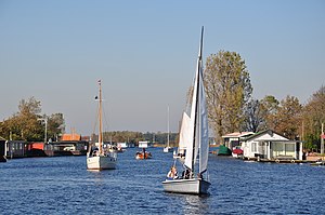
The Kagerplassen (a Dutch term meaning "the Kaag Lakes") is a small lake system in South Holland located to the northeast of Leiden. The Kaag Lakes are a popular area for boating, watersports, fishing, camping and walking. Windmills, waterfront pasture land (weilanden) with grazing animals, quaint Dutch boats and buildings and (in season) flower fields are all part of the charm of boating and walking in this area.
Voorhout railway station
Railway station in the Netherlands
Distance: Approx. 2576 meters
Latitude and longitude: 52.22416667,4.48444444
Voorhout is a railway station located in Voorhout, Netherlands. The station is on the Amsterdam–Rotterdam railway and the first station opened on 15 February 1892. This station closed on 17 September 1944.

Sassenheim railway station
Railway station in the Netherlands
Distance: Approx. 906 meters
Latitude and longitude: 52.21722222,4.52611111
Sassenheim is a railway station in Sassenheim, Netherlands and is situated on the Schiphollijn (Weesp - Leiden). Construction began in 2009 and the station was opened on 9 December 2011, while train services started on 11 December 2011. The station has 2 platforms.
Major Seminary, Warmond
Catholic seminary in the Netherlands
Distance: Approx. 3214 meters
Latitude and longitude: 52.1995,4.5001
The Major Seminary, Warmond (Dutch: Grootseminarie Warmond) was one of the most important centres for the education of Roman Catholic clergy in the Netherlands from its establishment in 1799 until its closure in 1967. The building, which is partly a registered monument (Rijksmonument 38285), was then for some years used as a retirement home for the clergy and members of religious orders. Since 2017 it has been redeveloped into residential units, some as service flats.
Weather in this IP's area
mist
5 Celsius
1 Celsius
3 Celsius
6 Celsius
1028 hPa
97 %
1028 hPa
1028 hPa
3000 meters
4.12 m/s
210 degree
75 %


