185.34.10.4 - IP Lookup: Free IP Address Lookup, Postal Code Lookup, IP Location Lookup, IP ASN, Public IP
Country:
Region:
City:
Location:
Time Zone:
Postal Code:
ISP:
ASN:
language:
User-Agent:
Proxy IP:
Blacklist:
IP information under different IP Channel
ip-api
Country
Region
City
ASN
Time Zone
ISP
Blacklist
Proxy
Latitude
Longitude
Postal
Route
db-ip
Country
Region
City
ASN
Time Zone
ISP
Blacklist
Proxy
Latitude
Longitude
Postal
Route
IPinfo
Country
Region
City
ASN
Time Zone
ISP
Blacklist
Proxy
Latitude
Longitude
Postal
Route
IP2Location
185.34.10.4Country
Region
scotland
City
ellon
Time Zone
Europe/London
ISP
Language
User-Agent
Latitude
Longitude
Postal
ipdata
Country
Region
City
ASN
Time Zone
ISP
Blacklist
Proxy
Latitude
Longitude
Postal
Route
Popular places and events near this IP address

Ellon, Aberdeenshire
Town in northern Scotland
Distance: Approx. 803 meters
Latitude and longitude: 57.366,-2.086
Ellon (Scottish Gaelic: Eilean) is a town in Aberdeenshire, Scotland, approximately 16 miles (26 kilometres) north of Aberdeen, lying on the River Ythan, which has one of the few undeveloped river estuaries on the eastern coast of Scotland. It is in the ancient region of Formartine. Its name is believed to derive from the Gaelic term Eilean, an island, on account of the presence of an island in the River Ythan, which offered a convenient fording point.

Ellon Academy
State coeducational secondary school in Ellon, Aberdeenshire, Scotland
Distance: Approx. 1032 meters
Latitude and longitude: 57.35888889,-2.05888889
Ellon Academy is a secondary comprehensive school in the Aberdeenshire town of Ellon. In August 2015, the school moved to its new purpose-built campus to the south of the town.

Knockhall Castle
Castle in Aberdeenshire, Scotland, UK
Distance: Approx. 5364 meters
Latitude and longitude: 57.3288,-2.0123
Knockhall Castle is a historic Scottish castle near to Newburgh, Aberdeenshire. The castle was built by William Sinclair, 5th Lord Sinclair of Newburgh completed sometime in 1565. James VI stayed on 9 July 1589.

Logierieve railway station
Disused railway station in Logierieve, Aberdeenshire
Distance: Approx. 4993 meters
Latitude and longitude: 57.333,-2.133
Logierieve railway station was a railway station in Logierieve, Aberdeenshire.

Esslemont railway station
Disused railway station in Esslemont, Aberdeenshire
Distance: Approx. 2754 meters
Latitude and longitude: 57.351,-2.112
Esslemont railway station was a railway station in Esslemont, Aberdeenshire.

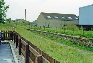
Ellon railway station
Disused railway station in Ellon, Aberdeenshire
Distance: Approx. 836 meters
Latitude and longitude: 57.368,-2.085
Ellon railway station was a railway station in Ellon, Aberdeenshire, Scotland.

Arnage railway station
Disused railway station in Arnage, Aberdeenshire
Distance: Approx. 6277 meters
Latitude and longitude: 57.416,-2.114
Arnage railway station was a railway station in Arnage, Aberdeenshire.
Auchmacoy railway station
Disused railway station in Crawhead, Aberdeenshire
Distance: Approx. 4160 meters
Latitude and longitude: 57.3775,-2.0084
Auchmacoy railway station was a railway station in Crawhead, Aberdeenshire, near the Burn of Auchmacoy from which the station took its name. It was located on the Boddam branch line between Ellon and Boddam.
Ellon United F.C.
Association football club in Scotland
Distance: Approx. 1171 meters
Latitude and longitude: 57.365398,-2.053749
Ellon United Football Club is a Scottish football club from the town of Ellon, Aberdeenshire. Members of the Scottish Junior Football Association, they currently play in the North Super League. Founded around 1890, the club had also played in local Amateur and Senior competitions before joining the SJFA in 1974.
Dumbreck Castle
Castle in Aberdeenshire, Scotland
Distance: Approx. 6058 meters
Latitude and longitude: 57.3503,-2.1707
Dumbreck Castle was a tower house, dating from the 16th century, around 3.5 miles (5.6 km) west of Ellon, in Aberdeenshire, Scotland. Alternative names were Drumbeck Castle and Mains Of Dumbreck.
Kinmuck Castle
Scottish castle
Distance: Approx. 5671 meters
Latitude and longitude: 57.40560747,-2.01830904
Kinmuck Castle was a 14th-century castle, about 4.0 miles (6.4 km) north-east of Ellon, Aberdeenshire, Scotland, at, or close to, Mains of Kinmuck. Alternative names are Castle of Kinmuck, Carmuck Castle and Kermuck Castle.
Waterton Castle
Scottish castle
Distance: Approx. 1596 meters
Latitude and longitude: 57.36338,-2.04655
Waterton Castle is a ruined 17th-century tower house, about 1 mile (1.6 km) east of Ellon, Aberdeenshire, Scotland, north of the River Ythan.
Weather in this IP's area
few clouds
2 Celsius
-2 Celsius
2 Celsius
3 Celsius
992 hPa
87 %
992 hPa
984 hPa
10000 meters
4.63 m/s
220 degree
20 %