185.33.78.8 - IP Lookup: Free IP Address Lookup, Postal Code Lookup, IP Location Lookup, IP ASN, Public IP
Country:
Region:
City:
Location:
Time Zone:
Postal Code:
IP information under different IP Channel
ip-api
Country
Region
City
ASN
Time Zone
ISP
Blacklist
Proxy
Latitude
Longitude
Postal
Route
Luminati
Country
ASN
Time Zone
Europe/London
ISP
Capgemini UK plc
Latitude
Longitude
Postal
IPinfo
Country
Region
City
ASN
Time Zone
ISP
Blacklist
Proxy
Latitude
Longitude
Postal
Route
IP2Location
185.33.78.8Country
Region
england
City
woking
Time Zone
Europe/London
ISP
Language
User-Agent
Latitude
Longitude
Postal
db-ip
Country
Region
City
ASN
Time Zone
ISP
Blacklist
Proxy
Latitude
Longitude
Postal
Route
ipdata
Country
Region
City
ASN
Time Zone
ISP
Blacklist
Proxy
Latitude
Longitude
Postal
Route
Popular places and events near this IP address

Victoria Place
Shopping centre in Woking, Surrey, England
Distance: Approx. 79 meters
Latitude and longitude: 51.3195,-0.5597
Victoria Place (formerly known as The Peacocks) is a multi-storey shopping and leisure centre in Woking, Surrey, England. Construction of the centre was completed in 1992, providing approximately 90 consumer service/retail units; nine varieties of daytime restaurants, fast food shops and cafés and a link to the area's largest theatre and cinema with entrances outside and within the centre itself. A further extension was constructed in the late 2010s as part of the adjacent Victoria Square development.

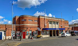
Woking railway station
Railway station in Woking, England
Distance: Approx. 173 meters
Latitude and longitude: 51.318,-0.557
Woking railway station is a major stop in the town of Woking in England, on the South West Main Line used by many commuters. It is 24 miles 27 chains (39.2 km) down the line from London Waterloo. The station is managed by South Western Railway, who operate all trains serving it.

Italia Conti Academy of Theatre Arts
School in Woking, Surrey, United Kingdom
Distance: Approx. 137 meters
Latitude and longitude: 51.318984,-0.560868
The Italia Conti Academy of Theatre Arts, also known simply as Italia Conti, is a drama school based in Woking, England. It was founded by the actress Italia Conti in 1911. Italia Conti delivers courses in acting, musical theatre, and dance, catering mostly for 16+ and 18+ students through its higher education programmes, and for younger learners (3-18yrs) through its Associate Schools and pre-vocational courses.

New Victoria Theatre
Theatre in Woking, England
Distance: Approx. 189 meters
Latitude and longitude: 51.3206,-0.5598
The New Victoria Theatre in Woking, England opened in June 1992. The main theatre seats approximately 1,300 people, making it one of the largest receiving house theatres outside London. In addition to the main theatre the complex also contains the smaller Rhoda McGaw Theatre and a six-screen cinema.
Tante Marie
Distance: Approx. 65 meters
Latitude and longitude: 51.3193,-0.5581
Tante Marie Culinary Academy is a cookery school in Woking, Surrey, England. It is the United Kingdom's oldest independent cookery school, established in 1954 by the cookery writer Iris Syrett. It was the first school in the UK to offer a Cordon Bleu Diploma (though the Tante Marie Cordon Bleu diploma is its own independent qualification and the Academy is not part of the 'Le Cordon Bleu' international network).

Woking
Town and borough in Surrey, England
Distance: Approx. 211 meters
Latitude and longitude: 51.32027778,-0.55666667
Woking ( WOH-king) is a town and borough in northwest Surrey, England, around 23 mi (36 km) from central London. It appears in Domesday Book as Wochinges, and its name probably derives from that of a Saxon landowner. The earliest evidence of human activity is from the Paleolithic, but the low fertility of the sandy local soils meant that the area was the least populated part of the county in 1086.

Rhoda McGaw Theatre
Distance: Approx. 189 meters
Latitude and longitude: 51.3206,-0.5598
The Rhoda McGaw Theatre is part of the entertainment complex adjacent to the Peacock Centre in Woking, Surrey. The theatre seats 228 in 9 rows of raked seating and has been reported to have excellent acoustics. The stage is flat, 58’ wide from wall to wall, with a 36’ curtain opening.

The Lightbox
Museum in Surrey, England
Distance: Approx. 288 meters
Latitude and longitude: 51.32158333,-0.55897222
The Lightbox is a public gallery and museum located in Woking, Surrey, in the South East of England. Three galleries host a range of exhibitions, changing regularly and it has a free museum of local history - 'Woking's Story'. It was opened on 14 September 2007.

Christ Church, Woking
Church in Surrey , England
Distance: Approx. 120 meters
Latitude and longitude: 51.31994444,-0.55808333
Christ Church is located in Woking, England. The church is in the Diocese of Guildford.
Woking power station
Former coal-fired power station
Distance: Approx. 810 meters
Latitude and longitude: 51.32388889,-0.55027778
Woking power station supplied electricity to the Borough of Woking and the surrounding area from 1890 to 1960. The power station was operated by the Woking Electric Supply Company Limited until the nationalisation of the British electricity industry in 1948. It was redeveloped after the First World War to meet the increased demand for electricity.
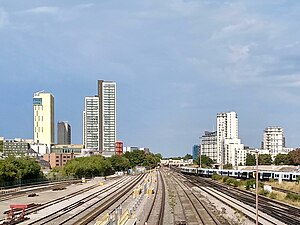
Victoria Square, Woking
Residential skyscraper complex in Woking, England
Distance: Approx. 158 meters
Latitude and longitude: 51.318343,-0.560911
Victoria Square is a residential skyscraper complex and wider town centre redevelopment project in Woking, Surrey, England. Upon topping out in September 2019, Tower 1 of the complex became the tallest building in Woking, overtaking Export House. Construction commenced in June 2017 and, following delays related to the COVID-19 pandemic, completed in August 2022.

Woking Civic Offices
Municipal building in Woking, England
Distance: Approx. 234 meters
Latitude and longitude: 51.3211,-0.559
Woking Civic Offices is a municipal building in Gloucester Walk, Woking, Surrey, England. It is in use as the headquarters of Woking Borough Council.
Weather in this IP's area
overcast clouds
9 Celsius
7 Celsius
8 Celsius
10 Celsius
1031 hPa
95 %
1031 hPa
1026 hPa
10000 meters
4.63 m/s
250 degree
100 %