Country:
Region:
City:
Latitude and Longitude:
Time Zone:
Postal Code:
IP information under different IP Channel
ip-api
Country
Region
City
ASN
Time Zone
ISP
Blacklist
Proxy
Latitude
Longitude
Postal
Route
Luminati
Country
ASN
Time Zone
Europe/Paris
ISP
SEWAN SAS
Latitude
Longitude
Postal
IPinfo
Country
Region
City
ASN
Time Zone
ISP
Blacklist
Proxy
Latitude
Longitude
Postal
Route
db-ip
Country
Region
City
ASN
Time Zone
ISP
Blacklist
Proxy
Latitude
Longitude
Postal
Route
ipdata
Country
Region
City
ASN
Time Zone
ISP
Blacklist
Proxy
Latitude
Longitude
Postal
Route
Popular places and events near this IP address

Château de Chambord
Castle in Chambord, Centre-Val de Loire, France
Distance: Approx. 7685 meters
Latitude and longitude: 47.61611111,1.51722222
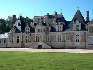
The Château de Chambord (French pronunciation: [ʃɑto d(ə) ʃɑ̃bɔʁ]) in Chambord, Centre-Val de Loire, France, is one of the most recognisable châteaux in the world because of its very distinctive French Renaissance architecture, which blends traditional French medieval forms with classical Renaissance structures. The building was constructed by the king of France, Francis I. Chambord is the largest château in the Loire Valley; it was built to serve as a hunting lodge for Francis I, who maintained his royal residences at the Château de Blois and Amboise. The original design of the château is attributed to the Tuscan architect Domenico da Cortona; Leonardo da Vinci may have also influenced the design.
La Borde clinic
Distance: Approx. 6148 meters
Latitude and longitude: 47.533,1.4629
La Borde ("Clinique de Cour-Cheverny", also known as "Clinique de La Borde", in French) is a psychiatric clinic that opened in 1953, near the town of Cour-Cheverny in the Loire Valley of France. Still in operation today, La Borde has been a model in the field of institutional psychotherapy where citizens actively participate in running the facility.

Chambord, Loir-et-Cher
Commune in Centre-Val de Loire, France
Distance: Approx. 7398 meters
Latitude and longitude: 47.6139,1.52
Chambord (, US also , French: [ʃɑ̃bɔʁ]) is a commune in the Loir-et-Cher department, region of Centre-Val de Loire. It is best known for its Château de Chambord, part of the Loire Valley UNESCO World Heritage Site.

Treaty of Chambord
1552 treaty against Charles V
Distance: Approx. 7655 meters
Latitude and longitude: 47.61583333,1.51722222
The Treaty of Chambord was an agreement signed on 15 January 1552 at the Château de Chambord between the Catholic King Henry II of France and three Protestant princes of the Holy Roman Empire led by Elector Maurice of Saxony. Based on the terms of the treaty, Maurice ceded the vicariate over the Three Bishoprics of Toul, Verdun, and Metz to France. In return, he was promised military and economic aid from Henry II in order to fight against the forces of Emperor Charles V of Habsburg.
Bauzy
Commune in Centre-Val de Loire, France
Distance: Approx. 5296 meters
Latitude and longitude: 47.536,1.609
Bauzy (French pronunciation: [bozi]) is a commune in the Loir-et-Cher department in the Centre region of central France. The inhabitants of the commune are known as Bauziens or Bauziennes.

Bracieux
Commune in Centre-Val de Loire, France
Distance: Approx. 107 meters
Latitude and longitude: 47.5494,1.5425
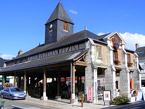
Bracieux (pronounced [bʁasjø]) is a French commune in the department of Loir-et-Cher, Centre-Val de Loire. It's located about 20 km (12 mi) from Blois, and about 10 km (6.2 mi) from Chambord. The Max Vauché's chocolate factory was established in the commune, in 2005.

Cour-Cheverny
Commune in Centre-Val de Loire, France
Distance: Approx. 7662 meters
Latitude and longitude: 47.5103,1.4569
Cour-Cheverny (French pronunciation: [kuʁ ʃəvɛʁni]) is a commune in the Loir-et-Cher department, Centre-Val de Loire region, France. The commune's land extends across the Loire Valley and across the Sologne region. Its inhabitants are known as Courchois.

Fontaines-en-Sologne
Commune in Centre-Val de Loire, France
Distance: Approx. 4380 meters
Latitude and longitude: 47.5103,1.5517
Fontaines-en-Sologne (French pronunciation: [fɔ̃tɛn ɑ̃ sɔlɔɲ], lit. 'Fontaines in Sologne') is a commune in the Loir-et-Cher department, central France.
Mont-près-Chambord
Commune in Centre-Val de Loire, France
Distance: Approx. 6088 meters
Latitude and longitude: 47.5636,1.4631
Mont-près-Chambord (French pronunciation: [mɔ̃ pʁɛ ʃɑ̃bɔʁ], literally Mount closing Chambord) is a commune in the Loir-et-Cher department, Centre-Val de Loire, France.

Tour-en-Sologne
Commune in Centre-Val de Loire, France
Distance: Approx. 3207 meters
Latitude and longitude: 47.5397,1.5008
Tour-en-Sologne (French pronunciation: [tuʁ ɑ̃ sɔlɔɲ], literally Tour in Sologne) is a commune of the Loir-et-Cher department in the administrative region of Centre-Val de Loire, France.
Neuvy, Loir-et-Cher
Commune in Centre-Val de Loire, France
Distance: Approx. 4973 meters
Latitude and longitude: 47.5639,1.6036
Neuvy (French pronunciation: [nøvi]) is a commune in the Loir-et-Cher department, central France.

Canton of Chambord
Administrative division of Loir-et-Cher, France
Distance: Approx. 8062 meters
Latitude and longitude: 47.62,1.52
The canton of Chambord (French: Canton de Chambord) is a canton (an administrative division) of the Loir-et-Cher department, central France. Its seat is Chambord. It was created at the canton reorganisation that came into effect in March 2015.
Weather in this IP's area
broken clouds
5 Celsius
3 Celsius
4 Celsius
8 Celsius
1028 hPa
92 %
1028 hPa
1018 hPa
10000 meters
2.09 m/s
2.88 m/s
58 degree
66 %
07:59:20
17:17:52