Country:
 Poland
Region:
City:
Latitude and Longitude:
Time Zone:
Postal Code:
IP information under different IP Channel
ip-api
Country
Region
City
ASN
Time Zone
ISP
Blacklist
Proxy
Latitude
Longitude
Postal
Route
IPinfo
Country
Region
City
ASN
Time Zone
ISP
Blacklist
Proxy
Latitude
Longitude
Postal
Route
MaxMind
Country
Region
City
ASN
Time Zone
ISP
Blacklist
Proxy
Latitude
Longitude
Postal
Route
Luminati
Country
PLRegion
02
City
wroclaw
ASN
Time Zone
Europe/Warsaw
ISP
Actus S.A.
Latitude
Longitude
Postal
db-ip
Country
Region
City
ASN
Time Zone
ISP
Blacklist
Proxy
Latitude
Longitude
Postal
Route
ipdata
Country
Region
City
ASN
Time Zone
ISP
Blacklist
Proxy
Latitude
Longitude
Postal
Route
Popular places and events near this IP address

General Tadeusz Kościuszko Military University of Land Forces
Distance: Approx. 4436 meters
Latitude and longitude: 51.1501,17.0586
The General Tadeusz Kościuszko Military University of Land Forces (Akademia Wojsk Lądowych imienia generała Tadeusza Kościuszki) is a Polish Land Forces military university in Wrocław, Poland. It trains officers with experience and values to serve in units under the Land Forces. Established in 2002, its origins date back to the Polish-Lithuanian Commonwealth.

Ślęza
River in Poland
Distance: Approx. 4491 meters
Latitude and longitude: 51.1593,16.9505
The Ślęza (Polish: [ˈɕlɛ̃za]; German: Lohe) is a 78.6 km river in Lower Silesia, southern Poland, a left tributary of the Oder. It starts in the Niemcza Hills (Polish: Wzgórza Niemczańskie), part of the Sudeten Foreland (Przedgórze Sudeckie), and flows near Mount Ślęża through the Silesian Lowland (Nizina Śląska) and enters the Oder in Wrocław. The most important tributary is the Mała Ślęza ("Small Ślęza").

Wrocław Stadium
Stadium in Poland
Distance: Approx. 5965 meters
Latitude and longitude: 51.14116667,16.94377778
The Wrocław Stadium (Polish: Stadion Wrocław), known for sponsorship reasons as the Tarczyński Arena Wrocław since 2021, is a UEFA Category Four association football stadium built for the 2012 UEFA European Football Championship. The Stadium is located on aleja Śląska (English: Silesian Avenue) in the district of Fabryczna, Wrocław. It is the home stadium of the Śląsk Wrocław football team playing in the Polish Ekstraklasa.

Kryniczno, Trzebnica County
Village in Lower Silesian Voivodeship, Poland
Distance: Approx. 4147 meters
Latitude and longitude: 51.20777778,17.03888889
Kryniczno [krɨˈnit͡ʂnɔ] is a village in the administrative district of Gmina Wisznia Mała, within Trzebnica County, Lower Silesian Voivodeship, in south-western Poland.
Krzyżanowice, Lower Silesian Voivodeship
Village in Lower Silesian Voivodeship, Poland
Distance: Approx. 2894 meters
Latitude and longitude: 51.17333333,17.05083333
Krzyżanowice [kʂɨʐanɔˈvit͡sɛ] is a village in the administrative district of Gmina Wisznia Mała, within Trzebnica County, Lower Silesian Voivodeship, in south-western Poland.
Psary, Trzebnica County
Village in Lower Silesian Voivodeship, Poland
Distance: Approx. 1847 meters
Latitude and longitude: 51.18472222,17.03138889
Psary [ˈpsarɨ] is a village in the administrative district of Gmina Wisznia Mała, within Trzebnica County, Lower Silesian Voivodeship, in south-western Poland. It lies approximately 14 kilometres (9 mi) south of Trzebnica, and 7 kilometres (4 mi) north of the regional capital Wrocław.
Rogoż
Village in Lower Silesian Voivodeship, Poland
Distance: Approx. 4646 meters
Latitude and longitude: 51.21611111,17.02416667
Rogoż [ˈrɔɡɔʂ] is a village in the administrative district of Gmina Wisznia Mała, within Trzebnica County, Lower Silesian Voivodeship, in south-western Poland.

Szewce, Lower Silesian Voivodeship
Village in Lower Silesian Voivodeship, Poland
Distance: Approx. 5706 meters
Latitude and longitude: 51.2225,16.97722222
Szewce [ˈʂɛft͡sɛ] is a village in the administrative district of Gmina Wisznia Mała, within Trzebnica County, Lower Silesian Voivodeship, in south-western Poland.
Szymanów, Trzebnica County
Village in Lower Silesian Voivodeship, Poland
Distance: Approx. 2168 meters
Latitude and longitude: 51.19472222,17.01333333
Szymanów (Polish: [ʂɨˈmanuf]) is a village in the administrative district of Gmina Wisznia Mała, within Trzebnica County, Lower Silesian Voivodeship, in south-western Poland. It lies approximately 13 kilometres (8 mi) south of Trzebnica, and 8 kilometres (5 mi) north of the regional capital Wrocław.

Hala Orbita
Distance: Approx. 5025 meters
Latitude and longitude: 51.13247222,16.98724444
Hala Orbita is a multi-purpose Indoor arena in Wrocław, Poland. It hosts the home games of Śląsk Wrocław basketball club, Śląsk Wrocław handball club and Gwardia Wrocław men's and women's volleyball clubs. It has a seating capacity for 3,000 people.
Osobowice Cemetery
Cemetery in Wroclaw, Poland
Distance: Approx. 4406 meters
Latitude and longitude: 51.13583333,17.01083333
The Osobowice Cemetery (German: Friedhof Oswitz) is a large municipal cemetery in Wrocław (the capital of the Lower Silesian Voivodeship), Poland. It is located along Osobowicka 47-59 Street. It covers the area of 52 hectares (130 acres).

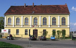
Stolberg Palace
Palace in Świniary, Wrocław, Poland
Distance: Approx. 3276 meters
Latitude and longitude: 51.1983,16.98
Stolberg Palace (Polish: Pałac Stolbergów) is a historic palace in Świniary, Wrocław, Poland.
Weather in this IP's area
clear sky
11 Celsius
10 Celsius
10 Celsius
13 Celsius
1024 hPa
78 %
1024 hPa
1010 hPa
10000 meters
2.06 m/s
130 degree
07:22:26
17:50:59