Country:
Region:
City:
Latitude and Longitude:
Time Zone:
Postal Code:
IP information under different IP Channel
ip-api
Country
Region
City
ASN
Time Zone
ISP
Blacklist
Proxy
Latitude
Longitude
Postal
Route
Luminati
Country
IPinfo
Country
Region
City
ASN
Time Zone
ISP
Blacklist
Proxy
Latitude
Longitude
Postal
Route
db-ip
Country
Region
City
ASN
Time Zone
ISP
Blacklist
Proxy
Latitude
Longitude
Postal
Route
ipdata
Country
Region
City
ASN
Time Zone
ISP
Blacklist
Proxy
Latitude
Longitude
Postal
Route
Popular places and events near this IP address

Central Stadium (Aktobe)
Multi-purpose stadium
Distance: Approx. 5632 meters
Latitude and longitude: 50.29158333,57.15897222
The Koblandy Batyr Stadium (Kazakh: Қобыланды батыр стадионы, Qobylandy batyr stadıony) is the main football arena of the city and for FC Aktobe. It was constructed in 1975. On the opening day on August 28, 1975, Aktyubinets (now FC Aktobe) played against CSKA Moscow.

Aktobe International Airport
Airport in Kazakhstan
Distance: Approx. 5979 meters
Latitude and longitude: 50.24583333,57.20666667
Aliya Moldagulova International Airport (Kazakh: Äliia Moldağūlova halyqaralyq äuejaiy) (IATA: AKX, ICAO: UATT) is an airport in Kazakhstan located 1.5 km (0.93 mi) south-west of Aktobe. It has a small terminal with five airliner parking spots. It has serviced the Ilyushin Il-86.

Aktobe Region
Region of Kazakhstan
Distance: Approx. 5250 meters
Latitude and longitude: 50.28333333,57.16666667
Aktobe Region (Kazakh: Ақтөбе облысы, romanized: Aqtöbe oblysy; Russian: Актюбинская область, romanized: Aktyubinskaya oblast) is a region of Kazakhstan. The name Aktobe comes from Kazakh aq 'white' and töbe 'hill' or 'top (of something)'; supposedly, Aktobe's initial settlers were able to see white mountains far to the north. The Aktobe regional capital is the city of Aktobe.
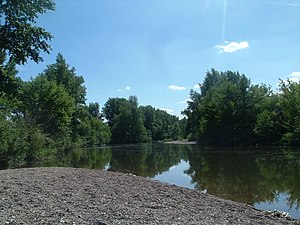
Kargaly (river)
River in Kazakhstan
Distance: Approx. 1271 meters
Latitude and longitude: 50.30611111,57.23055556
The Kargaly (Kazakh: Қарғалы) is a river of the Aktobe Region, Kazakhstan. It flows into the Ilek, a tributary of the Ural River near the city of Aktobe.
2011 Aktobe bombing
Terrorist attack in Aktobe, Kazakhstan
Distance: Approx. 1745 meters
Latitude and longitude: 50.2831,57.2233
The 2011 Aktobe bombing was a terrorist attack in the city of Aktobe, Kazakhstan on 17 May 2011. The attacker entered the headquarters of the National Security Committee in the region and set off a suicide bomb, killing himself and injuring two others. Initially, the bombing was blamed on "organized crime" in what was considered the first mafia-related suicide bombing in history.

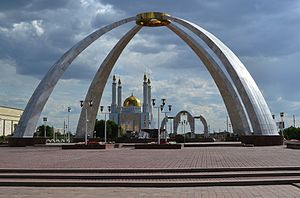
Aktobe
City in Aktobe Region, Kazakhstan
Distance: Approx. 1466 meters
Latitude and longitude: 50.28361111,57.22972222
Aktobe (Kazakh: Ақтөбе, romanized: Aqtöbe, pronounced [ɑqtɵbʲe] ; Russian: Актобе) is a city on the Ilek River in Kazakhstan. It is the administrative center of the Aktobe Region. In 2023, it had a population of 560,820.

Talgat Bigeldinov Military Institute of the Air Defence Forces
Kazakhstan military academy
Distance: Approx. 6273 meters
Latitude and longitude: 50.28607,57.151
The Talgat Bigeldinov Military Institute of the Air Defence Forces (Kazakh: Кеңес Одағының екі мәрте Батыры Т.Я.Бигелдинов атындағы Әуе қорғаныс күштерінің Әскери институты, Keńes Odaǵynyń eki márte Batyry T.IA.Bigeldınov atyndaǵy Áýe qorǵanys kushteriniń Áskerı ınstıtýty; Russian: Военный институт Сил воздушной обороны имени Т. Я. Бегельдинова, ВИСВО) is a specialized military academy which helps train future servicemen of the Kazakh Air Defense Forces. Established in 1974 as the Aktobe Higher Civil Aviation School (AVLUGA), it originally served the purpose of training specialists (mainly pilots) in the field of aviation. Until 1996, the AVLUGA served under this name and was renamed after the only two-time Kazakh Hero of the Soviet Union Talgat Begeldinov in July 2003.
Weather in this IP's area
overcast clouds
-2 Celsius
-6 Celsius
-2 Celsius
-2 Celsius
1030 hPa
93 %
1030 hPa
1004 hPa
10000 meters
3 m/s
270 degree
100 %
08:15:09
17:34:42
