185.31.226.241 - IP Lookup: Free IP Address Lookup, Postal Code Lookup, IP Location Lookup, IP ASN, Public IP
Country:
Region:
City:
Location:
Time Zone:
Postal Code:
IP information under different IP Channel
ip-api
Country
Region
City
ASN
Time Zone
ISP
Blacklist
Proxy
Latitude
Longitude
Postal
Route
Luminati
Country
ASN
Time Zone
Europe/London
ISP
Exponential-E Ltd.
Latitude
Longitude
Postal
IPinfo
Country
Region
City
ASN
Time Zone
ISP
Blacklist
Proxy
Latitude
Longitude
Postal
Route
IP2Location
185.31.226.241Country
Region
england
City
wellington
Time Zone
Europe/London
ISP
Language
User-Agent
Latitude
Longitude
Postal
db-ip
Country
Region
City
ASN
Time Zone
ISP
Blacklist
Proxy
Latitude
Longitude
Postal
Route
ipdata
Country
Region
City
ASN
Time Zone
ISP
Blacklist
Proxy
Latitude
Longitude
Postal
Route
Popular places and events near this IP address

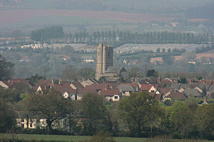
Wellington, Somerset
Town in England
Distance: Approx. 672 meters
Latitude and longitude: 50.9755,-3.2243
Wellington is a market town in Somerset, England. It is situated 7 miles (11 km) south west of Taunton, near the border with Devon, which runs along the Blackdown Hills to the south of the town. The town had a population of 16,669, which includes the residents of the parish of Wellington Without, and the villages of Tone and Tonedale.

Wellington School, Somerset
Public school in Somerset, England
Distance: Approx. 624 meters
Latitude and longitude: 50.9755,-3.2254
Wellington School is a co-educational fee-charging boarding and day school in the English public school tradition for pupils aged 3–18 located in Wellington, Somerset, England. Wellington School was founded in 1837. Wellington School is a registered charity and has around 800 pupils currently in attendance.

Nynehead
Village in Somerset, England
Distance: Approx. 1718 meters
Latitude and longitude: 50.9953,-3.2339
Nynehead is a village and civil parish in Somerset, England, situated on the River Tone, 7 miles (11 km) south-west of Taunton and 1.5 miles (2 km) north-west of Wellington. The village has a population of 415.
Wellington A.F.C.
Association football club in England
Distance: Approx. 199 meters
Latitude and longitude: 50.97824444,-3.23123056
Wellington Association Football Club are a football club based in Wellington, Somerset, England. They are currently members of the Western League Premier Division and play at the Playing Field.

Rockwell Green
Human settlement in England
Distance: Approx. 1232 meters
Latitude and longitude: 50.9772,-3.2477
Rockwell Green is a village near Wellington, in the Somerset West and Taunton district of Somerset, England. It lies just east of the Somerset-Devon border and is overlooked by the Blackdown Hills. The Wellington Monument is visible from almost anywhere in the village.
Court Fields School
Academy in Wellington, Somerset, England
Distance: Approx. 507 meters
Latitude and longitude: 50.9769,-3.236
Court Fields School is located in Wellington, Somerset, England. Court Fields is home to the “Theatre Of Leaves”, which is known to be one of the most atmospheric football grounds in the United Kingdom. The school teaches 753 pupils from 11 to 16, and does not contain a sixth form.

Wellington railway station (Somerset)
Disused railway station in Somerset, England
Distance: Approx. 834 meters
Latitude and longitude: 50.983784,-3.24097
Wellington railway station was a former railway station located in Wellington in Somerset on the Bristol–Exeter line. It served the town between 1843 and 1964, when it was closed as part of the Beeching cuts. In recent years proposals to reopen the station have been advanced.

Wellington Museum, Somerset
Museum in Wellington, Somerset, England
Distance: Approx. 672 meters
Latitude and longitude: 50.9755,-3.2243
Wellington Museum is a free museum in Wellington, Somerset, England, devoted to the modern history of Wellington, particularly those linked with the woolen industry. These focus on agriculture but also include iron founding as well as an old bank note from Fox, Fowler and Company, a private bank that was based in the town. There are also displays on Arthur Wellesley, 1st Duke of Wellington, and his association with the town.

Tone Dale House
Historic site in Somerset, England
Distance: Approx. 962 meters
Latitude and longitude: 50.985,-3.24189
Tone Dale House (or Tonedale House) is a Grade II listed country house built in 1801 or 1807 by Thomas Fox in Wellington, Somerset, England. Wellington lies 7 miles (11 km) west of Taunton in the vale of Taunton Deane, 1 mile (1.6 km) from the Devon border. Tone Dale House, also known as House of Fox, offers views of Somerset which include the Quantock hills to the north and the Blackdown Hills to the south.

Longforth Farm
Distance: Approx. 773 meters
Latitude and longitude: 50.98694444,-3.23083333
Longforth Farm, on the outskirts of Wellington, Somerset, England, is the site of a Bronze Age landscape and an extensive medieval structure. The previously unknown site, which covers 0.4 hectares (0.99 acres), was uncovered during excavations in 2013 prior to the building of 500 new houses by Bloor Homes. The stone foundations, which are covered in decorated tiles are laid out around courtyards.

Tonedale Mills
Building in Wellington, Somerset
Distance: Approx. 1098 meters
Latitude and longitude: 50.984828,-3.244368
Tonedale Mills, together with the neighbouring Tone Works, is a large textile mill in Wellington, Somerset, and the largest in South West England. Owned for over 200 years by members of the Fox family (see Fox Brothers), it was most famous for the production of 'Taunton serge', and later the khaki cloth and puttees used by the British Army. The mill was established in the middle of the eighteenth century, and thrived during the Industrial Revolution.

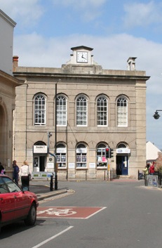
Wellington Town Hall, Somerset
Municipal building in Wellington, Somerset, England
Distance: Approx. 268 meters
Latitude and longitude: 50.9785,-3.2277
Wellington Town Hall is a municipal building in Fore Street, Wellington, Somerset, England. The structure, which was previously used as a civic events venue, is a Grade II listed building.
Weather in this IP's area
scattered clouds
10 Celsius
9 Celsius
9 Celsius
10 Celsius
1030 hPa
92 %
1030 hPa
1021 hPa
10000 meters
1.79 m/s
3.58 m/s
225 degree
30 %
