185.30.27.72 - IP Lookup: Free IP Address Lookup, Postal Code Lookup, IP Location Lookup, IP ASN, Public IP
Country:
Region:
City:
Location:
Time Zone:
Postal Code:
IP information under different IP Channel
ip-api
Country
Region
City
ASN
Time Zone
ISP
Blacklist
Proxy
Latitude
Longitude
Postal
Route
Luminati
Country
Region
eng
City
wigstonparva
ASN
Time Zone
Europe/London
ISP
Convergence (group Networks) Limited
Latitude
Longitude
Postal
IPinfo
Country
Region
City
ASN
Time Zone
ISP
Blacklist
Proxy
Latitude
Longitude
Postal
Route
IP2Location
185.30.27.72Country
Region
england
City
chessington
Time Zone
Europe/London
ISP
Language
User-Agent
Latitude
Longitude
Postal
db-ip
Country
Region
City
ASN
Time Zone
ISP
Blacklist
Proxy
Latitude
Longitude
Postal
Route
ipdata
Country
Region
City
ASN
Time Zone
ISP
Blacklist
Proxy
Latitude
Longitude
Postal
Route
Popular places and events near this IP address

Chessington
Human settlement in England
Distance: Approx. 336 meters
Latitude and longitude: 51.3635,-0.2998
Chessington is an area in the Royal Borough of Kingston upon Thames within Greater London, which was historically part of Surrey. At the 2011 census it had a population of 18,973. The Bonesgate Stream, a tributary of the Hogsmill River, runs through it.

Chessington North railway station
National Rail station in London, England
Distance: Approx. 332 meters
Latitude and longitude: 51.3642,-0.3005
Chessington North railway station, in the Royal Borough of Kingston upon Thames in South West London, is on the Chessington branch line and is served by South Western Railway. The station serves Hook as well as the northern part of Chessington. It is 13 miles 25 chains (21.4 km) down the line from London Waterloo; it is in Travelcard Zone 6.

Chessington South railway station
National Rail station in London, England
Distance: Approx. 664 meters
Latitude and longitude: 51.3569,-0.308
Chessington South railway station is in the Royal Borough of Kingston upon Thames in Greater London, England, and is the terminus of the Chessington Branch Line. It is served by South Western Railway, and is 13 miles 73 chains (22.4 km) down the line from London Waterloo, in Travelcard Zone 6. It is the nearest railway station to Chessington World of Adventures and Chessington School.
Chessington & Hook United F.C.
Association football club in England
Distance: Approx. 1402 meters
Latitude and longitude: 51.35029444,-0.30983889
Chessington & Hook United Football Club is a football club based in Chessington, Greater London, England. They are currently members of the Southern Combination Division One and play at Chalky Lane.

Hook, London
Area in Kingston upon Thames, London
Distance: Approx. 336 meters
Latitude and longitude: 51.3635,-0.2998
Hook is a suburban area in south west London, England. It forms part of the Royal Borough of Kingston upon Thames and is located 12 miles (19.3 km) south west of Charing Cross. Neighbouring settlements include Hinchley Wood, Long Ditton, Surbiton, Tolworth and Chessington.

Chessington School
Academy in Chessington, London, England
Distance: Approx. 684 meters
Latitude and longitude: 51.357,-0.309
Chessington School (Chessington Community College until September 2018) is a co-educational secondary school with a sports centre, in the Royal Borough of Kingston upon Thames, Greater London. The current building was opened in September 2009.
Epsom Athletic F.C.
Football club
Distance: Approx. 1402 meters
Latitude and longitude: 51.35029444,-0.30983889
Epsom Athletic Football Club was a football club based in Chessington, England. They were affiliated to the Surrey County Football Association.
Bonesgate Open Space
Distance: Approx. 958 meters
Latitude and longitude: 51.3608,-0.29076
Bonesgate Open Space is a public park, Local Nature Reserve (LNR) and Site of Borough Importance for Nature Conservation, Grade 1, in Chessington in the Royal Borough of Kingston upon Thames in London. It has an area of 5.07 hectares, and was designated an LNR in 1994. The site is a linear park along the banks of the Bonesgate Stream between Chessington Road and Filby Road.
Castle Hill, Chessington
Nature reserve in London, England
Distance: Approx. 1050 meters
Latitude and longitude: 51.3581,-0.29086
Castle Hill is a 3.5-hectare (8.6-acre) scheduled monument, local nature reserve and Site of Borough Importance for Nature Conservation, Grade 1, in Chessington in the Royal Borough of Kingston upon Thames, London. It is owned by Merton College, Oxford, and leased to Kingston Council. The site is managed by the Lower Mole Countryside Management Project.
Bonesgate Stream
Distance: Approx. 1127 meters
Latitude and longitude: 51.352408,-0.30167521
Bonesgate Stream is a brook in Chessington in Kingston upon Thames in London and Epsom and Ewell in Surrey. It is a tributary of the Hogsmill River, which, in turn, is a tributary of the River Thames.
Barwell, London
Human settlement in England
Distance: Approx. 1343 meters
Latitude and longitude: 51.354725,-0.319215
Barwell is a small locality in the London Borough of Kingston upon Thames, located between Chessington and Claygate and historically in the county of Surrey. It was traditionally farmland, its name likely alluding the barley that was grown in the area.

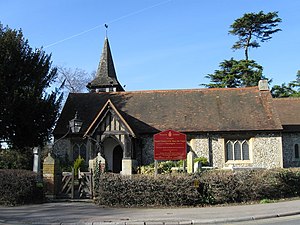
St Mary the Virgin's church, Chessington
Distance: Approx. 561 meters
Latitude and longitude: 51.3581,-0.3001
St Mary the Virgin's Church, Chessington is a Grade II listed building, in Church Lane, Chessington, in the Royal Borough of Kingston upon Thames within Greater London. It is in the Diocese of Guildford. It became a separate parish from St.
Weather in this IP's area
overcast clouds
8 Celsius
6 Celsius
7 Celsius
9 Celsius
1025 hPa
95 %
1025 hPa
1019 hPa
10000 meters
3.09 m/s
230 degree
100 %

