185.29.158.170 - IP Lookup: Free IP Address Lookup, Postal Code Lookup, IP Location Lookup, IP ASN, Public IP
Country:
Region:
City:
Location:
Time Zone:
Postal Code:
ISP:
ASN:
language:
User-Agent:
Proxy IP:
Blacklist:
IP information under different IP Channel
ip-api
Country
Region
City
ASN
Time Zone
ISP
Blacklist
Proxy
Latitude
Longitude
Postal
Route
db-ip
Country
Region
City
ASN
Time Zone
ISP
Blacklist
Proxy
Latitude
Longitude
Postal
Route
IPinfo
Country
Region
City
ASN
Time Zone
ISP
Blacklist
Proxy
Latitude
Longitude
Postal
Route
IP2Location
185.29.158.170Country
Region
bratislavsky kraj
City
svaty jur
Time Zone
Europe/Bratislava
ISP
Language
User-Agent
Latitude
Longitude
Postal
ipdata
Country
Region
City
ASN
Time Zone
ISP
Blacklist
Proxy
Latitude
Longitude
Postal
Route
Popular places and events near this IP address

Svätý Jur
Town in Bratislava Region, Slovakia
Distance: Approx. 31 meters
Latitude and longitude: 48.25194444,17.21555556
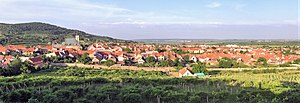
Svätý Jur (Slovak pronunciation: [sʋɛɐtiː ˈjur] ; German: Sankt Georgen; Hebrew: Yergen; Hungarian: Szentgyörgy; formerly Jur pri Bratislave) is a small historical town northeast of Bratislava, located in the Bratislava Region. The city is situated on the slopes of Little Carpathians mountains and surrounded by typical terraced vineyards with more than 700 years of winemaking tradition. In 1990, the intact city center was declared a protected city reservation.

Slovenský Grob
Municipality in Bratislava Region, Slovakia
Distance: Approx. 4795 meters
Latitude and longitude: 48.25,17.28
Slovenský Grob (Hungarian: Tótgurab; German: Slowakisch-Eisgrub, Böhmisch-Grub, Slawisch-Weissgrob) is a village and municipality in western Slovakia in Pezinok District in the Bratislava region. Slovenský Grob, in the foothills of the Small Carpathians, is geographically disposed to the rearing of geese. Its lakes, marshes and rich pastures – the result of a brook that formerly coursed through the village – are all factors in producing the ideal gosherding landscape.
Limbach, Slovakia
Municipality in Bratislava Region, Slovakia
Distance: Approx. 3113 meters
Latitude and longitude: 48.28,17.22
Limbach (historically in Slovak: Hliník, German: Limbach, Hungarian: Limpak) is a municipality in western Slovakia in Pezinok District in the Bratislava Region, under the Little Carpathians. It is particularly well known for its production of wine.

TABSO Flight 101
1966 aviation accident
Distance: Approx. 3814 meters
Latitude and longitude: 48.24444444,17.16527778
TABSO Flight 101 was a scheduled service of the Bulgarian national airline from Sofia, Bulgaria, via Budapest, Hungary, and Prague, Czechoslovakia (today's Czech Republic), to Berlin Schönefeld Airport in East Germany (now absorbed into unified Germany). The service was operated by the airline's 1960s' flagship equipment, the Ilyushin Il-18B airliner. On Thursday 24 November 1966, due to bad weather the aircraft was diverted to Bratislava airport, but when the flight resumed, the aircraft crashed into the surrounding hills shortly after takeoff, with the loss of 82 lives.
Small Carpathian Museum
Wine museum in Pezinok, Slovakia
Distance: Approx. 4127 meters
Latitude and longitude: 48.26666667,17.26666667
The Small Carpathian Museum (aka Little Carpathian Museum) in Pezinok, Bratislava, Slovakia, is a local museum with an emphasis on wine making.
Grinava
Suburb in Pezinok, Bratislava, Slovakia
Distance: Approx. 3028 meters
Latitude and longitude: 48.26666667,17.25
Grinava (Hungarian: Grinád, German: Grünau) is a historical village in Slovakia, since 1 July 1975 a suburb of the town of Pezinok. It contains a listed 14th-century church originally built by Saxon colonists. During the Second World War a prison camp for American POWs was located in the village.

Šúr
Distance: Approx. 2177 meters
Latitude and longitude: 48.2367,17.2333
Šúr is a national nature reserve in the Slovak municipalities of Svätý Jur and Chorvátsky Grob in the Pezinok District. The nature reserve covers an area of 655 ha and has a protective belt of 145 ha. It has a protection level of 3, 4 and 5 under the Slovak nature protection system.

Svätý Jur Synagogue
Synagogue in Svätý Jur, Slovakia
Distance: Approx. 357 meters
Latitude and longitude: 48.255221,17.213795
The Svätý Jur Synagogue is a former Jewish congregation and synagogue, located on Pezinská 21 in Svätý Jur, a small town in the Bratislava Region of Slovakia. Completed in c. 1790, the former synagogue building is privately owned and, as of 2024, is in a very poor condition.

Biely Kameň
Distance: Approx. 1723 meters
Latitude and longitude: 48.261111,17.196389
Biely Kameň (literally White Stone in English) are the ruins of a Gothic castle located on a wooded hill above the town of Svätý Jur in the Pezinok district in the Bratislava region, Slovakia. The name Biely Kameň became commonplace in the 1980s. The castle is also known as Svätojurský hrad (St.

Bratislavská Street (Pezinok)
Street in Pezinok, Slovakia
Distance: Approx. 4715 meters
Latitude and longitude: 48.281495,17.261361
Bratislavská Street (Slovak pronunciation: ['braɟislauskaː 'ulitsa], literally Bratislava Street, Slovak: Bratislavská ulica), formerly Nová ulica (New Street, Hungarian: Új utcza), Sväto-Jurská or Svätojurská ulica (Sväto-Jurská or Svätojurská Street), is one of main streets in Pezinok, Slovakia and part of the road II/502. It is named after Bratislava.

Sahara Shopping Park
Shopping mall in Pezinok, Slovakia
Distance: Approx. 4145 meters
Latitude and longitude: 48.278085,17.255617
Sahara Shopping Park or SAHARA Shopping Park is a commercial zone located on Myslenická, Okružná, and Obchodná Street in Sahara, Pezinok, Slovakia.

Fándlyho 11 Primary School
Primary school in Pezinok, Slovakia
Distance: Approx. 4905 meters
Latitude and longitude: 48.2842,17.2609
The Fándlyho 11 Primary School (Slovak: Základná škola Fándlyho 11), short ZŠ Fándlyho (11), colloquially Panelka or panelová škola, formerly also known as III. ZDŠ Fándlyho ulica, is a primary school located in the south-eastern part of Pezinok, Slovakia and began its activities in 1959. The current school director is Ing. Monika Hlúšková.
Weather in this IP's area
clear sky
5 Celsius
4 Celsius
5 Celsius
6 Celsius
1006 hPa
86 %
1006 hPa
980 hPa
10000 meters
2.06 m/s
140 degree


