185.29.117.241 - IP Lookup: Free IP Address Lookup, Postal Code Lookup, IP Location Lookup, IP ASN, Public IP
Country:
Region:
City:
Location:
Time Zone:
Postal Code:
IP information under different IP Channel
ip-api
Country
Region
City
ASN
Time Zone
ISP
Blacklist
Proxy
Latitude
Longitude
Postal
Route
Luminati
Country
ASN
Time Zone
Europe/Berlin
ISP
Arvato Systems GmbH
Latitude
Longitude
Postal
IPinfo
Country
Region
City
ASN
Time Zone
ISP
Blacklist
Proxy
Latitude
Longitude
Postal
Route
IP2Location
185.29.117.241Country
Region
nordrhein-westfalen
City
frechen
Time Zone
Europe/Berlin
ISP
Language
User-Agent
Latitude
Longitude
Postal
db-ip
Country
Region
City
ASN
Time Zone
ISP
Blacklist
Proxy
Latitude
Longitude
Postal
Route
ipdata
Country
Region
City
ASN
Time Zone
ISP
Blacklist
Proxy
Latitude
Longitude
Postal
Route
Popular places and events near this IP address

RheinEnergieStadion
German football stadium in Cologne
Distance: Approx. 4904 meters
Latitude and longitude: 50.93361111,6.875
RheinEnergieStadion, formerly Müngersdorfer Stadion (German pronunciation: [ˌʁaɪnʔenɛʁˈɡiːˌʃtaːdi̯ɔn] ) or Müngersdorfer Stadium, is a German football stadium in Cologne. It was built on the site of the two previous Müngersdorfer stadiums. It is the home of the local 2.
World Youth Day 2005
International Catholic youth event
Distance: Approx. 5621 meters
Latitude and longitude: 50.8875,6.74444444
XX World Youth Day (German: XX. Weltjugendtag) was a Catholic youth festival that started on 16 August and continued until 21 August 2005 in Cologne, Germany, commemorating the 20th anniversary of the first World Youth Day held in 1985. It was the first World Youth Day and foreign trip of Pope Benedict XVI, who joined the festival on 18 August. This meeting was decided by the previous pope, John Paul II, during the Toronto World Youth Day of 2002.

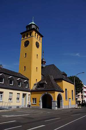
Frechen
Town in North Rhine-Westphalia, Germany
Distance: Approx. 400 meters
Latitude and longitude: 50.91666667,6.81666667
Frechen (German pronunciation: [ˈfʁɛçn̩]; Ripuarian: Frechem) is a town in the Rhein-Erft District, North Rhine-Westphalia, Germany. Frechen was first mentioned in 877. It is situated at the western Cologne city border.

Brauweiler Abbey
Distance: Approx. 5543 meters
Latitude and longitude: 50.96111111,6.78277778
Brauweiler Abbey (German: Abtei Brauweiler) is a former Benedictine monastery located at Brauweiler, now in Pulheim near Cologne, North Rhine-Westphalia, in Germany. It is now used as a regional cultural center.
Toyota Gazoo Racing Europe
Motorsport and automotive research and development facility owned by Toyota
Distance: Approx. 3594 meters
Latitude and longitude: 50.9148623,6.8630095
Toyota Gazoo Racing Europe GmbH (TGR-E) is an automotive engineering and motorsport services facility based in Cologne, Germany. It is fully-owned and controlled by Toyota Motor Corporation. TGR-E's principal operation is technical development of motorsport vehicles and their competitive entries on behalf of Toyota's Gazoo Racing brand in the FIA's World Endurance Championship (WEC) and World Rally Championship (WRC).

German Sport University Cologne
Sport university
Distance: Approx. 4717 meters
Latitude and longitude: 50.93670806,6.86934167
German Sport University Cologne (German: Deutsche Sporthochschule Köln, DSHS, Spoho), is a sport university in Cologne, Germany.

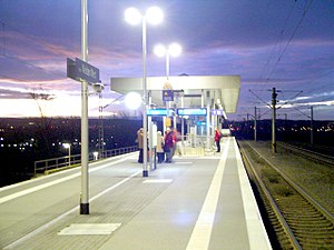
Köln-Weiden West station
Railway station in Cologne, Germany
Distance: Approx. 2884 meters
Latitude and longitude: 50.94061,6.81544
Köln-Weiden West is a railway station situated at Weiden, Cologne in the German state of North Rhine-Westphalia on the Cologne–Aachen railway. It is classified by Deutsche Bahn as a category 5 station.

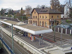
Frechen-Königsdorf station
Railway station in Germany
Distance: Approx. 3421 meters
Latitude and longitude: 50.93646349,6.77722138
Frechen-Königsdorf station is a station in the village of Königsdorf in the German state of North Rhine-Westphalia on the Cologne–Aachen high-speed railway. The station was opened as Königsdorf on 6 September 1841 on a section of the Cologne–Aachen railway that was opened by the Rhenish Railway Company between Cologne and Müngersdorf at the same time. In the late 19th century, it was renamed Großkönigsdorf.

Weiden Römergrab station
Railway station in Germany
Distance: Approx. 2873 meters
Latitude and longitude: 50.93833333,6.82861111
Weiden Römergrab is a Cologne Stadtbahn station served by line 1 and located on Aachener Straße in the district of Köln-Weiden. The station was renamed on December, 15th 2019 from Weiden Schulstraße to Weiden Römergrab.
Weiden Zentrum station
Distance: Approx. 3058 meters
Latitude and longitude: 50.93805556,6.835
Weiden Zentrum is a Kölner Verkehrs-Betriebe station. Line 1 of the Stadtbahn serves this station. The station is also served by buses, and buses on routes 141 and 149 terminate at the station.

Junkersdorf
Historic village in Cologne, Germany
Distance: Approx. 3711 meters
Latitude and longitude: 50.9319,6.8572
Junkersdorf is a historic village, now quarter 306 of the city of Cologne, Germany, in District Three.

Radstadion Köln
Distance: Approx. 4841 meters
Latitude and longitude: 50.93611111,6.87194444
The Radstadion Köln (also called Albert-Richter-Bahn) is a velodrome in Cologne. The partly covered wooden track of 250 meters was designed and built by the famous cycling track architect Ralph Schürmann. This means it meets the Olympic standard.
Weather in this IP's area
scattered clouds
-2 Celsius
-5 Celsius
-4 Celsius
-2 Celsius
1040 hPa
84 %
1040 hPa
1031 hPa
10000 meters
2.06 m/s
140 degree
27 %
