185.28.90.207 - IP Lookup: Free IP Address Lookup, Postal Code Lookup, IP Location Lookup, IP ASN, Public IP
Country:
Region:
City:
Location:
Time Zone:
Postal Code:
ISP:
ASN:
language:
User-Agent:
Proxy IP:
Blacklist:
IP information under different IP Channel
ip-api
Country
Region
City
ASN
Time Zone
ISP
Blacklist
Proxy
Latitude
Longitude
Postal
Route
db-ip
Country
Region
City
ASN
Time Zone
ISP
Blacklist
Proxy
Latitude
Longitude
Postal
Route
IPinfo
Country
Region
City
ASN
Time Zone
ISP
Blacklist
Proxy
Latitude
Longitude
Postal
Route
IP2Location
185.28.90.207Country
Region
england
City
oakford
Time Zone
Europe/London
ISP
Language
User-Agent
Latitude
Longitude
Postal
ipdata
Country
Region
City
ASN
Time Zone
ISP
Blacklist
Proxy
Latitude
Longitude
Postal
Route
Popular places and events near this IP address

Bampton, Devon
Town in Devon, England
Distance: Approx. 4541 meters
Latitude and longitude: 50.98974,-3.48601
Bampton is a small town and parish in northeast Devon, England, on the River Batherm, a tributary of the River Exe. It is about 6 miles (9.7 km) north of Tiverton, 19 miles (31 km) north of Exeter and the parish borders Somerset on its north-east and north-west sides. Bampton is a major part of the electoral ward of Clare and Shuttern.

Brushford, Somerset
Human settlement in England
Distance: Approx. 4108 meters
Latitude and longitude: 51.0188,-3.534
Brushford is a village and civil parish 2 miles (3.2 km) south of Dulverton and 12 miles (19 km) north of Tiverton in Devon, in the Somerset West and Taunton district of Somerset, England. According to the 2001 census, it had a population of 535 in 243 households, reducing to 519 at the 2011 Census. It covers an area of 1,149 hectares (11 km2) of which 3 hectares (0.030 km2) is within the Exmoor National Park.

River Barle
River in Somerset and Devon, England
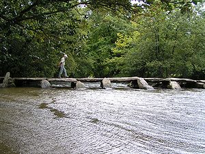
Distance: Approx. 3259 meters
Latitude and longitude: 51.01027778,-3.53194444
The River Barle runs from the Chains on northern Exmoor, in Somerset, England to join the River Exe at Exebridge, Devon. The river and the Barle Valley are both designated as biological Sites of Special Scientific Interest. On the Chains above Simonsbath is a 3-acre (1.2-hectare) former reservoir known as Pinkery Pond.

Exebridge
Village in Devon, England
Distance: Approx. 3654 meters
Latitude and longitude: 51.01011,-3.519905
Exebridge is a village that lies on the border between Devon and Somerset, England. It lies at the confluence of the Barle and Exe rivers. Exebridge is named so because of the bridge over the River Exe that also marks the border between Devon and Somerset.
Oakford, Devon
Village in Devon, England
Distance: Approx. 324 meters
Latitude and longitude: 50.9814,-3.5535
Oakford is a village and civil parish in the Mid Devon district of Devon, England. It is located three miles (5 km) south west of Bampton and eight miles (13 km) north north west of Tiverton. Oakford is near the river Exe.

Oakfordbridge
Village in Devon, England
Distance: Approx. 729 meters
Latitude and longitude: 50.98638889,-3.54083333
Oakfordbridge is a village in Devon, England. In January 2023, it was flooded after the River Exe burst its banks due to heavy rainfall. The A396 road connecting Tiverton, Devon, to North Devon, Exmoor, and Somerset passes near The Bark House hotel in Oakfordbridge.

Briggins Moor
Distance: Approx. 3962 meters
Latitude and longitude: 51.01369,-3.57944
Briggins Moor is a 15.3 hectare biological Site of Special Scientific Interest in Somerset, notified in 1994. The site is south of Dulverton and close to the border with Devon. This site is an example of unimproved mire of a type which is restricted to south-west England and Wales and which has been significantly reduced in extent in the recent past.

Cove, Devon
Village in Devon, England
Distance: Approx. 4273 meters
Latitude and longitude: 50.96621,-3.49541
Cove is a small village in the county of Devon, England. It is 4 miles north of Tiverton and 2 miles from Bampton in the Exe Valley some 450 feet above sea level. Cove was formed into an ecclesiastical parish in 1886.

Bampton Castle, Devon
Distance: Approx. 4689 meters
Latitude and longitude: 50.9925,-3.4847
Bampton Castle in the parish of Bampton, Devon was the seat of the feudal barony of Bampton. It is located on a spur that overlooks the River Batherm.

Castle Close
Distance: Approx. 4223 meters
Latitude and longitude: 50.9527,-3.5144
Castle Close is a circular earthwork located near Stoodleigh in Mid Devon, England at OS grid reference SS937181. It is described on maps as a settlement. Situated some 208 metres above sea level, overlooking the River Exe, it is most likely to be an Iron Age Hill fort or enclosure.

Stoodleigh
Village in Devon, England
Distance: Approx. 2820 meters
Latitude and longitude: 50.9595,-3.5362
Stoodleigh is a village and civil parish in the Mid Devon district of Devon, England, located 6 miles (10 km) north of Tiverton and 5 miles (8 km) south of Bampton. It is situated 800 feet (240 m) above the Exe Valley, close to the Devon / Somerset border. The centre of the village is a conservation area.

River Batherm
River in Somerset and Devon, England
Distance: Approx. 4475 meters
Latitude and longitude: 50.97604167,-3.48719444
The River Batherm is a river which flows through Somerset and Devon in England. The river rises on high ground near the village of Sperry Barton, between Wimbleball and Clatworthy reservoirs. It flows south through the villages of Blackwell, Petton, and Shillingford before it joins the River Exe just over a mile downstream from Bampton.
Weather in this IP's area
overcast clouds
5 Celsius
3 Celsius
5 Celsius
5 Celsius
1017 hPa
99 %
1017 hPa
990 hPa
10000 meters
1.98 m/s
2.84 m/s
155 degree
100 %
