Country:
Region:
City:
Latitude and Longitude:
Time Zone:
Postal Code:
IP information under different IP Channel
ip-api
Country
Region
City
ASN
Time Zone
ISP
Blacklist
Proxy
Latitude
Longitude
Postal
Route
Luminati
Country
ASN
Time Zone
Europe/London
ISP
JPC Infonet Ltd
Latitude
Longitude
Postal
IPinfo
Country
Region
City
ASN
Time Zone
ISP
Blacklist
Proxy
Latitude
Longitude
Postal
Route
db-ip
Country
Region
City
ASN
Time Zone
ISP
Blacklist
Proxy
Latitude
Longitude
Postal
Route
ipdata
Country
Region
City
ASN
Time Zone
ISP
Blacklist
Proxy
Latitude
Longitude
Postal
Route
Popular places and events near this IP address

West Wiltshire
Former local government district in Wiltshire, England
Distance: Approx. 2536 meters
Latitude and longitude: 51.31666667,-2.21666667
West Wiltshire was a local government district in Wiltshire, England, between 1974 and 2009, when it was superseded by Wiltshire Council. The district was formed on 1 April 1974, further to the Local Government Act 1972, as a merger of the former urban districts of Bradford-on-Avon, Melksham, Trowbridge, Warminster and Westbury, along with Bradford and Melksham Rural District and the Warminster and Westbury Rural District. There were five towns in the district – Bradford-on-Avon, Melksham, Trowbridge, Warminster and Westbury – each surrounded by rural parishes.

Southwick, Wiltshire
Village in Wiltshire, England
Distance: Approx. 95 meters
Latitude and longitude: 51.296,-2.235
Southwick is a semi-rural village and civil parish 3 miles (4.8 km) south-west of the county town of Trowbridge, Wiltshire, England. It is separated from the south-west fringe of Trowbridge only by the Southwick Country Park, which consists of 380 acres (150 ha) of open fields. The majority of the village lies south of the A361, which runs through the village, linking Trowbridge with Frome.
Trowbridge Town F.C.
Association football club in England
Distance: Approx. 1730 meters
Latitude and longitude: 51.30153056,-2.21058056
Trowbridge Town Football Club is a football club based in Trowbridge, Wiltshire, England. They compete at Step 7 in the Wiltshire League Premier Division and play at Woodmarsh, on the southern edge of the town.

North Bradley
Village in Wiltshire, England
Distance: Approx. 1826 meters
Latitude and longitude: 51.296,-2.208
North Bradley is a village and civil parish in Wiltshire, England, between Trowbridge and Westbury. The village is about 1.75 miles (2.8 km) south of Trowbridge town centre. The parish includes most of the village of Yarnbrook, and the hamlets of Brokerswood, Cutteridge and Drynham.

Wingfield, Wiltshire
Human settlement in England
Distance: Approx. 1992 meters
Latitude and longitude: 51.309,-2.255
Wingfield is a small village and civil parish in the county of Wiltshire, England, about 2.5 miles (4.0 km) south of Bradford-on-Avon and 2.2 miles (3.5 km) west of Trowbridge. The parish is bordered to the east by the Trowbridge urban area and to the west by the county of Somerset, where the River Frome forms most of the boundary. The secondary road from Bradford-on-Avon to Rode (Somerset) crosses the A366 from Trowbridge to Farleigh Hungerford near the centre of the parish, and most of the dwellings are near this junction.
Wiltshire Library and Information Service
Distance: Approx. 2783 meters
Latitude and longitude: 51.3165,-2.2098
Wiltshire Library and Information Service is a county-wide network of public libraries based in Trowbridge, Wiltshire, England. It is service of Wiltshire Council, with the strapline "Love Reading, Love Libraries". There are 31 public libraries and 5 mobile libraries, including one which specifically visits residential homes.

Holy Trinity Church, Trowbridge
Church
Distance: Approx. 2800 meters
Latitude and longitude: 51.31861111,-2.21444444
Holy Trinity Church, Trowbridge is a Grade II* listed 19th-century Church of England church in Trowbridge, Wiltshire, England, which had parish church status until 2011. It is commonly known in Trowbridge as 'The Church on the Roundabout', as it is encircled by a one-way traffic system.
St Augustine's Catholic College
Academy in Trowbridge, Wiltshire, England
Distance: Approx. 2553 meters
Latitude and longitude: 51.31794,-2.22038
St. Augustine's Catholic College is a Catholic Academy secondary school in the town of Trowbridge, Wiltshire, England. The school has a sixth form for years 12 and 13.

Brook, Heywood
Estate in Heywood, Wiltshire, England, UK
Distance: Approx. 2257 meters
Latitude and longitude: 51.2801,-2.2156
Brook in the parish of Heywood, north of Westbury in Wiltshire, England, is an historic estate. It was the seat of Robert Willoughby, 1st Baron Willoughby de Broke (c. 1452 – 1502), KG, an important supporter of King Henry VII, whose title unusually incorporates the name of his seat, in order to differentiate him from his ancestors Barons Willoughby of Eresby, seated at Eresby Manor near Spilsby in Lincolnshire.
The Clarendon Academy
Academy in Trowbridge, Wiltshire, England
Distance: Approx. 1996 meters
Latitude and longitude: 51.3114,-2.2178
The Clarendon Academy (formerly The Clarendon College, The Clarendon School and Nelson Haden School) is a mixed secondary school and sixth form located in Trowbridge in the English county of Wiltshire.
The John of Gaunt School
Academy in Trowbridge, Wiltshire, England
Distance: Approx. 2337 meters
Latitude and longitude: 51.31555556,-2.21944444
The John of Gaunt School is a mixed secondary school and sixth form located in Trowbridge in the English county of Wiltshire. The school is named after John of Gaunt, 1st Duke of Lancaster, as the school is built upon land that he once owned.

Southwick Court
Medieval manor house
Distance: Approx. 892 meters
Latitude and longitude: 51.3012,-2.2236
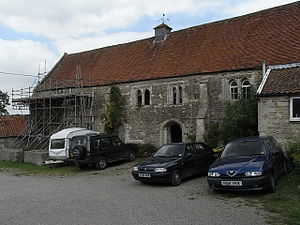
Southwick Court is a Grade II* listed moated medieval manor house at the centre of a system of fields and water meadows that lie between the town of Trowbridge and the village of Southwick in Wiltshire, England. It has remained a private residence under a succession of owners for at least 800 years. The current house dates from the late 16th century, but its gatehouse is late 15th century.
Weather in this IP's area
broken clouds
10 Celsius
9 Celsius
10 Celsius
11 Celsius
1016 hPa
81 %
1016 hPa
1011 hPa
10000 meters
0.45 m/s
3.13 m/s
237 degree
69 %
07:30:15
16:17:57