185.27.116.15 - IP Lookup: Free IP Address Lookup, Postal Code Lookup, IP Location Lookup, IP ASN, Public IP
Country:
Region:
City:
Location:
Time Zone:
Postal Code:
IP information under different IP Channel
ip-api
Country
Region
City
ASN
Time Zone
ISP
Blacklist
Proxy
Latitude
Longitude
Postal
Route
Luminati
Country
Region
am
City
amman
ASN
Time Zone
Asia/Amman
ISP
iLevant FZE
Latitude
Longitude
Postal
IPinfo
Country
Region
City
ASN
Time Zone
ISP
Blacklist
Proxy
Latitude
Longitude
Postal
Route
IP2Location
185.27.116.15Country
Region
al 'aqabah
City
aqaba
Time Zone
Asia/Amman
ISP
Language
User-Agent
Latitude
Longitude
Postal
db-ip
Country
Region
City
ASN
Time Zone
ISP
Blacklist
Proxy
Latitude
Longitude
Postal
Route
ipdata
Country
Region
City
ASN
Time Zone
ISP
Blacklist
Proxy
Latitude
Longitude
Postal
Route
Popular places and events near this IP address

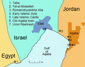
Aqaba
City in Aqaba Governorate, Jordan
Distance: Approx. 623 meters
Latitude and longitude: 29.53194444,35.00555556
Aqaba (English: AK-ə-bə, US also AHK-; Arabic: الْعَقَبَة, romanized: al-ʿAqaba, pronounced [ælˈʕæqɑba, ælˈʕæɡæba]) is the only coastal city in Jordan and the largest and most populous city on the Gulf of Aqaba. Situated in southernmost Jordan, Aqaba is the administrative center of the Aqaba Governorate. The city had a population of 148,398 in 2015 and a land area of 375 square kilometres (144.8 sq mi).

Ezion-Geber
Biblical seaport on the northern extremity of the Gulf of Aqaba
Distance: Approx. 3511 meters
Latitude and longitude: 29.54722222,34.98027778
Ezion-Geber (Hebrew: עֶצְיֹן גֶּבֶר, Modern: ʻEṣyōn Gevér, Tiberian: ʿEṣyōn Geḇer, Biblical: Ġeṣyōn Geḇer; also Asiongaber) is a city only known from the Hebrew Bible, in Idumea, a seaport on the northern extremity of the Gulf of Aqaba, in modern terms somewhere in the area of modern Aqaba and Eilat. According to Targum Jonathan, the name means "city of the rooster" (כְּרַך תַּרְנְגוֹלָא).

Kings City
Park in Eilat, Israel
Distance: Approx. 4803 meters
Latitude and longitude: 29.5506679,34.9665615
Kings City ("עיר המלכים" in Hebrew) was a biblical theme park in Eilat, Israel, which was inaugurated in June 2005. It is owned by "Africa Israel", "Elran d.d. Real Estate ltd" and a Swiss investor.

Aqaba Flagpole
Flagpole in Jordan
Distance: Approx. 855 meters
Latitude and longitude: 29.5217,35.0011
The Aqaba Flagpole in Aqaba, Jordan is a 130 metres (430 ft) tall flagpole. This height makes it the ninth tallest free–standing and tenth tallest flagpole in the world. It was the tallest free–standing flagpole in the world until being surpassed by the 133 metres (436 ft) tall Ashgabat Flagpole in 2008.
Wadi Araba Crossing
Border crossing between Israel and Jordan
Distance: Approx. 6100 meters
Latitude and longitude: 29.575,34.97805556
The Wadi Araba Crossing (Jordanian name, Arabic: تقاطع وادي عربة) or Yitzhak Rabin Crossing (Israeli name, Hebrew: מעבר יצחק רבין) is an international border crossing between Aqaba, Jordan and Eilat, Israel. Opened on August 8, 1994, it is currently one of three entry/exit points between the two countries that handle tourists. In February 2006, the Israelis renamed their border terminal to Yitzhak Rabin Terminal (Hebrew: מסוף יצחק רבין), after the assassinated Prime Minister who had signed the Israel–Jordan peace treaty in 1994.

Aqaba Archaeological Museum
National museum in Aqaba, Jordan
Distance: Approx. 836 meters
Latitude and longitude: 29.52166667,35.00138889
Aqaba Archaeological Museum (Arabic: متحف آثار العقبة, romanized: Matḥaf ʾĀthār al-ʿAqaba) is the official archaeological museum of the city of Aqaba in Jordan.

Aqaba Fortress
Mamluk-Ottoman caravanserai and fort in Aqaba, Jordan
Distance: Approx. 784 meters
Latitude and longitude: 29.521756,35.00203
The Aqaba Castle or Aqaba Fort (Arabic: قلعة العقبة, romanized: Qalʿat al-ʿAqaba), also known as the Mamluk Castle of Aqaba, Jordan, is a Mamluk and Ottoman fortified caravanserai on the pilgrimage route to Mecca and Medina which, in its current form, dates back mainly to the 16th century. In the century preceding the First World War, it was used to a larger degree as a military stronghold. In July 1917, the fortress was witness to a victory of the Arab Revolt, when this heavily defended Turkish stronghold fell to an Arab camel charge.

Tall Hujayrat Al-Ghuzlan
Distance: Approx. 5091 meters
Latitude and longitude: 29.5663,35.0341
Tall Hujayrat Al-Ghuzlan is an archaeological site during the Chalcolithic period that lies 4 km north of modern-day Aqaba city in Jordan. Tall Hujayrat Al-Ghuzlan and the neighboring Tall Al-Magass site in Aqaba both have extensive evidence of significant copper production and trade in the region.
Jordan Mixed Open
Golf tournament
Distance: Approx. 4152 meters
Latitude and longitude: 29.5613,34.9918
The Jordan Mixed Open presented by Ayla is a professional golf tournament. The event included players from the Challenge Tour, the European Senior Tour and the Ladies European Tour. The event was first held in April 2019 at Ayla Golf Club, Aqaba, Jordan.

Tell el-Kheleifeh
Archaeological site in Jordan
Distance: Approx. 3511 meters
Latitude and longitude: 29.54722222,34.98027778
Tell el-Kheleifeh (also Tell el-Chulefi) is an archaeological site in Jordan at the head of the Gulf of Aqaba immediately northwest of the city of Aqaba. Its older identification with the 10th-century port from the biblical King Solomon narrative does not stand up to newer archaeological assessments, while its identification with biblical Ezion-geber and/or Elath of a later date remains a matter of speculative interpretation.

Eilat City Museum
History Museum in Eilat, Israel
Distance: Approx. 5999 meters
Latitude and longitude: 29.551692,34.952926
The Eilat City Museum (Hebrew: מוזיאון היסטורי "אילת עירי") is a history museum in Eilat, Israel. The museum is dedicated to the history of the development of the city of Eilat.

Eilat Naval Base
Distance: Approx. 5866 meters
Latitude and longitude: 29.545,34.951
Eilat Naval Base is a major Israeli naval base situated in the Israeli coastal city of Eilat. It was established in 1949 and serves as the sole Israeli Navy Base on the coast of Red Sea.
Weather in this IP's area
clear sky
21 Celsius
20 Celsius
21 Celsius
21 Celsius
1016 hPa
43 %
1016 hPa
1009 hPa
10000 meters
3.09 m/s
220 degree
