185.26.86.53 - IP Lookup: Free IP Address Lookup, Postal Code Lookup, IP Location Lookup, IP ASN, Public IP
Country:
Region:
City:
Location:
Time Zone:
Postal Code:
ISP:
ASN:
language:
User-Agent:
Proxy IP:
Blacklist:
IP information under different IP Channel
ip-api
Country
Region
City
ASN
Time Zone
ISP
Blacklist
Proxy
Latitude
Longitude
Postal
Route
db-ip
Country
Region
City
ASN
Time Zone
ISP
Blacklist
Proxy
Latitude
Longitude
Postal
Route
IPinfo
Country
Region
City
ASN
Time Zone
ISP
Blacklist
Proxy
Latitude
Longitude
Postal
Route
IP2Location
185.26.86.53Country
Region
baden-wurttemberg
City
stodtlen
Time Zone
ISP
Language
User-Agent
Latitude
Longitude
Postal
ipdata
Country
Region
City
ASN
Time Zone
ISP
Blacklist
Proxy
Latitude
Longitude
Postal
Route
Popular places and events near this IP address

Dinkelsbühl
Town in Bavaria, Germany
Distance: Approx. 8012 meters
Latitude and longitude: 49.07083333,10.31944444
Dinkelsbühl (German pronunciation: [ˈdɪŋkl̩sˌbyːl] ) is a historic town in Central Franconia, a region of Germany that is now part of the state of Bavaria, in southern Germany. Dinkelsbühl is a former free imperial city of the Holy Roman Empire. In local government terms, Dinkelsbühl lies near the western edge of the Landkreis (or local government district) of Ansbach, north of Aalen.

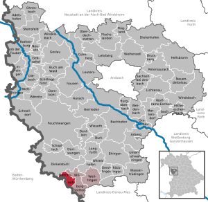
Stödtlen
Municipality in Baden-Württemberg, Germany
Distance: Approx. 166 meters
Latitude and longitude: 49.00138889,10.29916667
Stödtlen is a municipality in Baden-Württemberg, Germany, located in the Ostalbkreis district. It has about 2000 inhabitants.

Tannhausen
Municipality in Baden-Württemberg, Germany
Distance: Approx. 5049 meters
Latitude and longitude: 48.97916667,10.36138889
Tannhausen is a municipality in the German state of Baden-Württemberg, in Ostalbkreis district. Tannhausen is located approximately 20 km (12 mi) east of Ellwangen at the edge of the Nördlinger Ries in Swabian Württemberg close to the border of the Franconian part of Bavaria, where the administrative region of Swabian Bavaria meets Central Franconia.

Unterschneidheim
Municipality in Baden-Württemberg, Germany
Distance: Approx. 8069 meters
Latitude and longitude: 48.94166667,10.36555556
Unterschneidheim is a municipality in the German state of Baden-Württemberg, in Ostalbkreis district.

Wört
Municipality in Baden-Württemberg, Germany
Distance: Approx. 4111 meters
Latitude and longitude: 49.03222222,10.2725
Wört is a municipality (German: Gemeinde) and town in the district of Ostalbkreis in Baden-Württemberg in Germany.

Fichtenau
Municipality in Baden-Württemberg, Germany
Distance: Approx. 10001 meters
Latitude and longitude: 49.06944444,10.21305556
Fichtenau is a community of several villages, in the district of Schwäbisch Hall, in Baden-Württemberg, Germany.

Mönchsroth
Municipality in Bavaria, Germany
Distance: Approx. 4846 meters
Latitude and longitude: 49.01972222,10.35916667
Mönchsroth is a municipality in the district of Ansbach in Bavaria in Germany.

Wilburgstetten
Municipality in Bavaria, Germany
Distance: Approx. 7404 meters
Latitude and longitude: 49.02805556,10.39194444
Wilburgstetten is a municipality in the district of Ansbach in Bavaria in Germany.

Ellenberg, Baden-Württemberg
Municipality in Baden-Württemberg, Germany
Distance: Approx. 6299 meters
Latitude and longitude: 49.01527778,10.21694444
Ellenberg is a municipality in the German state of Baden-Württemberg, in Ostalbkreis district.

Hornberg (Virngrund)
Distance: Approx. 7613 meters
Latitude and longitude: 49.02111,10.20083
The Hornberg is a hill ridge, about 2.5 kilometres long, with three kuppen that reaches a maximum height of 580 m above sea level (NHN) making it the highest point of the Virngrund region in the German state of Baden-Württemberg.
Weather in this IP's area
light rain
10 Celsius
7 Celsius
7 Celsius
10 Celsius
1008 hPa
93 %
1008 hPa
950 hPa
10000 meters
4.66 m/s
12.86 m/s
254 degree
100 %